Kamon Farm Conservation Area (ECGA)
Kamon Farm Conservation Area (ECGA)
Essex County Greenbelt Association Ipswich, Massachusetts 01938
Official WebsiteKamon Farm Conservation Area map
About this Location
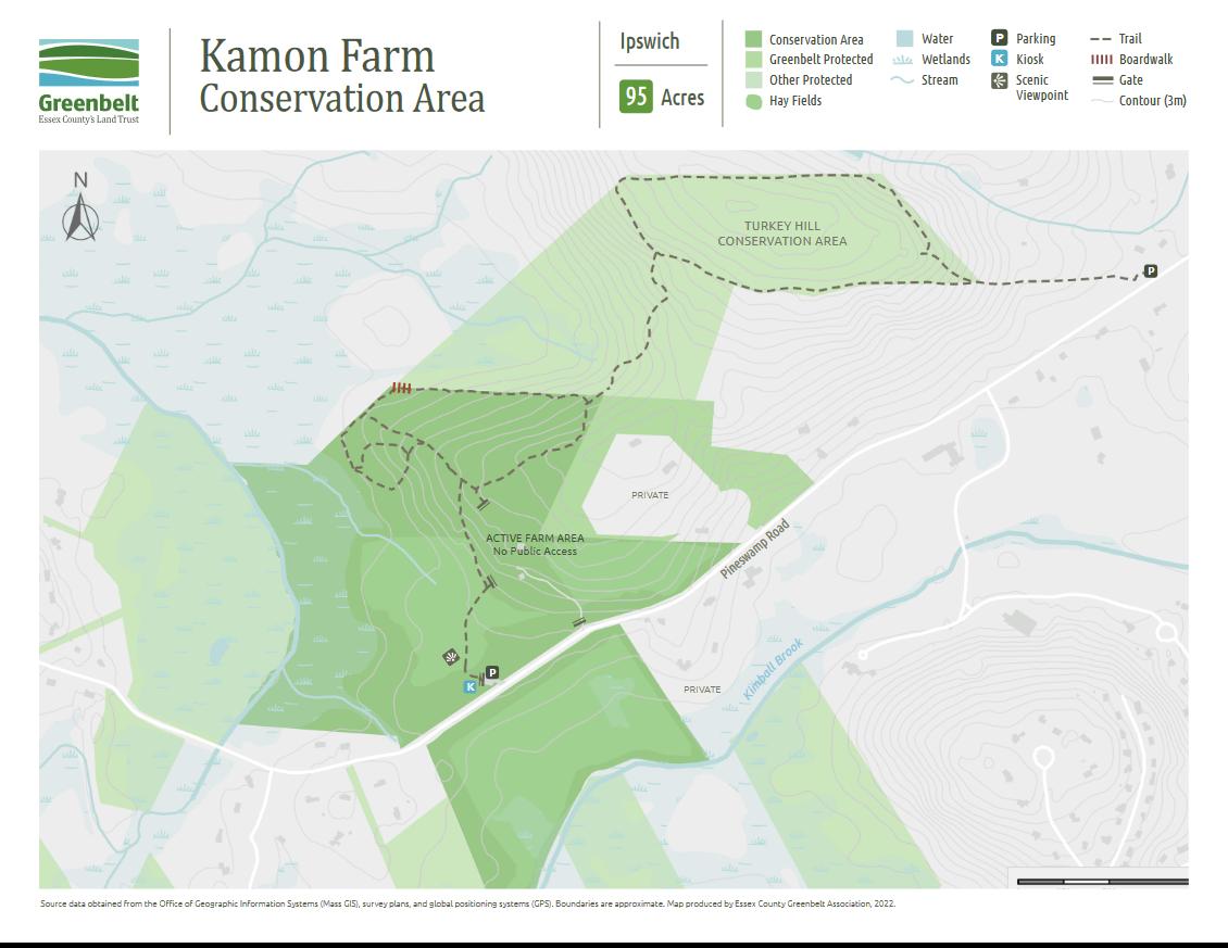
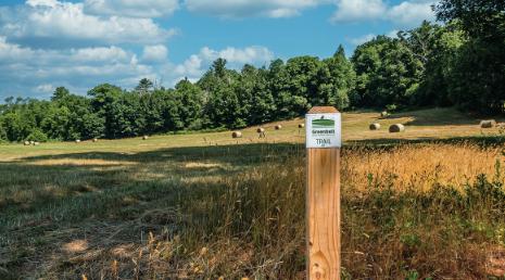
Kamon Farm Conservation Area has open fields, wooded uplands, and low-lying wetlands that host a diversity of wildlife and offer extraordinary views and hiking trails that connect to the Turkey Hill Conservation Area. Expanding along both sides of Pineswamp Road, this conservation area straddles two watersheds and helps protect important drinking water supplies. Beneath the northern portion, groundwater flows to Bull Brook Reservoir in the Parker River watershed.
To the south, water drains to the Mile Lane Wells in the Ipswich River watershed. Portions of this land are used for haying, and agricultural use will continue to be compatible with drinking water supply goals. On the east side of the property, trails lead from open fields to wooded uplands and connect to a
broader trail network on Turkey Hill Conservation Area and other conserved land. The all-access portion of the trail leads to a bench with sweeping views across open fields.
At the time of European contact, Pawtucket people who became known as the Agawam Indians were growing corn on the lower slopes of Turkey Hill and exploiting the subsistence resources of the nearby wetlands and pine groves. They canoed to Ipswich Bay and Plum Island Sound via nearby Bull Brook to Rowley River.
The Kamon Farm area was periodically occupied by Indigenous people since Paleoindian times circa 14,000 years ago when bands of hunter-gatherers met near here for the cooperative hunting of caribou. Stone artifacts from archaeological sites on and around Turkey Hill are housed at the Harvard Peabody Museum of Archaeology and Ethnology in Cambridge.
Notable Trails
1.1 miles of easy terrain with connecting trails
Features
Restrooms on site
Wheelchair accessible trail
Entrance fee
Content from Official Website
Last updated March 27, 2024