Caesar Creek SP--Archery Range
Caesar Creek SP--Archery Range
Middletown Road Waynesville, OH 45068
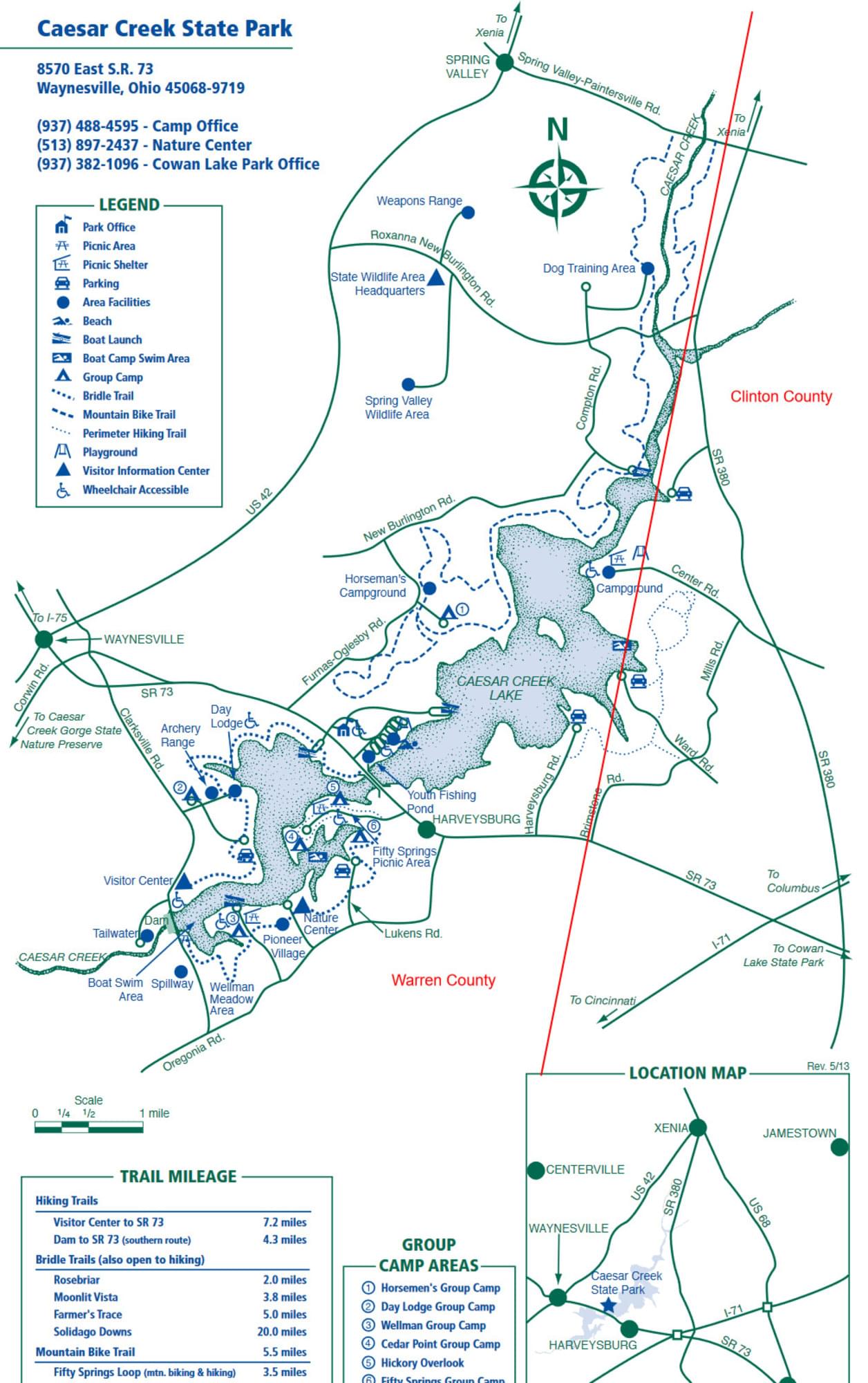
Caesar Creek State Park websiteCaesar Creek State Park map
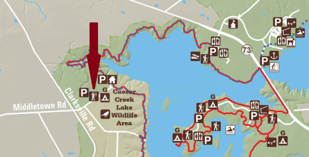
Caesar Creek Lake map
About this Location
The archery range is located near the southwest end of the lake on the drive leading to the Hopewell Day Lodge.
About Caesar Creek State Park
See all hotspots at Caesar Creek State Park
The Caesar Creek State Park area sits astride the crest of the Cincinnati Arch, a convex tilting of bedrock layers caused by an ancient upheaval. Younger rocks lie both east and west of this crest where some of the oldest rocks in Ohio are exposed. The sedimentary limestones and shales tell of a sea hundreds of millions of years in our past that once covered the state. The park’s excellent fossil finds give testimony to the life of this long-vanished body of water.
The forests of the area are comprised of over 65 species of plants. Several major communities thrive in the area. A northern floodplain forest is found in the valley, while mixed associations of oak-hickory and beech-maple woodlands clothe the ridges and hillsides. Red-tail hawks, white-tail deer, raccoons, red foxes, and box turtles make the park their home.
There are numerous restrooms in Caesar Creek State Park, but most are closed during the cold months. The Visitor’s Center has flush toilets available when the Center is open.
Features
Restrooms on site
Wheelchair accessible trail
Entrance fee
Roadside viewing
Content from Caesar Creek State Park website and Ohio Ornithological Society
Last updated October 8, 2023