Rio Mora NWR--Juniper Trail
Rio Mora NWR--Juniper Trail
Watrous, New Mexico 87753
Rio Mora National Wildlife Refuge Official WebsiteRio Mora National Wildlife Refuge map
Tips for Birding
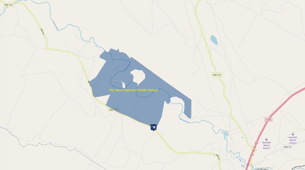
The Juniper Trail trailhead, with graveled parking area View Map, vault toilet, and shaded picnic table, is located a third of a mile north of NM-161, along county road C-016, also known as Loma Parda Road. This “lollipop” shaped trail, about 2.5 miles out and back, makes its way through shortgrass prairie and pinyon-juniper woodland, passing by a small riparian area as well as skirting the canyon edge overlooking the Mora River valley.
Most of the non-loop portion, the lollipop “handle”, is surfaced in crushed gravel and ADA accessible. This segment starts at the trailhead where the hotspot map pin is located and runs slightly downhill less than a third of a mile through shortgrass prairie to where there is shaded interpretive signage. Horned Lark, Western Meadowlark, Say’s Phoebe, and swallow species frequent this portion of the trail. Long-billed Curlew have been known to nest in the area.
Continuing further north, the now dirt but relatively easy-to-follow cairned path passes down, then up the shallow head of an arroyo, and quickly comes to the fork that begins the 2-mile loop portion of the trail. Taking the left fork, you roughly follow the east side of the arroyo, descending to a shallow pond, covering maybe a hundred square feet, created by a rock and earthen dam at the downstream or north end. Red-winged and occasionally Yellow-headed Blackbird may be seen here.
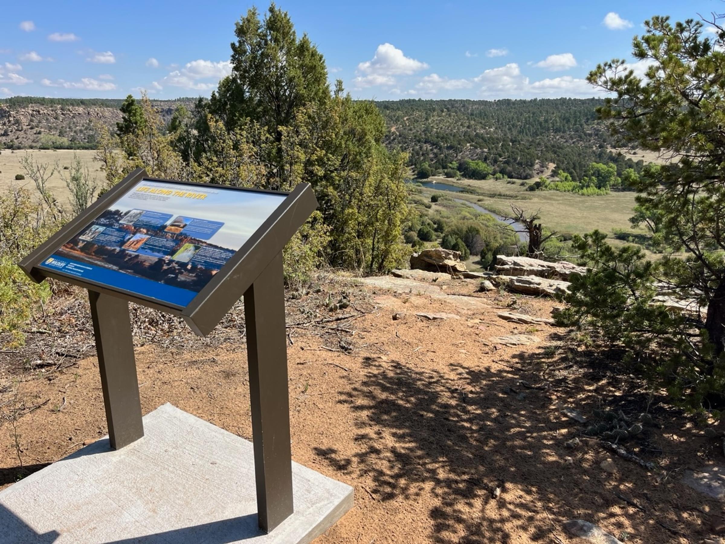
From the pond, the trail ascends 0.75 miles northwest through the pinyon-juniper woodland, complete with oak understory and taller Ponderosa Pine, to the rim of the Mora River canyon, oriented roughly east-west. Juniper Titmouse, White-breasted Nuthatch, and Woodhouse’s Scrub-Jay may be encountered in this habitat. As you hike along the south side of the canyon, occasionally stop to scan the river for waterfowl; at this distance, some identifications will be challenging, but Canada Goose and Great Blue Heron can be confirmed with average binoculars. Wild Turkeys are often spotted both on the trail and down in the river canyon. One excellent location to view the river is marked by USFWS educational signage, approximately a quarter mile from where you began following the rim. The trail turns back southwest from near this point. As you get closer to where you started the loop, the woodland thins, with greater swaths of intervening prairie. Western Wood-Pewee and Spotted Towhee seem to favor this area, as do kingbirds; it may be useful to review your calls prior to beginning the trail, given that both Western and Cassin’s Kingbird are seasonally present and mobile connections are weak at best after leaving the initial graveled trail segment.
Of course, the route may be traveled in a counter-clockwise, rather than clockwise direction, leaving the riparian area until near the end of your hike. Do include details of your route in Checklist Comments, particularly if you also bird between the state road and trailhead. Should you bird beyond the trailhead, farther north on Loma Parda Road, that list should not be recorded for the Juniper Trail, but rather for the general refuge hotspot.
A cautionary note: Bison may be encountered while you are driving Loma Parda Road or hiking this trail. Trailhead signage advises keeping 100 yards away from these animals.
Birds of Interest
Long-billed Curlew, Horned Lark, Western Meadowlark, Say’s Phoebe, Red-winged Blackbird, Yellow-headed Blackbird, Juniper Titmouse, White-breasted Nuthatch, Woodhouse’s Scrub-Jay, Western Wood-Pewee, Spotted Towhee, Wild Turkey, Canada Goose
This hotspot was established spring 2023. Birders may contribute significantly to a better understanding of seasonal species frequency by submitting lists over the next few years.
About this Location
The Juniper Trail winds through several types of habitat, including shortgrass prairie, piñon, juniper, oak, and coniferous forests.
Juniper Trail, 2.25 miles, is a lollipop trail (a trail with a loop at the end of an out-and-back start and finish), a natural surface of dirt, gravel, and rock, with moderate difficulty.
About Rio Mora National Wildlife Refuge
See all hotspots at Rio Mora National Wildlife Refuge
Rio Mora National Wildlife Refuge and Conservation Area, established in 2012, is located in the transition zone between the Great Plains and the Southern Rocky Mountains. The refuge is 4,224 acres and has shortgrass prairie, riparian wetlands, piñon/juniper, oak, and coniferous forests. Five miles of the Mora River meanders through the refuge. The variety of habitats supports a wide range of animal and plant life. Rio Mora National Wildlife Refuge partners with many organizations and facilitates research, outreach, interpretation, and environmental education.
Features
Restrooms on site
Wheelchair accessible trail
Entrance fee
Content from Rio Mora National Wildlife Refuge Official Website and John Montgomery
Last updated July 1, 2023
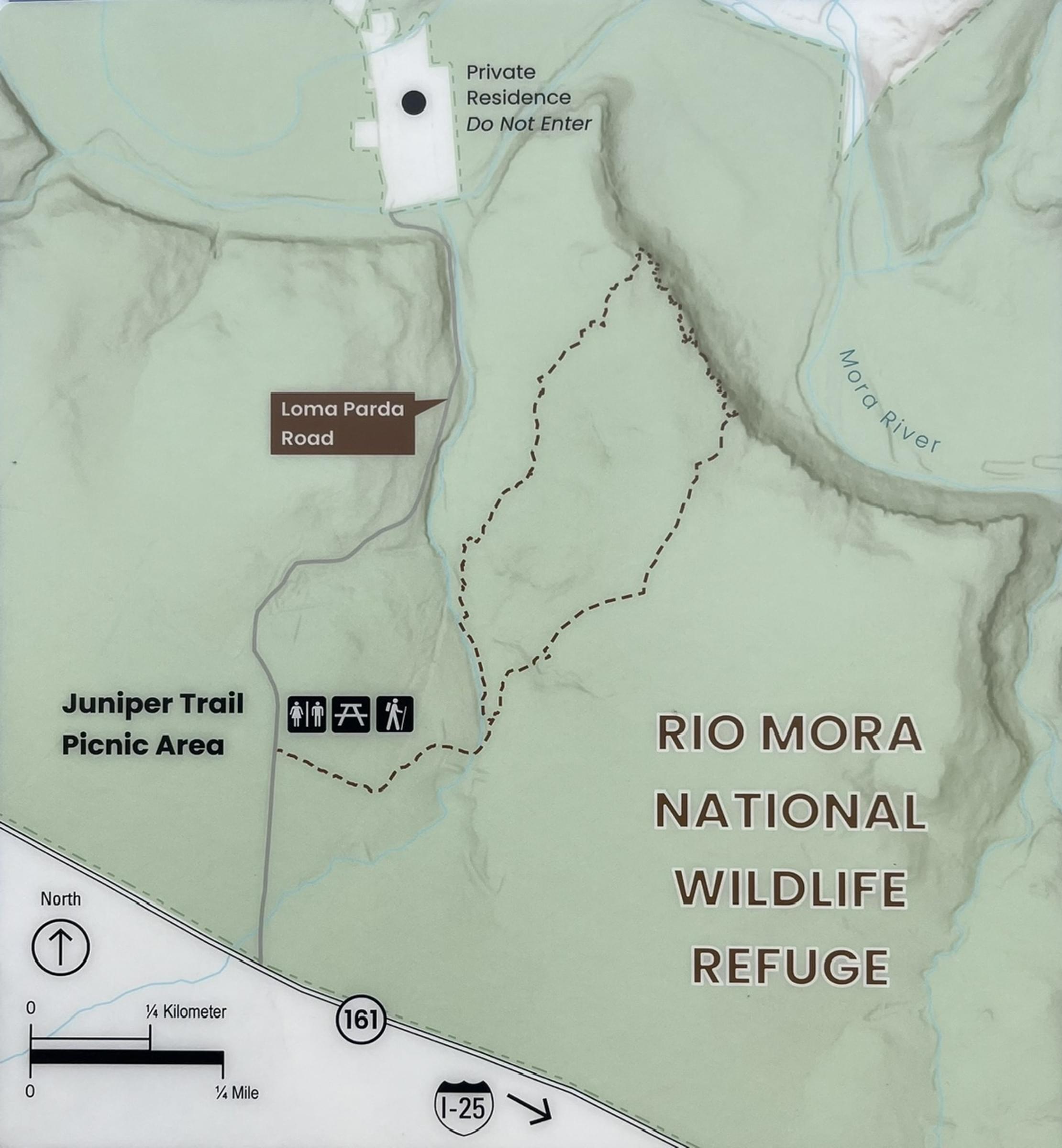 Trailhead map
John Montgomery