Smith Point
About this Location
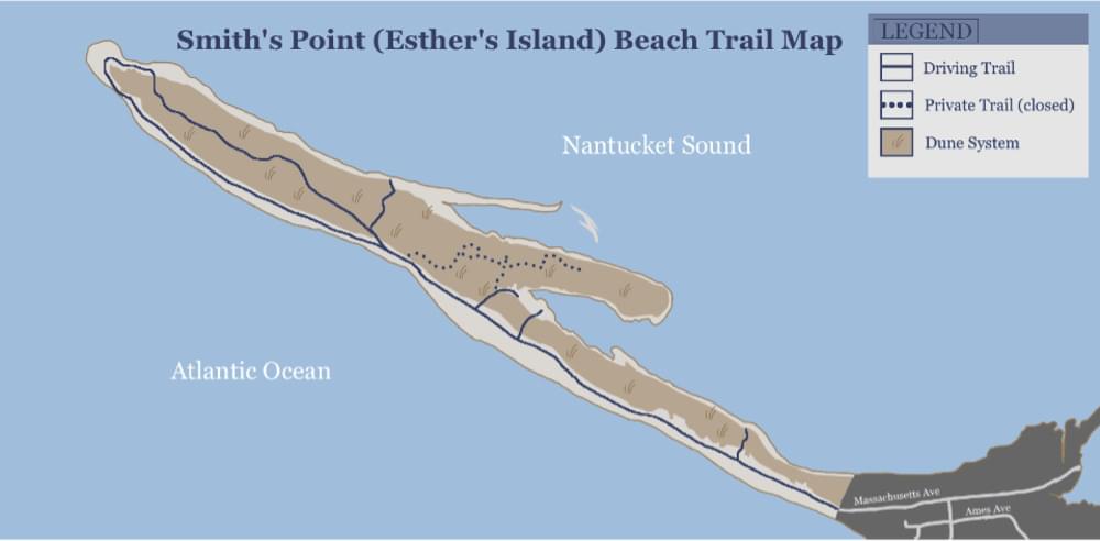
Smith’s Point, also known as Esther’s Island (named after Hurricane Esther formed an island from Smith’s Point by cutting it in two in 1961), is an approximately 1.5-mile-long pristine barrier beach located at the farthest west end of Nantucket, past the village of Madaket. Smith’s Point consists of both north and south-facing shorelines, with rolling dunes in between. As referred to by locals, “Smith’s” offers the best place to view the famous Madaket Sunset. This natural area is great for fishing and watching wildlife such as birds and seals. On a clear day, one can also glimpse Tuckernuck Island from the end of the point. Federally-protected shorebirds utilize this remote beach for nesting and breeding during the spring and summer months, so please respect any symbolic fencing and signage in place, and do not enter any fenced areas. Look out for signs stating “Restricted Area” that delineate shorebird habitat.
Follow Madaket Road to the very end, and take a right onto Ames Avene when you see the concrete barriers. There is no parking past this point, so if you need to reduce your tire pressure, it is recommended to do so in the public Madaket Beach parking lot, on the left just before the end of the road. Continue down Ames Avene across Millie’s Bridge, and turn right onto New Jersey Avene. Take a left at the stop sign onto Massachusetts Avene and continue down the road onto Smith’s Point Beach. There are no amenities past the end of Madaket Road, so please come prepared with sunscreen, bug spray, snacks, and plenty of water if you plan to hike the beach.
Features
Restrooms on site
Wheelchair accessible trail
Content from Official Website
Last updated March 25, 2024