Mountain Meadow Preserve (TTOR)
Mountain Meadow Preserve (TTOR)
The Trustees of Reservations Mason Street Williamstown, Massachusetts 01267
Official WebsiteMountain Meadow Preserve map
Mountain Meadow Preserve Official Website
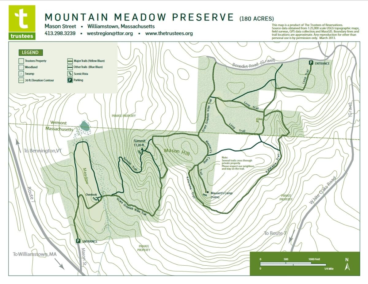
Mountain Meadow Preserve map
Tips for Birding
The Mountain Meadow Preserve is on the Massachusetts-Vermont border and has sections of the preserve, and eBird hotspots, in both states. Birders who carefully keep bird records by state should be aware of the location of the state line and use the appropriate eBird hotspot when submitting checklists.
About Mountain Meadow Preserve
See all hotspots at Mountain Meadow Preserve
Rising in elevation from 690 feet at the Williamstown parking lot to more than 1,100 feet, Mountain Meadow Preserve provides multiple natural habitats and rich ecology: it’s home to bears, coyotes, bobcats, fox, and deer as well as wetland amphibians and numerous small mammals and reptiles. Meanwhile, the meadow’s mix of flowers and grasses, including aster, little bluestem, and fringed gentian, attracts a variety of butterflies. From the meadow, peek through a forested ridge and enjoy mountain vistas across 180 acres.
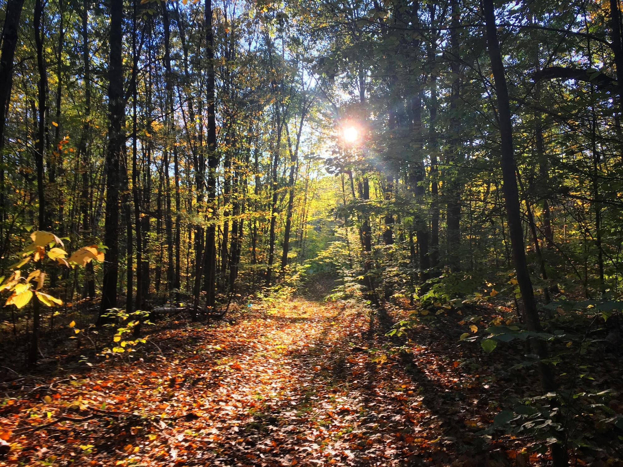
Hike the four miles of trails and gather your own special memories, like watching a butterfly light on a wildflower, or catching the cry of a red-tailed hawk as it soars overhead. From the broad meadow a few hundred yards beyond the parking lot, enjoy a view of the Hoosac Valley that includes both Williamstown church spires and Mount Greylock. Climb a half-mile loop trail to a hilltop, where you can also continue your hike into the Pownal, Vermont side of the reservation. And if you prefer your vistas without the uphill walk, enter the reservation from the Pownal parking lot, meander along a network of flat trails to a woods road leading to a scenic overlook at the ruins of Mausert’s Camp, a circa-1970s rustic family getaway.
To reach the Williamstown, Massachusetts parking area: From the intersection of US-2 and US-7 in Williamstown, take US-7 north for 1.7 miles. Bear right onto Mason Street (steep dirt road uphill) and follow it to the entrance and parking (10 cars).
To reach the Pownal, Vermont parking area: From the intersection of US-2 and US-7 in Williamstown, follow US-7 north for 1.7 miles, turn right onto Sand Spring Road, then bear right onto Bridges Road. Follow Bridges Road for 0.3 miles, turn left onto White Oaks Road, and follow it for 1.1 miles when the road becomes dirt. Continue for 0.4 miles, bear left at the fork onto Benedict Road, and continue 0.1 miles to the entrance and parking (8 cars) on the left.
Notable Trails
The AllTrails website has a description and map of a hike at Mountain Meadow Preserve.
Features
Entrance fee
Restrooms on site
Wheelchair accessible trail
Content from Official Website and Mountain Meadow Preserve Official Website
Last updated November 24, 2023