Alander Mountain, Mount Washington
Alander Mountain, Mount Washington
Mount Washington, Massachusetts 01258
Official WebsiteMount Alander (SummitPost) webpage
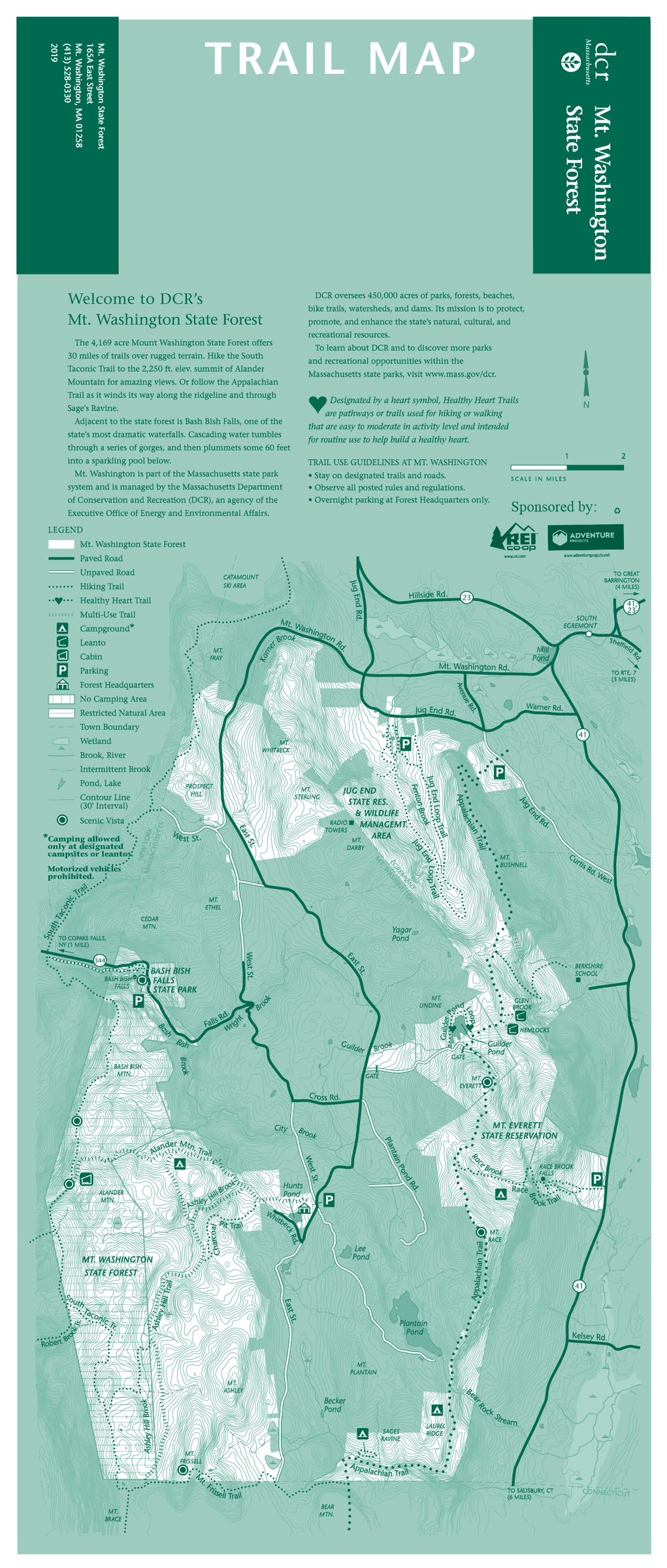
Mount Washington State Forest map
About this Location
The re-grown red oak northern hardwood forest of Mount Washington State Forest offers more than 30 miles of trails for hiking and mountain biking. Hike the South Taconic Trail to the 2,250-foot elevation summit of Alander Mountain for a breathtaking view.
Buried in the southwest corner of Massachusetts, hidden in the Berkshires, lies Alander Mountain. It is a small mountain with massive views, rewarding those who climb to its open summit with views into New York, Connecticut, and across Massachusetts.
Part of the Taconic Plateau, the area provides access to multiple peaks Mount Frisse (south) and Everett (east), and Bash Bish Falls.
You may only park in the designated lot at the park headquarters on East Street. Parking is free.
Notable Trails
Alander Mountain Trail
Begin your hike at the Mount Washington State Forest Headquarters. Distance: 6 miles round trip, difficult. The Alander Mountain trail climbs moderately westward for 1.5 miles to intersect with the backcountry campground access trail. As you approach the summit after another 1.5 miles hiking becomes more difficult. Views await you at the summit where the South Taconic Trail (white-blazed) intersects. Return via the same route or head back through the backcountry campground to the Ashley Hill Trail.
The AllTrails website has a description and map of a hike at Mount Alander.
Features
Restrooms on site
Wheelchair accessible trail
Entrance fee
Content from Official Website and Mount Alander (SummitPost) webpage
Last updated January 6, 2024