Wetherbee Conservation Land
Wetherbee Conservation Land
Acton, Massachusetts 01720
Official WebsiteWetherbee Conservation Land map
Birds of Interest
Breeding field birds include savannah sparrow, vesper sparrow, swamp sparrow, red-tailed and sharp-shinned hawk, indigo bunting, and eastern bluebird. Breeding upland birds include hermit thrush, scarlet tanager, red-eyed and warbling vireos, cardinal, robin, black-capped chickadee, tufted titmouse, and white-breasted nuthatch. Coursing over the field during the summer, both barn swallows and chimney swifts gather the abundant insects. In fall, the bare field attracts flocks of American pipits and killdeer and is a favorite roosting area for large groups of crows.
About this Location
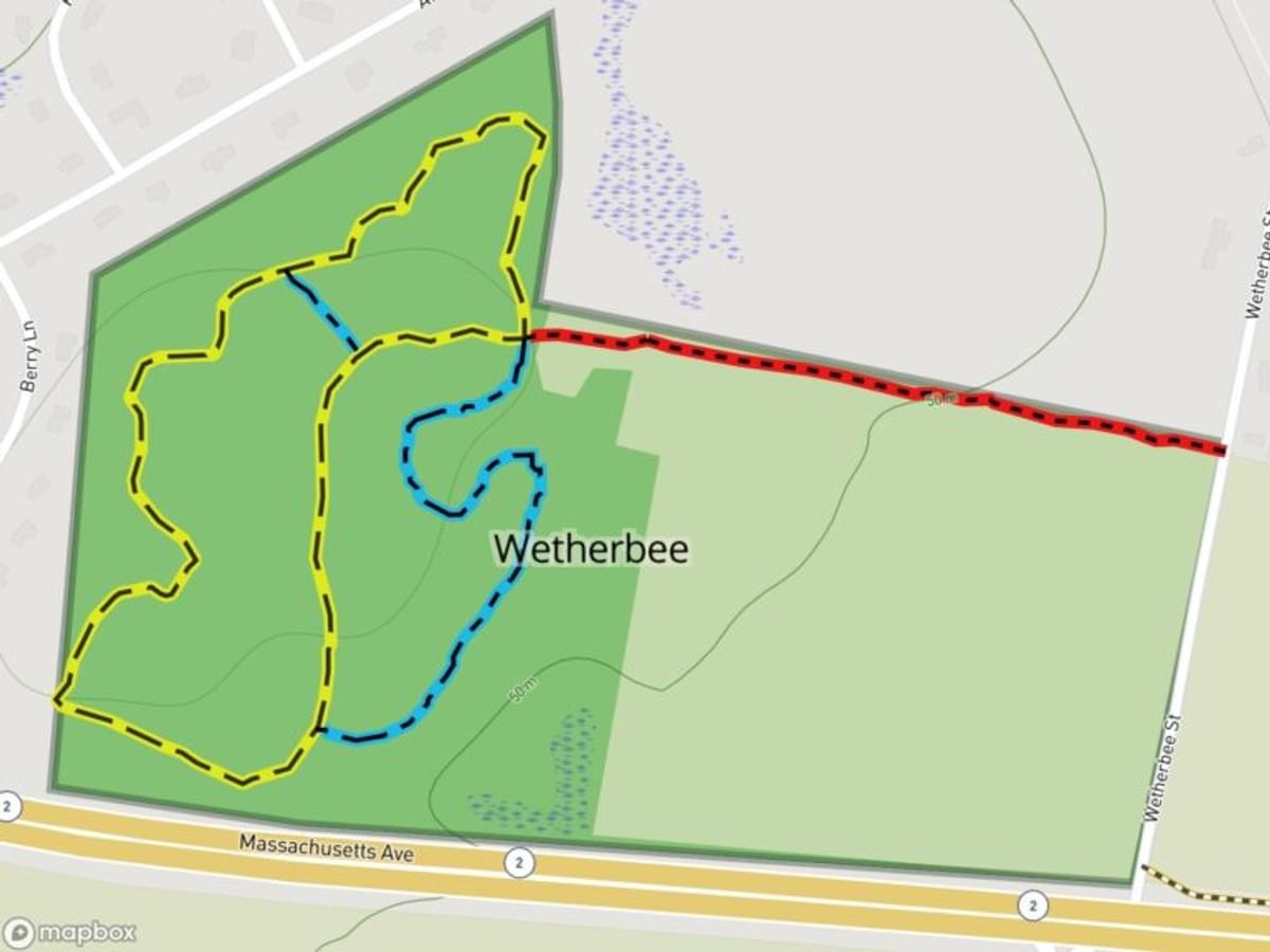
Wetherbee Conservation Land’s most prominent feature is the farm field along MA-2 that is bordered on the east by Wetherbee Street. Formerly part of a farm of the same name, this 31-acre field is now one of only two actively farmed agricultural fields that belong to the Town of Acton. The Massachusetts Department of Correction (for MCI Concord) has a license agreement with the Acton Conservation Commission to farm the field. Typically they grow corn to feed the cow herd maintained at the Correctional Center on Barretts Mill Road near the rotary. The remaining 41 acres of land, which extend to Alcott Road and Berry Lane on the north and west, consist of meadows, marsh, and woodland.
The trail system is located within the parcel’s wooded portion and is accessed by an open trail about 0.3 miles long from Wetherbee Street along the northern edge of the farm field. The yellow loop trail is bisected by one short blue secondary trail, while another blue trail, outside the yellow loop, makes possible a side tour through the southeastern portion of the woodland, close to the field, passing along a stone wall for most of its length.
Just beyond the northwest corner of the field, a small, sloping, short-grass meadow, accented with crabapple trees, provides an inviting approach to the upland loop. South of this meadow lies a marshy habitat that in turn feeds a tiny north-to-south stream and vernal pool that separate the woods from the field’s western edge. The property’s back section, further to the west, is wooded with secondary growth typical of New England upland and features red maple, black and red oak, and white pine, with a scattering of ash, bigtooth aspen, sassafras, hawthorn, and sumac. In the woods, old stone walls still define early boundaries.
Notable Trails
The AllTrails website has a map and description of a hike at the Wetherbee Conservation Land.
Features
Restrooms on site
Wheelchair accessible trail
Entrance fee
Content from Official Website
Last updated January 9, 2024