Waterbury Center State Park
Waterbury Center State Park
Waterbury Center, Vermont 05677
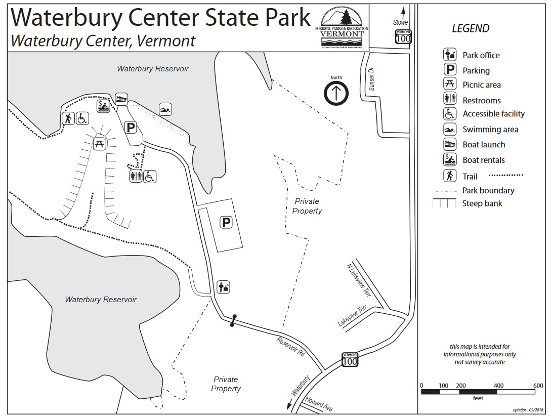
Official WebsiteWaterbury Center State Park map and guide
About this Location
Waterbury Center State Park lies on the easterly trivium of Waterbury Reservoir, a quarter-mile off Route 100. It is an integral recreation resource in Central Vermont and one of the newer park facilities within Mount Mansfield State Forest. The Reservoir is the ninth-largest body of water in the state of Vermont and was created in the 1930s by the CCC as a flood control project to protect towns and villages along the Winooski River Valley. From late spring to early fall the Reservoir is maintained to a surface area of 850 acres and has a maximum depth of 100 feet. To prepare for normal spring snowmelt and runoff, the surface area is reduced to between 415-610 acres throughout the winter. The designed flood control capacity of the Waterbury Reservoir is approximately 9,000,000,000 gallons.
Notable Trails
The TrailFinder website has a description and map of a hike at Waterbury Center State Park.
Features
Restrooms on site
Entrance fee
Wheelchair accessible trail
Content from Official Website
Last updated October 13, 2023