Podunk WMA
Birds of Interest
Ruffed grouse and wild turkey can be found on the Podunk Wildlife Management Area, as well as osprey, great-horned owls, and goshawks. A variety of other deciduous and coniferous forest-associated songbirds are certain to be found.
About this Location
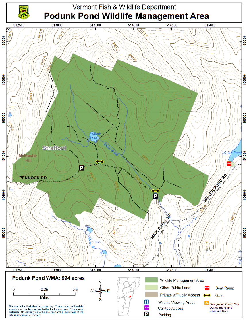
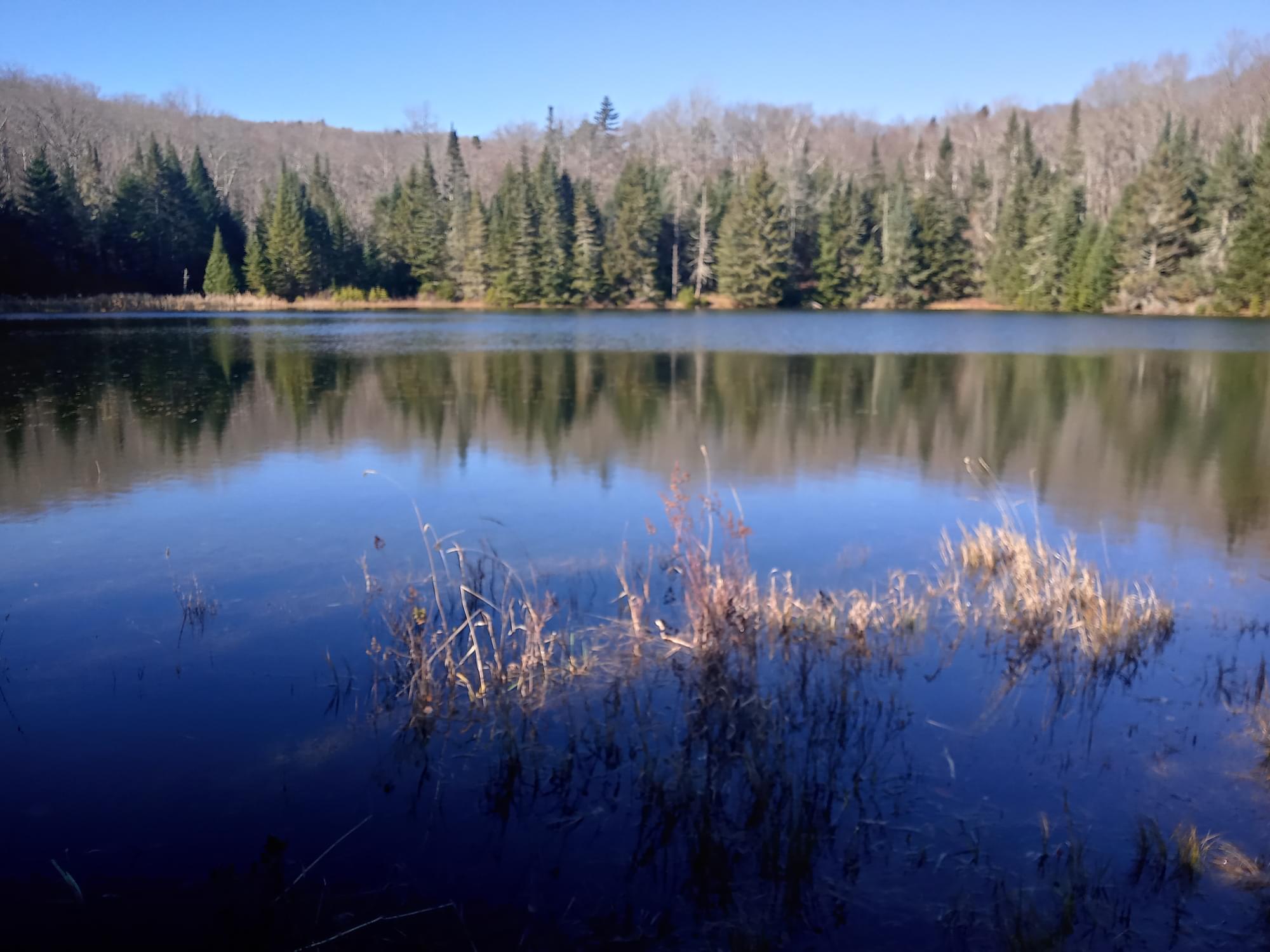
Podunk Wildlife Management Area (WMA) is located in the east-central Vermont town of Strafford, due west of Miller Pond. The WMA is 924 acres in size, is owned by the State of Vermont, and is managed by the Vermont Fish and Wildlife Department. Access to the WMA can be gained from the west via Justin Morrill Highway to Old City Falls Road, and then to Pennock Road, which eventually turns into an unmaintained Class 4 town road that bisects the WMA. The same Class 4 road can be accessed from the east via Miller Pond Road and Maple Hill Road. A developed parking lot is located off the Class 4 road on the east end of the WMA. Undeveloped parking exists at the entrance to the Podunk Pond access trail, and further west on the Class 4 road where the road reaches its highest point, adjacent to a maintained field. Podunk Pond, a 4-acre impoundment, is in the middle of the WMA, north of the Class 4 road.
Habitat Features The WMA lies within the Ompompanoosuc River watershed and is mostly forested with a mix of sugar maple, white birch, beech, some red oak, balsam fir, red spruce, hemlock, and plantations of white and red pines and Norway spruce. The coniferous areas in the mid-eastern portion of the WMA provide wintering habitat for white-tailed deer. There are about 10 acres of field in five separate areas that are maintained by the Department through brush hogging. The largest field (~5 acres) is located along the Class 4 town road in the middle of the WMA, and it is associated with the remains of an old farmstead. There are good concentrations of apple trees in these fields which are maintained through release cuttings.
Several intermittent streams feed Podunk Pond. The outlet of the pond eventually joins the outlet of Miller Pond and empties into Abbott Brook, which in turn empties into the West Branch of the Ompompanoosuc River. Elevations range from 1,900 feet on McMaster Hill to 1,300 feet at the lowest point in the WMA.
Features
Restrooms on site
Wheelchair accessible trail
Entrance fee
Content from Podunk Wildlife Management Area guide and map
Last updated December 3, 2023