Great Rock Bight Preserve
About this Location
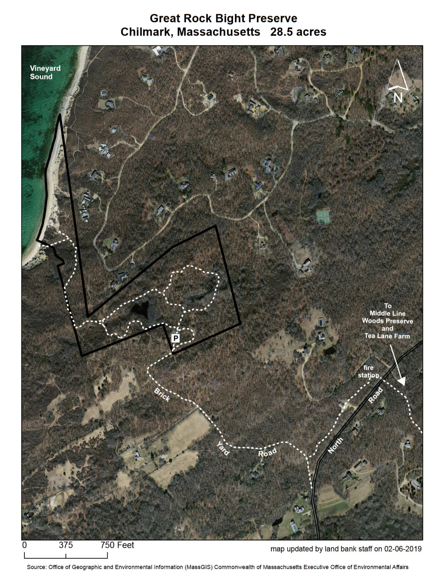
The park-like quality of Great Rock Bight Preserve results from the previous owner’s devotion to it: tall specimen trees, grassy fields, gurgling wetlands, and a cordate pond. All of this rolls down to a seaside bluff over a sandy cove; the land bank owns 1300 feet of Vineyard Sound beach here. The ponds host populations of rare clam shrimp, which are the only places where they have been documented on the island. Marl Pond, the easternmost of the property’s chain of ponds, is of special interest: its natural acidity was used to preserve the baskets and hemp ropes of early settlers.
Travel 3.8 miles on the North Road after its intersection with the State Road in West Tisbury; turn right at the land bank logo post and follow signs to the trailhead. Parking and access are limited and visitors may have to be turned away; please have an alternate destination in mind if you are planning a trip to this property.
The land was once owned by Rebecca Amos, who was known for spotting Charles Grey’s flagship as it struggled through Quick’s Hole along with other transports of the infamous 1778 raid on the island.
The Great Rock Bight area was also known mainly for its clay, specifically its deposits of blue Gardiner's clay; a plant built at the Roaring Brook outlet produced 600,000 bricks annually and led to considerable deforestation at the end of Chilmark.
Notable Trails
Universal access trail rated difficult.
1,200 feet of semi-hardened trail and 100 feet of raised boardwalk. The Marl Pond loop offers views of a large vernal pool and upland woodland. There is 1 bench on the trail.
Features
Wheelchair accessible trail
Restrooms on site
Entrance fee
Content from Official Website
Last updated March 22, 2024