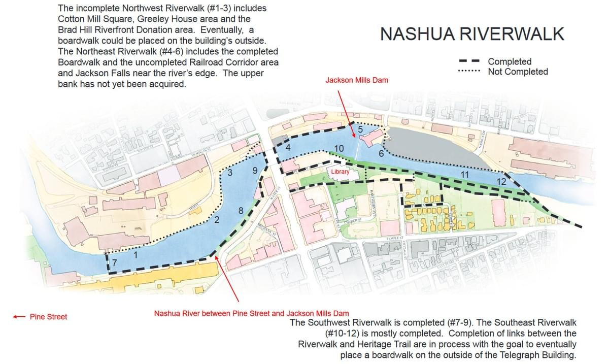
Nashua River between Pine St. and Jackson Mills Dam
Nashua River between Pine St. and Jackson Mills Dam
Nashua, New Hampshire 03060
Nashua River Walk webpageNashua River Watershed website
About this Location
One of the sections of the Nashua River that has historical and environmental significance is the stretch between Pine Street and Jackson Mills Dam in Nashua. This section is part of a 3-mile canal that was built in the 1800s to bring water to the mills operated by the Nashua Manufacturing Company. The Jackson Mills Dam, located at river mile 1.25, is a 180-foot-long by 33-foot-high masonry structure that houses a 1.0 megawatt hydroelectric project. The project provides upstream and downstream fish passage for migratory species. The project also operates in a run-of-river mode and maintains a minimum flow of 207 cubic feet per second to support aquatic habitat.
A section of the Nashua River Walk is open from the Library to the Cotton Transfer Bridge.
About Nashua River
See all hotspots at Nashua River
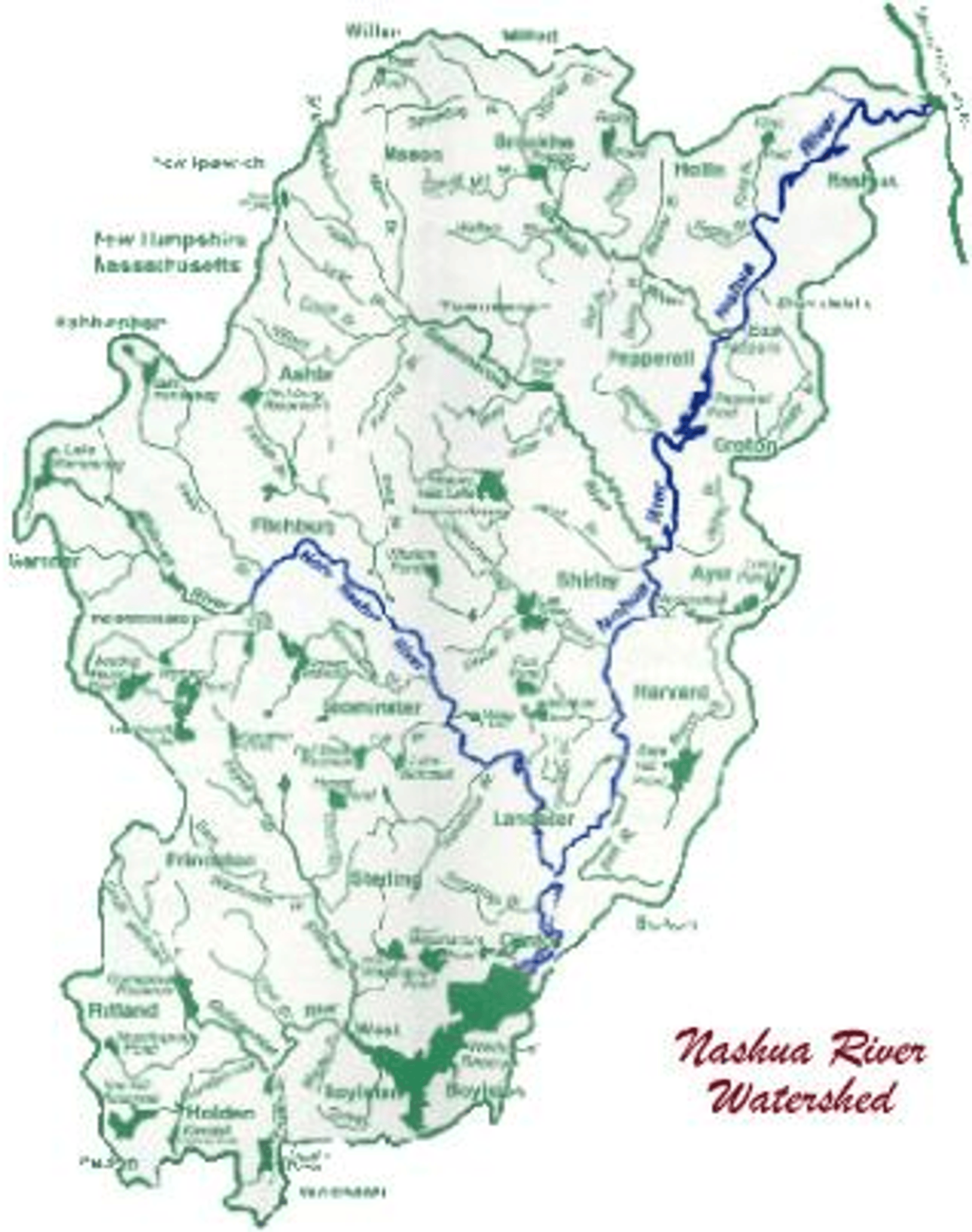
The Nashua River main stem forms the core of the Bolton Flats Wildlife Management Area and the Oxbow National Wildlife Refuge in Lancaster, Bolton, and Harvard where it winds north through marshy areas and former agricultural fields. Pepperell Dam in east Pepperell forms Pepperell Pond, an impoundment on the river popular for trophy large mouth bass and duck hunting. The river flows north through Hollis and Nashua, Hampshire where it joins the Merrimack River. The towns of Ayer and Pepperell have wastewater treatment plants discharging directly to the main stem Nashua River. The Devens Wastewater Treatment Plant has a sub surface wastewater discharge.
Nashua River Mainstem tributaries include Bowers Brook, Catacunemaug Brook, Flints Brook, James Brook, Mulpus Brook, Nonacoicus Brook, North Nashua River, South Nashua River, Still River, Unkety Brook, and Varnum Brook.
Features
Wheelchair accessible trail
Roadside viewing
Restrooms on site
Entrance fee
Content from Nashua River Watershed website
Last updated October 22, 2023