Mary's Pond
About this Location
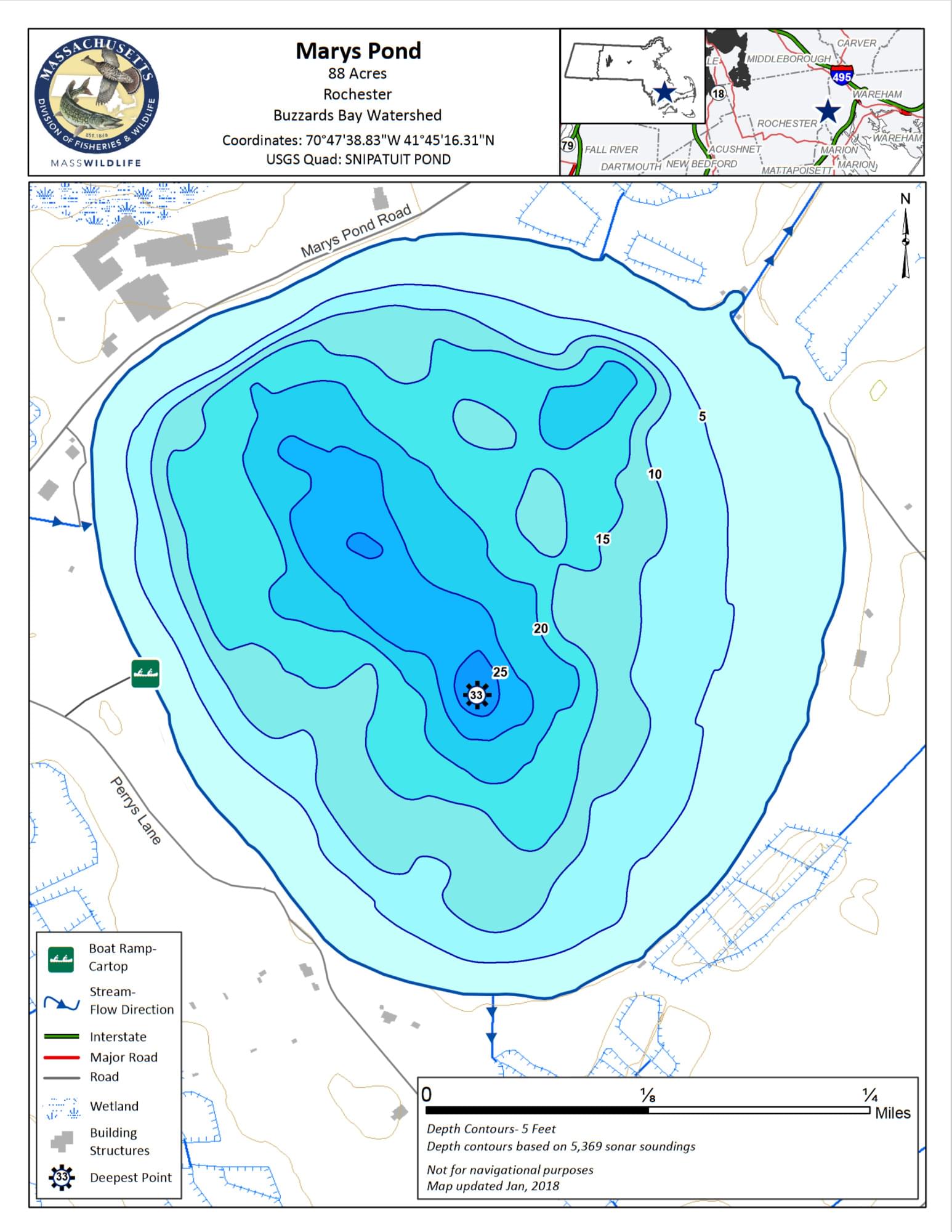
Marys Pond in Rochester is an 88-acre Great Pond with an average depth of 11 feet and a maximum depth of 33 feet. Approximately half of the 1.2 miles of the shoreline is developed with cottages, road frontage, and cranberry bogs, but this is still a pretty pond and a nice place to fish. The pond is supplied by groundwater and used as a water source for nearby cranberry bogs, it is generally infertile and the pH ranges on the slightly acidic side.
Access is provided by a town-managed cartop boat launch off of Perrys Lane which is on the left after you pass by the pond. Anglers can launch cartop boats and canoes here and the entire shoreline can be easily waded due to the hard, gradually sloping bottom. Ample parking is available.
Features
Roadside viewing
Restrooms on site
Wheelchair accessible trail
Entrance fee
Content from Mary's Pond information sheet and map
Last updated February 29, 2024