Burnt Mountain
Burnt Mountain
Groton, Vermont 05046
Burnt Mountain (PeakBagger) webpageGroton State Forest Official Website
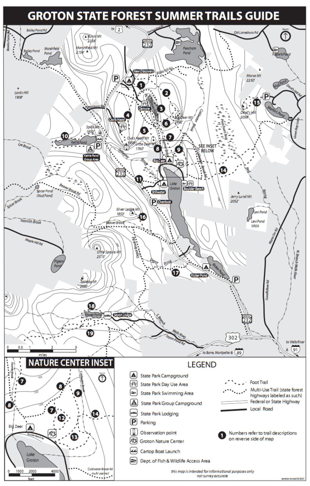
Groton State Forest Summer Trails guide and map
About this Location
Burnt Mountain, 2252 feet, is in the Groton State Forest. There is no designated trail to the peak.
About Groton State Forest
See all hotspots at Groton State Forest
The acquisition of Groton State Forest began in 1919. The Forest is managed for timber resources, wildlife habitat, and recreational activities. Many rare, threatened, and endangered plants and animals occur in the Forest. The most sensitive species are associated with the cliffs, bogs and swamps, lakes, and forests around lakes.
Groton State Forest is home to seven state parks, the Groton Nature Center, and eight lakes and ponds. The area was once home to 12 sawmills and remnants are still visible. The Civilian Conservation Corps (CCC) was instrumental in developing the area, constructing roads, trails, fire lookouts, and picnic shelters, and planting trees within the forest. Glaciers covered the area 10,000 years ago and their retreat created the mountainous terrain mixed with streams, ponds, bogs, and wetlands.
Groton State Forest is also home to several state-designated natural areas, such as Peacham Bog Natural Area (748 acres) and Lords Hill Natural Area (25 acres).
Groton State Forest is open for varied and dispersed recreation, including but not limited to camping, hiking, swimming, boating, fishing, hunting, trapping, horseback riding, cross country skiing, and snowshoeing. The Montpelier and Wells River Railroad bed was converted to a multi-use trail and is part of the Cross Vermont Trail. Snowmobiling is allowed on designated VAST trails.
Features
Restrooms on site
Wheelchair accessible trail
Entrance fee
Content from Burnt Mountain (PeakBagger) webpage, Groton State Forest Official Website, and Birdwatching in Vermont
Last updated April 26, 2024