Black Mountain Natural Area
Black Mountain Natural Area
The Nature Conservancy Dummerston, Vermont 05301
Official WebsiteBlack Mountain Natural Area map
About this Location
Black Mountain rises abruptly from the West River in Dummerston to a horseshoe ridge with a summit of 1,280 feet. The mountain originated as a mass of molten rock deep beneath the surface of the earth between 345 and 395 million years ago. Erosion has exposed the granite that forms the core of the mountain.
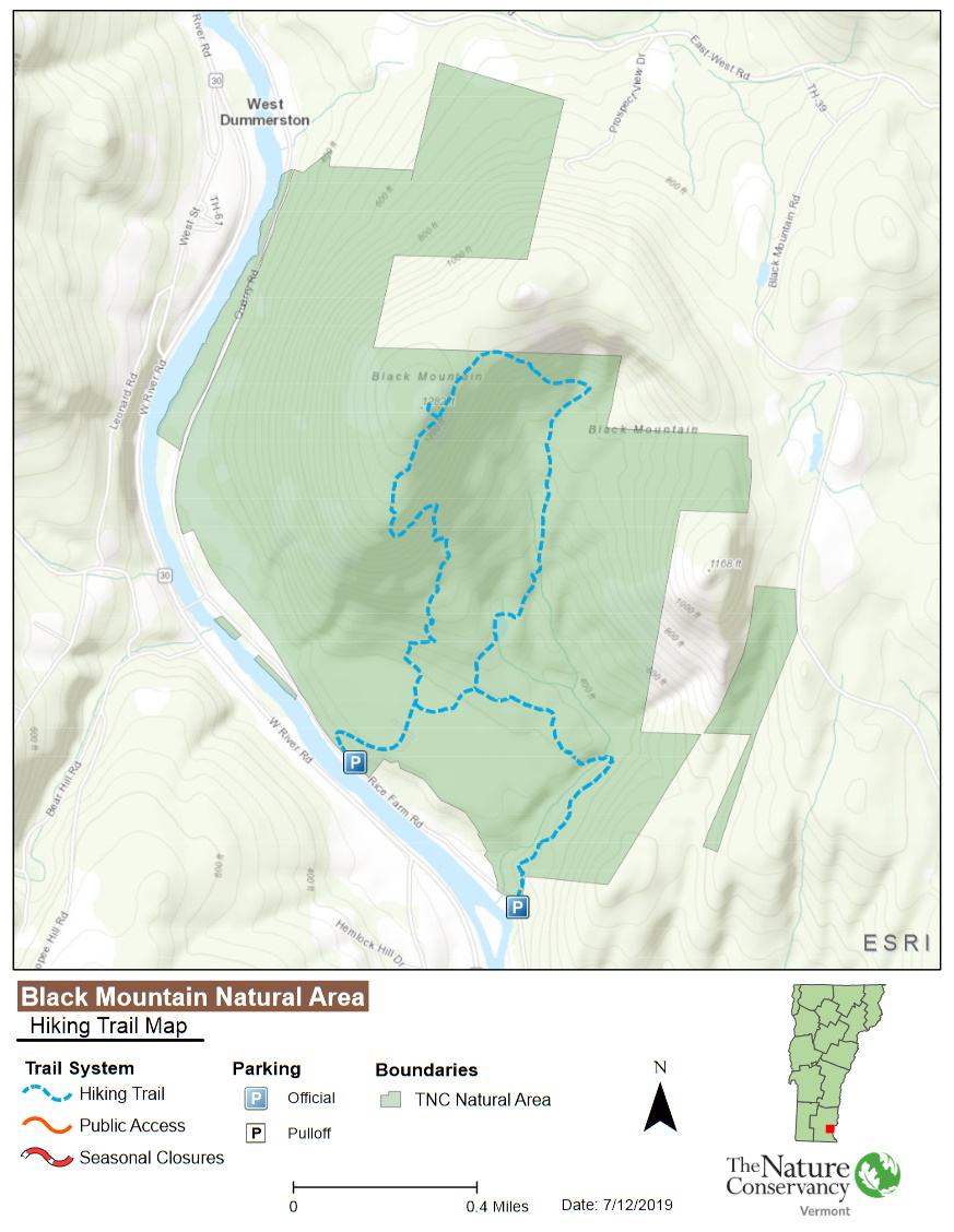
From the preserve’s trailhead, the path up Black Mountain climbs for more than a quarter mile in a very clearly defined stair-like pattern over a set of ancient floodplain terraces. Some of the terraces represent the shore of ancient Lake Hitchcock, the great glacial lake that ran much of the length of the Connecticut and West Rivers at the end of the ice age. From the top of the mountain, there are views as far as New Hampshire’s Mount Monadnock and into the river valleys.
The complex of dry ridge-top communities on Black Mountain’s rugged granite contours is exemplary for the region.
The Nature Conservancy has been working for decades to protect Black Mountain and its surrounding landscape. Recently, they have focused on public experience in the natural area, improving the trail system and points of access.
There is a 3-mile trail network here that provides hikers the option to loop back to their starting point from either of the trailheads on Rice Farm Road. Regardless of the starting point, the ascent to the summit is a steep and difficult climb. Remember to bring lots of water and take breaks as necessary.
Notable Trails
The TrailFinder website has a description and map of a hike at Black Mountain Natural Area.
Features
Restrooms on site
Wheelchair accessible trail
Entrance fee
Content from Official Website
Last updated October 6, 2023