Hogback Ridge Metropark
Hogback Ridge Metropark
Main Entrance (South): 4700 Emerson Road North Entrance: 7300 Warner Road Madison Township, Ohio 44057
Official WebsiteHogback Ridge Metropark map
Grand River Public Access Guide
Also, see all the hotspots at:
Grand River-Lower Watershed Important Bird Area
About this Location
Hogback Ridge Park, one of the first Lake Metroparks, is named for its most prominent natural feature: a high, narrow ridge of land bounded on two sides by steep valleys. This type of ridge is named for its resemblance to the bony spine of a hog. The hogback at this park is bordered on the north by the Grand River and on the south by Mill Creek.
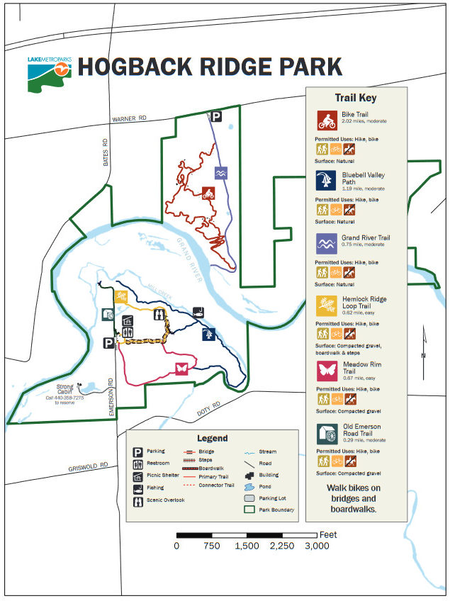
The 414-acre Hogback Ridge Park’s main recreational amenities, including a picnic shelter, its hiking trail network, and fishing access to both the Grand River and Mill Creek are accessible from the Emerson Road entrance on the south side of the river. The park’s mountain bike trail is accessible from the Warner Road entrance on the north side of the river and does not connect with the southern area.
Notable Trails
Hogback Ridge Metropark Trails
Trails at Hogback Ridge Metropark include:
Bike Trail – 2.02 miles – moderate
Bluebell Valley Path – 1.19 miles – moderate
Grand River Trail – .75 mile – moderate
Hemlock Ridge Loop Trail – .62 mile – easy
Meadow Rim Trail – .67 mile – easy
Old Emerson Road Trail – .29 mile – moderate
A description with a map of a 1.2-mile hike at Hogback Ridge Metropark is on AllTrails website
Features
Restrooms on site
Wheelchair accessible trail
Entrance fee
Roadside viewing
Content from Official Website and Lake Erie Public Access Guide