Stratton Mountain
Tips for Birding
Birdwatching in Vermont, pp. 83-84.
About this Location
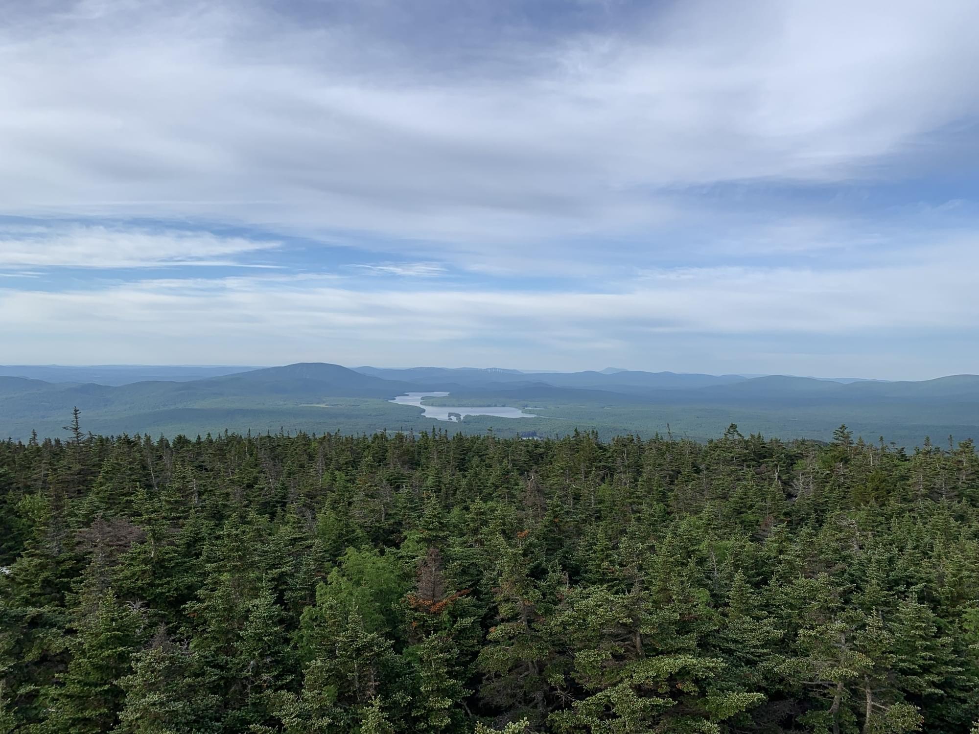
Stratton Mountain is a mountain located in Windham County in the Green Mountain National Forest. The mountain is the highest point of Windham County, and of the southern Green Mountains generally. A fire tower located on the summit is generally open for climbing by the public. There is also a small caretaker cabin (not open to the public) at the summit that is inhabited in season by a caretaker from the Green Mountain Club.
Stratton Mountain stands within the watershed of the Connecticut River, which drains into Long Island Sound in Connecticut. The south and southeast slopes of Stratton Mountain drain into Ball Mountain Brook, thence into the West River, and into the Connecticut River. The east side of Stratton drains via Kidder Brook into the North Branch of Ball Mountain Brook. The north side of Stratton drains into the North Branch of Ball Mountain Brook. The northwest side of Stratton drains into the Winhall River, and thence into the West River. The southwest slopes of Stratton drain into the East Branch of the Deerfield River, another tributary of the Connecticut River.
The mountain has two peaks, of which the southern one is the highest, at 3940 feet. The mountain ridge descends to northward to a saddle at 3830 feet, before rising to the north peak at 3875 feet. The south summit is wooded, except for the small clearing housing the tower and caretaker’s cabin. The tower was built about 1934 by a crew of the Civilian Conservation Corps, and the cabin dates to about 1970. The tower is the subject of a 1992 listing on the National Register of Historic Places, as one of the state’s last surviving towers, and one of the last three to be taken out of service for fire spotting (in 1982).
About Long Trail
See all hotspots at Long Trail
Vermont’s Long Trail follows the main ridge of the Green Mountains from the Massachusetts-Vermont line to the Canadian border. Built between 1910 and 1930, it was the vision of James P. Taylor and later became the inspiration for the Appalachian Trail. The Long Trail and Appalachian Trail share 100 miles of trail in the southern part of the state.
On the Long Trail, hikers encounter the best natural features Vermont has to offer, including pristine ponds, alpine sedges, hardwood forests, and swift streams. Known as the “footpath in the wilderness,” it is easy in a few sections and rugged in most. Steep inclines and plenty of mud present hikers with plenty of challenges.
As maintainer and protector of the Long Trail, the Green Mountain Club works in partnership with the Green Mountain National Forest, the State of Vermont, Appalachian Trail Conservancy, and private landowners to offer a world-class hiking trail.
The Long Trail is truly the trail for everyone. Each year, hundreds of thru-hikers set out to complete the trail in one go, a journey that has been completed in under 5 days but typically takes multiple weeks. Section hikers tackle the trail in bursts, often completing the Long Trail over the course of many years.
Hikers who hike every mile of the Long Trail, whether in day trips, multi-day sections, or all at once, are called “End-to-Enders” and are eligible to register for inclusion in the GMC’s official records.
Most trail users are day hikers, who enjoy desired destinations as day trips without camping out on the trail.
Features
Restrooms on site
Wheelchair accessible trail
Entrance fee
Content from Long Trail website and Wikipedia
Last updated October 6, 2023