Alburg Dunes State Park
About this Location
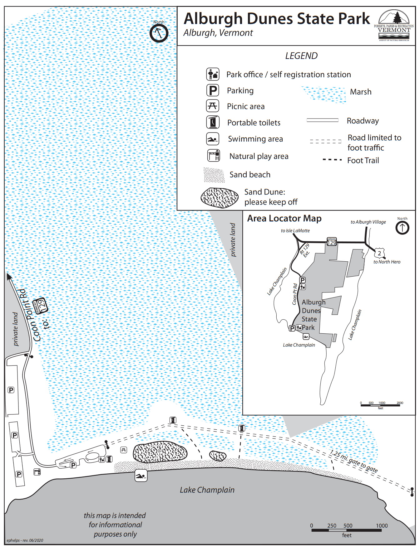
Alburgh Dunes, 625 acres, became a state park in 1996. It is named for the sand dunes near the center and western end of the south-facing, natural sand beach. This beach is amongst the longest beaches on Lake Champlain.
The beach and dunes together make up what is known as a barrier island, geologically similar to coastal formations more common along ocean shorelines. At Alburgh Dunes, the sand has come from a layer of glacial till- the soil that was left atop the low bluffs southeast of the beach when the last glacier melted. The bluffs have eroded over thousands of years, and the soil is carried off by lake currents. Sand from that soil settles out in the pocket between the rocky “Point of Tongue” to the east and “Coon Point” to the west, forming the beach. Prevailing southerly winds, in the late summer and fall, when lake levels are the lowest, blow the sand back from the shore, forming dunes. It’s a barrier between the lakeshore and the wetland behind, and an island because the beach and dunes, however slowly, continue to migrate into and over the wetland. Deposits of exposed peat are visible on the low end of the beach or in the shallow water just offshore. This peat was formed in the wetland; as the beach and dunes have moved back the peat has been overlaid by sand. Erosion from the waves continues to uncover it.
Alburgh’s dunes were altered before the area became a state park. Portions of the dunes were bulldozed for sand with which to replenish the beach. Protective vegetation was damaged or destroyed when trees were cut for firewood, and beach visitors climbing through and over the dunes wore pathways through the stabilizing grasses. These changes hastened beach and dune erosion. Today, protective fencing is installed around the dunes. It is hoped the dunes will eventually repair themselves. Please help us protect this unique sand dune area by staying outside of the fence. The fence is both to minimize human disturbance and to protect rare plants growing inside. Two species of rare plants, Champlain beach grass, and the low-growing beach pea, are remnants from the post-glacial era in which Lake Champlain was an inland estuary of the Atlantic Ocean. Isostatic rebound, a slow-rising of the earth’s crust once freed from the great weight of the overlying glacier, has raised Lake Champlain to its current 30-meter (100-foot) elevation above sea level. Thousands of years of rain and snowmelt have flushed out the seawater.
The wetland behind the beach includes the largest black spruce bog in Grand Isle County. Black spruce swamps and bogs are more typical of colder, northern climates than of the Champlain Valley, which is Vermont’s warmest area. Core samples from the bog reveal peat to depths of more than 8 meters (26 feet). From these samples comes a record of climate and vegetation dating back to the ice age, and further evidence of isostatic rebound.
Alburgh’s wetlands are important to wildlife, providing habitat for breeding, feeding, nesting, and over-wintering. The park’s wetlands and adjacent white cedar forest uplands are the primary components of the largest and most important deer wintering area in Grand Isle County. Wild turkeys, too, are abundant in and around the area. Alburgh Dunes certainly lends itself to wildlife viewing!
Notable Trails
A description and map of the trails at Alburg Dunes State Park is on the TrailFinder website.
Features
Restrooms on site
Entrance fee
Wheelchair accessible trail
Content from Official Website
Last updated October 16, 2023