Wollomonopoag Conservation Area
Wollomonopoag Conservation Area
Elysium Street Wrentham, Massachusetts 02093
Wrentham Guide to Open Spaces and Conservation Land booklet and mapsAbout this Location
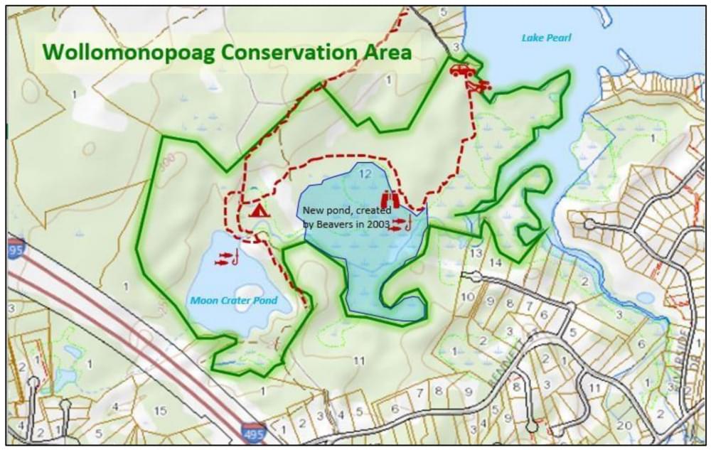
“Wollomonopoag” means “Place of Shells,” it features miles of trails, large eskers, several beaver dams, extensive marshes, a large heron rookery, and a mature White Pine forest. Eskers are the remnants of river beds that ran beneath glaciers more than 13,000 years ago. As the glaciers melted, flood waters ran beneath the ice in tunnels. The flood waters contained loads of gravel and boulders laid down as steep, linear ridges. Because eskers are comprised of gravel they are typically mined and sold as fill. Therefore, eskers are becoming increasingly scarce in eastern Massachusetts. It is not hard to imagine that Native Americans found this area attractive: close to the water and a natural defensive position that the eskers provided. Wollomonopoag lies on the upper reaches of the Charles River watershed. The area is important to water quality on a regional level and is the keystone in over 600 acres of open space the Town maintains in this portion of the watershed. Downstream, the towns of Wrentham, Franklin, Norfolk, Millis, and Medway have well fields that depend on this water.
The mixed hardwood and pine forests of Wollomonopoag are home to scarlet tanager, deer, beaver, pine martin, Great Blue Heron, Osprey, and wild turkey. The Town acquired this property by eminent domain in 2001. In two places, the trails run off the property. The public may use these trails but stay on the trail and be respectful of those adjoining properties.
Elysium Street is off MA-140 a few hundred feet before entering Franklin. Ignore any “Private Road” signs and go to the end of Elysium Street where there is off-street parking on an unpaved lot.
Notable Trails
Miles of hiking trails through wooded areas, wildlife viewing, and areas of interest for glacial geology. Long trails require some rigor in places.
Features
Restrooms on site
Wheelchair accessible trail
Entrance fee
Content from Wrentham Guide to Open Spaces and Conservation Land booklet and maps
Last updated February 16, 2024