Tillinghast Pond Manangement Area
Tillinghast Pond Manangement Area
West Greenwich, Rhode Island 02817
Official WebsiteTillinghast Pond Manangement Area map
About this Location
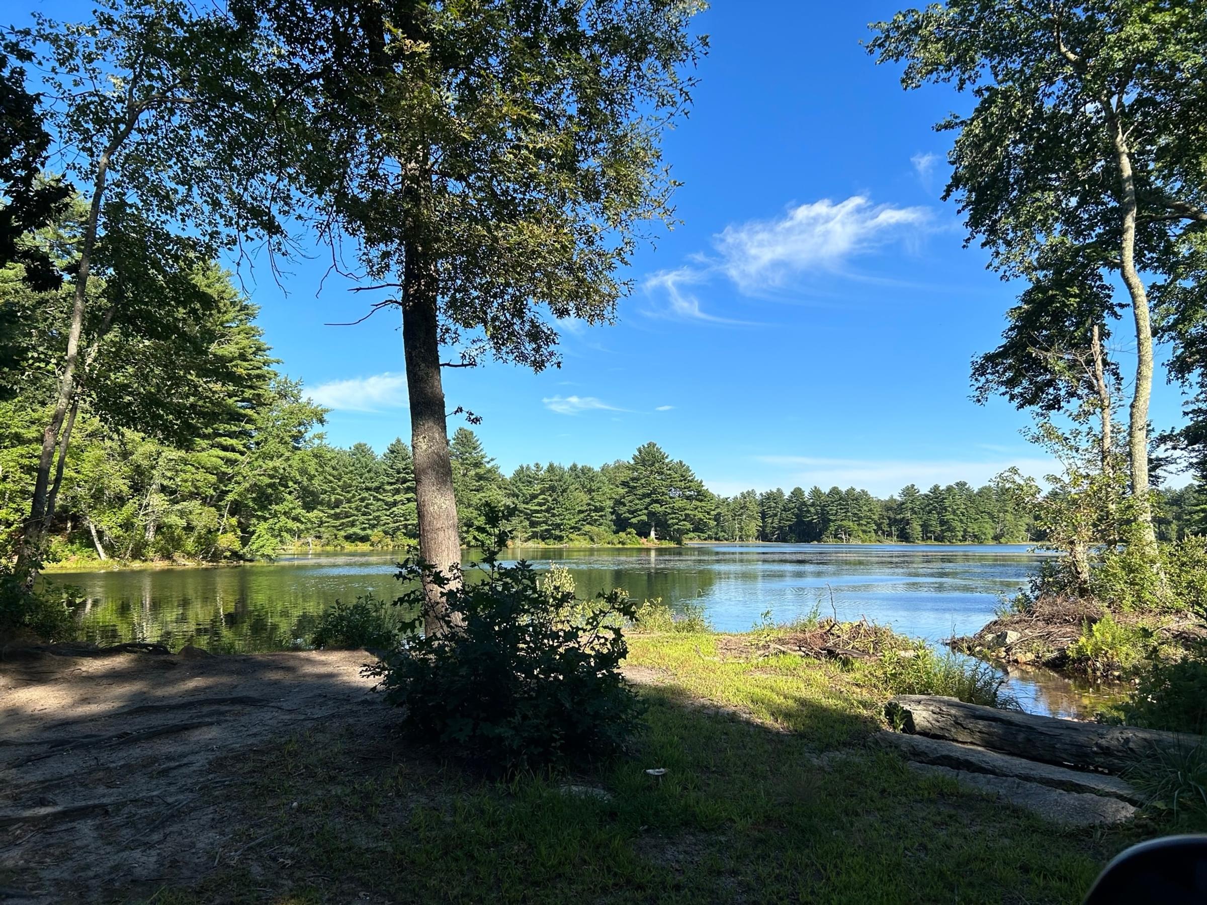
Surrounded by protected forest, Tillinghast Pond Management Area offers serenity and natural beauty that rank among the best in southern New England.
Tillinghast Pond’s waters are clear and shallow, perfect for a family paddle. Cast a line, explore the coves, or just float around and let the solitude recharge your batteries.
The Conservancy, RIDEM, and the Town of West Greenwich are working closely together to establish Tillinghast Pond as a top hiking destination. Four interconnected loop trails provide for a wide range of options, from a short walk in the woods to a 10-mile day hike.
Notable Trails
The 2.3-mile Pond Loop (blazed white) starts from either end of the Plain Road parking lot. The trail passes over easy, flat terrain around Tillinghast Pond, with ample opportunities to look for wildlife or simply enjoy the long views across the water. An observation platform is located roughly halfway around the pond. The Pond Loop also includes three hayfields, which are leased to a local dairy farmer.
The Flintlock Loop (blazed yellow) winds for 2.6 miles through the open woods east of Tillinghast Pond and is highlighted by a glacial “boulder garden,” a historic cemetery, and an 1830s-era farmstead. Start on the Pond Loop (white blazes) by the kiosk; walk for two-tenths of a mile and look for the sign for the Flintlock Trail. The trail is also accessible from the small parking lot on Plain Meeting House Road, via an old farm road.
The Coney Brook Loop (blazed orange) takes hikers through a forest restoration site, past the stone walls of an early 1800s farm, and along the tops of glacial ridges, shaded by hemlocks and beeches. Coney Brook highlights the 2.3-mile route, rushing over a dam and through a small ravine. Start on the Pond Loop (white blazes) from the north side of the Plain Road parking lot and watch for the sign to Coney Brook approximately 500 feet ahead.
The Wickaboxet Loop (blazed blue) connects the Tillinghast Pond and Wickaboxet Management Area trail systems. Combining new woodland paths with old fire roads, the 4-mile trail provides a lot of variety for hikers and features two historic cemeteries and several well-preserved cellar holes. Park at the Plain Meetinghouse Road entrance and follow a farm lane for a half-mile to the trailhead. This trail is also accessible from the Wickaboxet parking lot and the West Greenwich Land Trust’s Pratt Conservation Area, at the end of Saddle Rock Road.
The half-mile Logger’s Trail is a rough path through a wildlife restoration area. Seedling trees, pasture grasses, and berry bushes are abundant following a 2010 timber harvest, as are the songbirds that depend on such open habitat. The trailhead is about a tenth of a mile from the Plain Road parking lot, branching off from the Coney Brook Loop.
Features
Restrooms on site
Content from Official Website
Last updated September 1, 2023
