Sweet Alice Conservation Area
Sweet Alice Conservation Area
Amherst, Massachusetts 01002
Sweet Alice Conservation Area brochure and mapAbout this Location
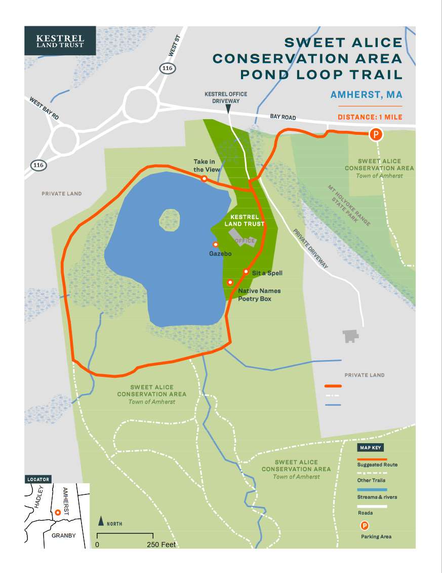
The Sweet Alice Conservation Area Loop Trail is an easy walk at the base of the Mount Holyoke Range that follows a scenic loop around the pond that connects the Town of Amherst Sweet Alice Conservation Area and Kestrel Land Trust's office grounds.
Notable Trails
Sweet Alice Conservation Area Loop Trail
From the Sweet Alice parking area on Bay Road, head west/right toward the private driveway. Follow the painted animal footprints up the side of the driveway, then turn right at the trail sign to cross over to Kestrel’s driveway. Begin the Pond Loop Trail (purple blazes) by continuing straight across the driveway to the grassy dam that creates the pond. Enjoy the view across the pond of the Mt. Holyoke Range and look for signs of turtles, beavers, and other wildlife. Continue into the woods and follow the historic trolley line over the Notch from 1906 to 1932.
When you reach the powerline cut, bear left/east to follow the purple blazes into the woods. Pass through the wooded wetland surrounding the pond, and cross over the Plum Brook inlet that creates it. Continue out of the woods and onto Kestrel’s grounds, where you can check out our Native Names Poetry box. From here you can visit the Lower Meadow or Gazebo, and enjoy the view of the pond. To complete the loop, continue up the hill staying along the edge of the woods the Kestrel office parking lot, and follow the painted animal tracks back down the driveway to return to the public parking area.
Features
Restrooms on site
Wheelchair accessible trail
Entrance fee
Content from Sweet Alice Conservation Area brochure and map
Last updated December 2, 2023