Mount Holyoke Range SP--Mount Norwottuck
Mount Holyoke Range SP--Mount Norwottuck
Amherst, Massachusetts 01002
Mount Holyoke Range State Park Official WebsiteMount Holyoke Range State Park map
About this Location
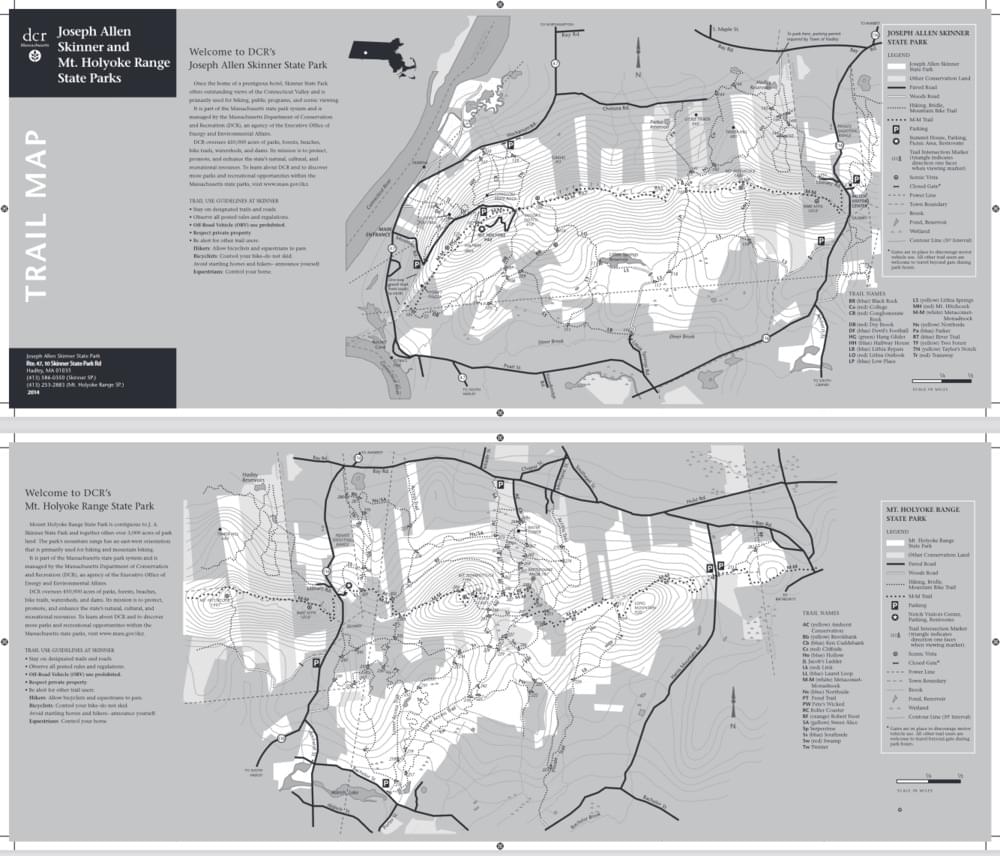
Mount Norwottuck is the highest peak in the Holyoke Range, with an elevation of 1,106 feet. It is part of the Metacomet Ridge, a long traprock mountain range that extends from Long Island Sound to the Vermont border. Mount Norwottuck is a popular destination for hikers, who can enjoy panoramic views of the Connecticut River Valley and the Berkshires from the summit. The mountain also features a distinctive rock formation known as the Horse Caves, which was used as a hiding place by Native Americans and colonists during King Philip's War.
About Mount Holyoke Range State Park
See all hotspots at Mount Holyoke Range State Park
Mount Holyoke Range State Park encompasses more than 3,000 acres of forested land along a 7-mile ridge of the Metacomet Ridge. The park offers scenic views, hiking trails, camping facilities, and educational programs. The park includes streams, wetlands, woods, and thickets. Visitors can explore more than 30 miles of blazed trails. The park is managed by the Massachusetts Department of Conservation and Recreation.
Notable Trails
The AllTrails website has descriptions and maps of hikes at Mount Holyoke Range State Park.
Features
Restrooms on site
Wheelchair accessible trail
Entrance fee
Content from Mount Holyoke Range State Park Official Website
Last updated January 6, 2024