Trout Pond Conservation Area
Trout Pond Conservation Area
Wrentham, Massachusetts 02093
Town of Wrentham Open Spaces booklet and mapsAbout this Location
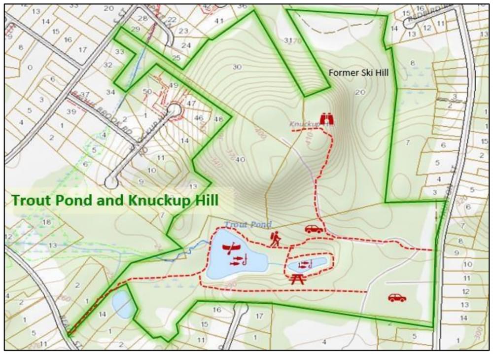
Trout Pond and Knuckup Hill are located off Taunton Street and offer trails that run through forests and varied terrain on approximately 100 acres within a mile of the Town Center. This area consists of a chain of Town properties: Town Hall, the Town Library, Sweatt Ball Fields, Knuckup Hill, and the Trout Ponds. Two ponds lie at the center of the Trout Pond area and have long been used for fishing and skating. The Trout Pond area began with a 42.5-acre gift to the town in 1908 when the state authorized the taking of the ponds and surrounding land for the town's water supply. The donors were Ellen F. Mason, Mary A. and Maria F. Smith, Fred E. Gilmore, George W. Porter, and Daniel Brown. Trout Pond was the site of the original Town Well #1 which was exhausted in the 1960s.
Knuckup Hill lies on the north side of the Trout Pond area and has trails running to the top of the Hill. The top of the former ski hill, abandoned in 1980, offers a sweeping vista to the northwest of the Town Center and is quite beautiful at the foliage change. At one time Sweatt Ski Hill offered local skiing for 50¢ per day after school. A short, very steep walk downhill to the ballfields demonstrates the challenge this small hill offered skiers. West of Knuckup Hill and north of Trout Pond are 19 acres of open space obtained from the Badus Brook subdivision in the early 2000s. This area has several trails that wind over interesting terrain but need to be marked and mapped. Knuckup Hill is also the site of one of the Town's water towers and is crossed by the Warner Trail. Knuckup Hill was put together from small properties purchased with town Conservation Funds in 1964 for recreational use.
Features
Restrooms on site
Wheelchair accessible trail
Entrance fee
Content from Town of Wrentham Open Spaces booklet and maps
Last updated February 14, 2024