Sunapee-Ragged-Kearsarge (SRK) Greenway Trail--#11 Winslow SP to Kearsarge Valley Rd.
Sunapee-Ragged-Kearsarge (SRK) Greenway Trail--#11 Winslow SP to Kearsarge Valley Rd.
Sunapee-Ragged-Kearsarge Greenway Andover, New Hampshire 03216
Sunapee-Ragged-Kearsarge Greenway Trail #11 mapSunapee-Ragged-Kearsarge Greenway website
Sunapee-Ragged-Kearsarge Greenway maps
About this Location
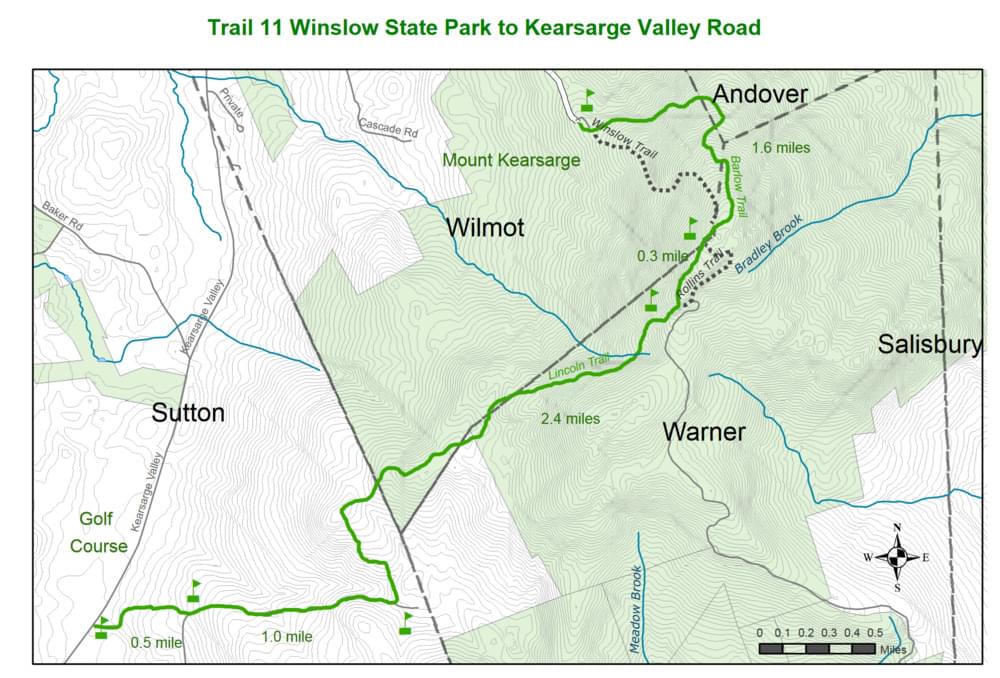
Total Distance: 5.8 miles Estimated time: 4 hours Total Ascents: 1100 feet Total Descents: 2100 feet
This SRKG section traverses the summit of Mount Kearsarge (2937 feet), the highest point on the SRKG, and then descends to Kearsarge Valley Road in North Sutton. It passes through two New Hampshire state parks, Winslow and Rollins; Mount Kearsarge State Forest; and privately owned forest lands along the lower two miles of the Lincoln Trail. The route lies within three towns: Wilmot, Warner, and Sutton. The USS Kearsarge, the victor over the CSS Alabama in a famous Civil War naval battle, was named after Mount Kearsarge. Its commander, Captain John Winslow, lent his name to a 19th-century summer hotel, the Winslow House, and subsequently to the park. The cellar hole of this old resort is still visible in the Winslow State Park picnic area near the trailhead. On the bare summit, one discovers a fire tower and a tall communications tower. With a 360-degree view, clear days reveal mountain peaks in Massachusetts, Vermont, and New Hampshire. The summit in summer is the most likely place on the SRKG to encounter the song of the white-throated sparrow (Zonotrichia albicollis).
The northern trailhead is located in Winslow State Park. It is accessed from Kearsarge Valley Road, between NH-11 in Wilmot Flat and North Road in Sutton. From I-89 Exit 10, take North Road south .5 mile to a left on Kearsarge Valley Road, then right on Kearsarge Mountain Road, where signs point uphill 2.2 miles to the park gate. An entrance fee is charged during late spring, summer, and early fall. The trailhead is at the upper end of the large parking/picnic area. The park gate is closed in winter, but parking near the gate or lower, at the snowplow turn, is allowed. The southern trailhead on Kearsarge Valley Road is 3.6 miles south of NH-11 on Kearsarge Valley Road and .4 miles north of North Road. Parking is in a sandy open area on the east side of Kearsarge Valley Road. Look for the Link Trail at the edge of the woods. The summit and the upper end of the Lincoln Trail can also be reached via the Rollins Trail, found at the west end of the parking area in Rollins State Park on the south side of Mount Kearsarge. This car park, only .5 mile below the summit, is reached from Warner. From Main Street NH-103) in Warner take Tory Hill and Kearsarge Mountain roads to the park ranger station, where an entrance fee is charged. Car access to Rollins State Park is closed in winter.
About Sunapee-Ragged-Kearsarge (SRK) Greenway Trail
See all hotspots at Sunapee-Ragged-Kearsarge (SRK) Greenway Trail
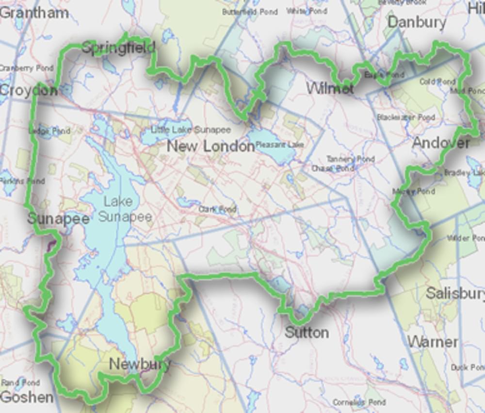
The Sunapee-Ragged-Kearsarge (SRK) Greenway Trail is a 75-mile loop of hiking trails in central New Hampshire. The Greenway Trail System circles the Lake Sunapee area and connects Sunapee, Ragged, and Kearsarge Mountains.
The Greenway’s mission is to create and maintain a forever green, great circle of trail corridors and conserved lands providing walkers with minimally-developed access to the mountains, lakes, vistas, and historical sites of the Lake Sunapee Region.
Features
Entrance fee
Restrooms on site
Wheelchair accessible trail
Content from Sunapee-Ragged-Kearsarge Greenway website
Last updated November 3, 2023