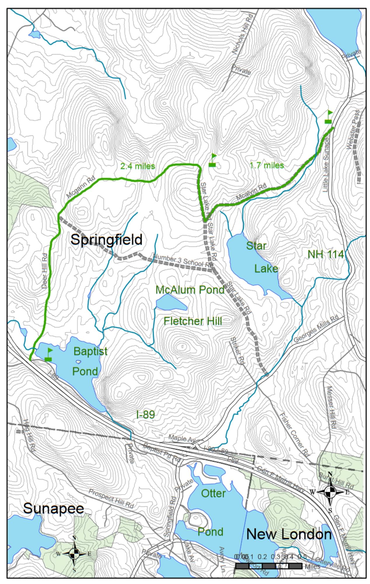
Sunapee-Ragged-Kearsarge (SRK) Greenway Trail--#4 Deer Hill Rd. to NH-114, Goshen
Sunapee-Ragged-Kearsarge (SRK) Greenway Trail--#4 Deer Hill Rd. to NH-114, Goshen
Sunapee-Ragged-Kearsarge Greenway Springfield, New Hampshire 03284
Sunapee-Ragged-Kearsarge Greenway Trail #4 mapSunapee-Ragged-Kearsarge Greenway website
Sunapee-Ragged-Kearsarge Greenway maps
About this Location
The western trailhead is at the intersection of Stoney Brook Road (also Baptist Pond Road) and Deer Hill Road. From I-89 Exit 12-A going south on Georges Mills Road, Stoney Brook Road is the first right. At 1.5 mi., after passing Baptist Pond, this road intersects Deer Hill Road, where there is a small parking area. Also, parking can be found on the shoulders of Stoney Brook Road beyond the I-89 underpass near the road intersection. There is ample parking at the eastern trailhead where the Protectworth Trail joins NH-114. From I-89 Exit 12A, Georges Mills Road goes north to NH-114. From this intersection, it is 1.5 mi. north on NH-114 to the parking area on the right side.
About Sunapee-Ragged-Kearsarge (SRK) Greenway Trail
See all hotspots at Sunapee-Ragged-Kearsarge (SRK) Greenway Trail
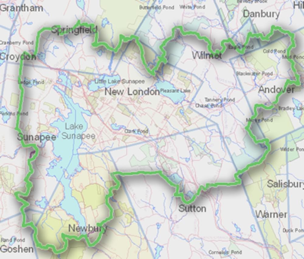
The Sunapee-Ragged-Kearsarge (SRK) Greenway Trail is a 75-mile loop of hiking trails in central New Hampshire. The Greenway Trail System circles the Lake Sunapee area and connects Sunapee, Ragged, and Kearsarge Mountains.
The Greenway’s mission is to create and maintain a forever green, great circle of trail corridors and conserved lands providing walkers with minimally-developed access to the mountains, lakes, vistas, and historical sites of the Lake Sunapee Region.
Features
Restrooms on site
Wheelchair accessible trail
Entrance fee
Content from Sunapee-Ragged-Kearsarge Greenway website
Last updated October 28, 2023