Lyndon State Forest
Lyndon State Forest
New Boston Road Lyndonville, Vermont 05851
Official WebsiteLyndon State Forest map
About this Location
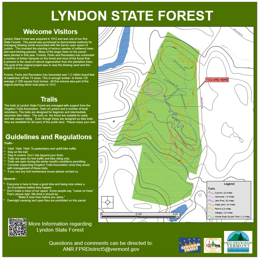
Lyndon State Forest was one of the first parcels of land acquired by the State of Vermont, purchased in 1912. The area is hilly and composed mostly of sandy soils. Early photos show drifting sand “dunes” and sparse patches of grass. Soon after the parcel was acquired, plantings of Scotch pine, white pine, red pine, and some white spruce began and occurred until 1984.
Lyndon State Forest is an excellent example of intensive forest management practices over time. Due to grazing and deforestation, the area was a sand drift at the time of acquisition. Today, the forest is used for many different types of educational opportunities and is used by local schools for various field trips.
Lyndon State Forest is open for dispersed recreational activities such as bird watching, hunting, snowshoeing, berry picking, and cross-country skiing. In 2017, a proposal was brought forward by Kingdom Trails Association to build and maintain a network of multi-use trails in the forest. Approximately one mile of double-track trail and approximately four miles of single-track trail were proposed. Public input was gathered through a number of public meetings. The Lyndon Planning Commission and several local businesses supported the proposal. Work on the trail system began in the summer of 2017. Trails are open to walkers and bikers as well snowshoers, cross-country skiers, and fat bikers during winter months.
Notable Trails
The TrailFinder website has a description and map of a hike at Lyndon State Forest.
Features
Restrooms on site
Wheelchair accessible trail
Entrance fee
Content from Official Website
Last updated October 15, 2023