Foundry Pond, Hingham
About this Location
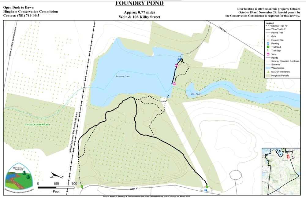
Foundry Pond is a pond, salt marsh, and an abandoned quarry at a scenic spot on the Weir River. 32 acres, with 0.77 miles of trails. In the spring, look for river herring swimming upstream at the fish ladder.
Foundry Pond was created when the Weir River was dammed in the late 1700s. The Hingham Malleable Iron Company (1840-1876) and Colonel Weston’s wool processing factory (until 1888) were both located here, but they each were destroyed by fire. Later, The Sportsmen’s Club acquired the property, and in time, sold it to the Town of Hingham.
Across Rockland Street, check out Amonte Meadow (3.3 acres), a small conservation parcel on the Weir River with grassy areas, wetlands, and a stand of Tupelo trees.
Both Native Americans and colonists used weirs to catch herring here, and that’s how the river got its name. The herring run is impacted by upstream water withdrawals that lower streamflow in the summer and fall when juvenile herring are migrating downstream. Like many fish ladders placed on old dams, this one is not ideal for fish passage.
Some of the fish that might be found at Foundry Pond include river herring, smelt, brown trout (stocked from Europe), brook trout, largemouth bass, redfin pickerel, bluegill, pumpkinseed sunfish, and American eel.
The forest here is composed of pine, oak, and cedar, plus some bittersweet and holly. There is also marshland, with plenty of cattails. Deer hunting is permitted on this property from October 19 to November 28, but only with a Special Permit from the Hingham Conservation Commission.
Foundry Pond was created by a dam on the Weir River. Formed at the confluence of Crooked Meadow River and Fulling Mill Brook, the Weir River flows north through Hingham, with Tower Brook and Accord Brook joining it in its first mile. It gradually turns northeast and flows for another 1.4 miles, through Weir River Farm and eventually into Foundry Pond. The Weir River Estuary, designated by the Commonwealth of Massachusetts as an Area of Critical Concern, begins just below the manmade dam at the pond. The mile-wide estuary forms the border between Hingham and Hull and empties into Hingham Bay.
Notable Trails
There is a very short trail at the Kilby Street entrance, where you can cross a small wooden bridge over the spillway and possibly get up-close views of migrating fish (in season). This entrance puts you almost directly on the dam itself, so it’s a very short walk to the water.
The Weir Street entrance features 0.77 miles of woodland trails, both wide and narrow, that lead to Foundry Pond, and to a spot where you can view the fish ladder.
Content from Official Website