Lower Vine Brook Conservation Area
Lower Vine Brook Conservation Area
Lexington, Massachusetts 02420
Lower Vine Brook Conservation Area information and mapAbout this Location
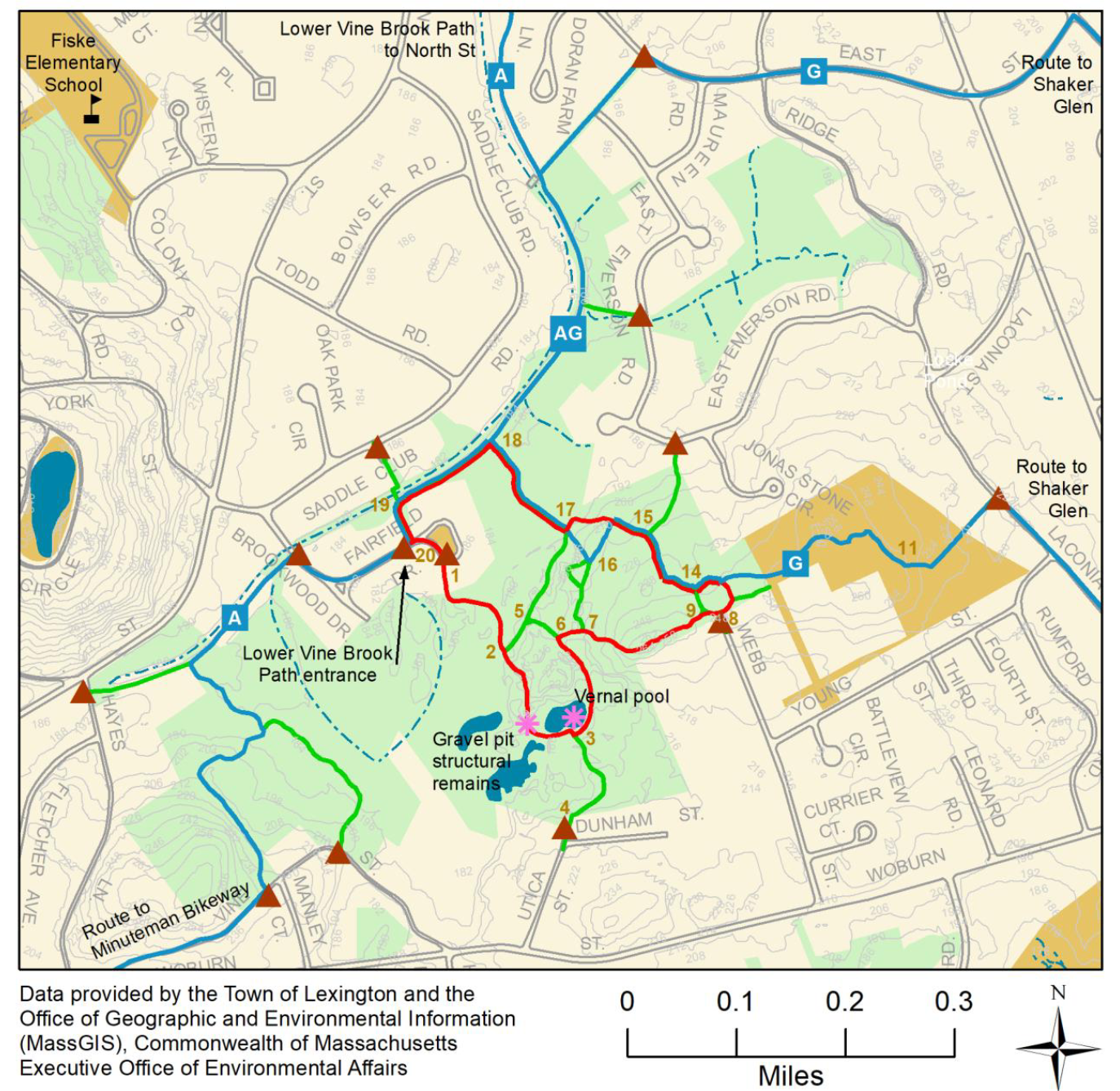
Lower Vine Brook Conservation Area, 110 acres, has 4.2 miles of trails (including the Lower Vine Brook Path). Lower Vine Brook offers a dramatic forested landscape shaped by a sand and gravel company that mined here until 1940. a paved recreation path runs along Vine Brook from Fairfield Drive to East Street and then continues along Vine Brook to North Street. A 14-acre parcel off of Vine Street purchased in 2009 now connects the western and eastern parts of the area.
Access is from the recreation path, as well as from Utica Street, East Emerson Road, Vine Street, Webb Street, Hayes Lane, Laconia Street, Brookwood Drive, Saddleclub Road, and Fairfield Drive.
Notable Trails
The AllTrails website has a description and map of a hike at Lower Vine Brook Conservation Area.
Features
Restrooms on site
Wheelchair accessible trail
Entrance fee
Content from Lower Vine Brook Conservation Area information and map
Last updated January 3, 2024