Crockers Neck
About this Location
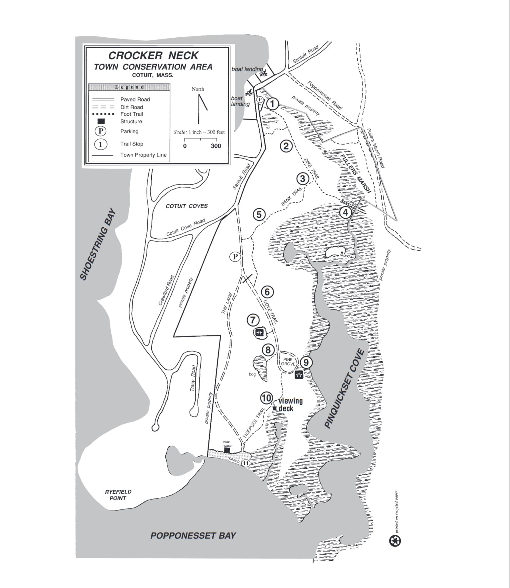
Crocker Neck Conservation Area is a 97-acre town-owned conservation area managed by the Town of Barnstable.
Located at the southwestern corner of the village of Cotuit, Crocker Neck is named for the old Barnstable family that owned much of it. The Neck is part of the outwash plain, sands carried south off the melting glacier 12,000 years ago. Habitat types found here include pine/oak forest, salt marsh, freshwater marsh, shrub swamp, beach, and estuarine flats.
A total of 1.5 miles of walking trails are maintained on Crocker Neck. A leisurely stroll of the property takes less than one hour, but more time is recommended to soak in the rich tapestry of life to be found. Parking space is provided at the northern gate on Santuit Road and inside The Lane. Picnic tables are available at the white pine grove and overlooking the cove.
Notable Trails
The AllTrails website has a description and map of a hike at Crockers Neck.
Features
Restrooms on site
Wheelchair accessible trail
Entrance fee
Content from Crocker Neck Conservation Area brochure
Last updated March 5, 2024