Mohawk Trail State Forest
Mohawk Trail State Forest
Charlemont, Massachusetts 01339
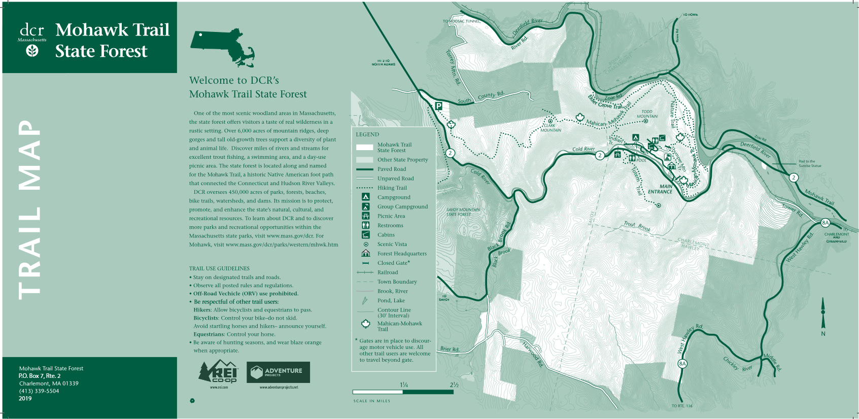
Official WebsiteMohawk Trail State Forest map
About this Location
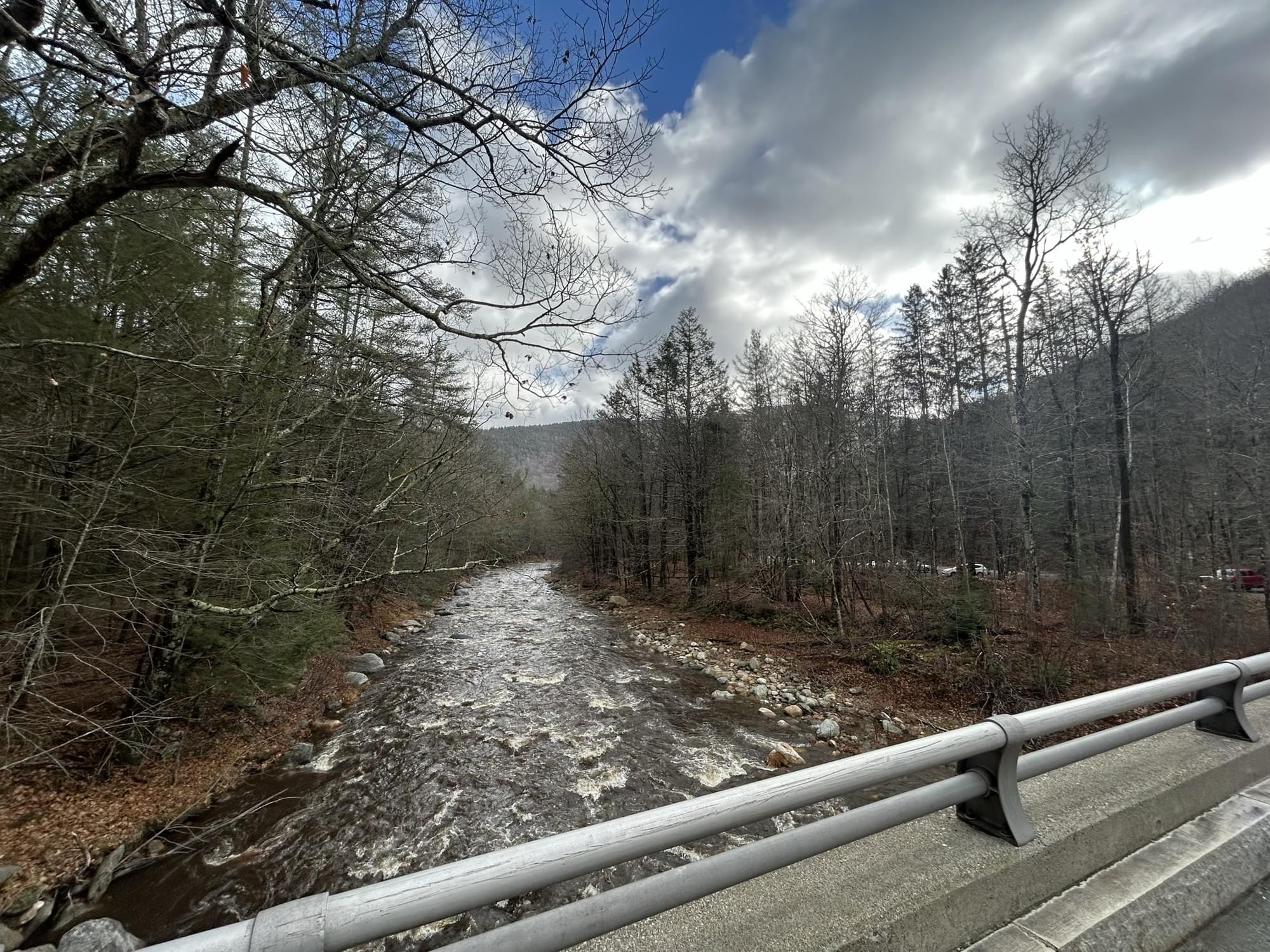
Mohawk Trail State Forest is located along the historic Mohawk Trail auto road. The forest covers more than 7,700 acres of mountain ridges, gorges, and old-growth forests. The forest features a section of the original ancient footpath used by Native Americans, now known as the Mahican-Mohawk Trail. Visitors enjoy camping, hiking, fishing, and wildlife viewing.
Notable Trails
Nature Trail Loop at the Upper Meadow, 3.4 miles round-trip Difficulty: Moderate
Park at the headquarters parking area. View Map
From the park headquarters hike up the paved campground road. Continue uphill following signs to the Group Camp Site past the last cabin the road turns to dirt. Continue along the dirt road past the group campsite and through the gate. As you continue down the dirt road, look up. These are some of the tallest recorded white pine trees in New England! Near the bottom of the slope, turn left onto the Nature Trail, it overlaps with the Mahican-Mohawk Trail here. Follow this trail through woods to and through the Upper Meadow. In the meadow, the Nature Trail soon splits, turns right, and re-enters the woods going downhill. Continue to the Lower Meadow, re-enter the woods, turn right, and return up the dirt road, over the ridge, and back through the campground to the park headquarters.
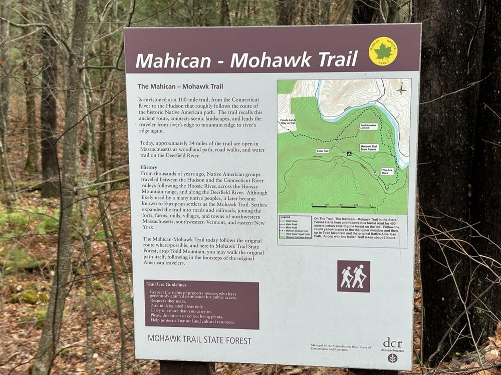
Indian Trail to Mahican-Mohawk Trail, 4.1-mile loop Difficulty: Difficult
Park at the headquarters parking area. View Map
Ascend out of the Deerfield River Valley as the First People did centuries ago. From the park headquarters hike up the road and through the campground. Continue straight to the very end of the road (0.7 miles), where you take a right onto the Indian Trail, and start to climb. This route is one of several identified footpath routes used by First Peoples centuries ago. It was used for trade, diplomacy, and conflict. It socially connected tribes between the Connecticut and Hudson Rivers to other tribes and routes further east, or west. You are walking in their footsteps! This trail climbs steeply up Todd Mountain Ridge (0.4 miles). At the top meet the Mahican-Mohawk Trail,. If you are adventurous, consider taking a diversion by hiking the Todd Mountain Trail to the 1,687 ft. summit and a scenic view (add on 0.7 miles). Otherwise, bear right onto the Mahican Mohawk Trail and down the backside of the ridge, through the Upper Meadow and back through woodlands to the park headquarters (3 miles).
The AllTrails website has descriptions and maps of hikes at Mohawk Trail State Forest.
Features
Roadside viewing
Restrooms on site
Wheelchair accessible trail
Entrance fee
Content from Official Website
Last updated December 5, 2023
 Noah Henkenius