Weir River Inner Estuary
Weir River Inner Estuary
Hingham, Massachusetts 02043
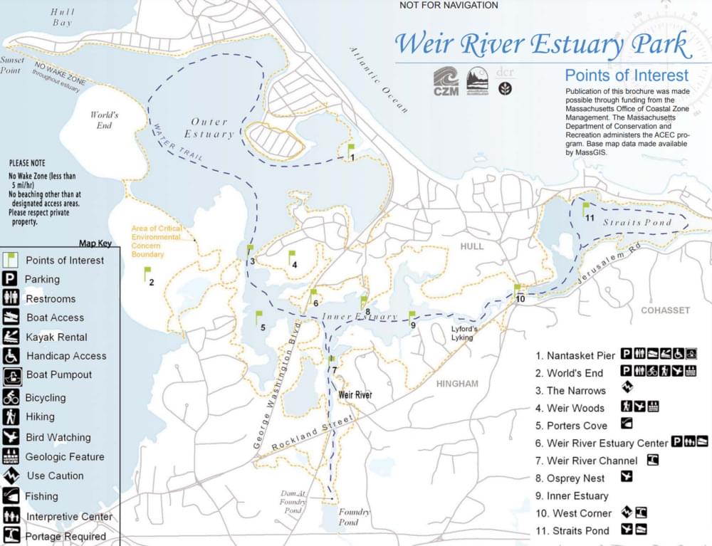
Weir River Inner Estuary (North and South Rivers Watershed Association) webpageWeir River Estuary Park map
About this Location
The Weir River Estuary Center is the Home of the Weir River Watershed Association. The facility provides river access as well as two meeting rooms for community organizations.
No formal trails here, but behind the informational kiosk there is a rough trail among cedars and shrubs that leads to numerous river views (about 0.1 miles). Also within the estuary, there are hiking opportunities at World’s End and Weir River Woods.
Formed at the confluence of Crooked Meadow River and Fulling Mill Brook, the Weir River flows north through Hingham, with Tower Brook and Accord Brook joining it in its first mile. It gradually turns northeast and flows for another 1.4 miles, through Weir River Farm and eventually into Foundry Pond. The Weir River Estuary, designated by the Commonwealth of Massachusetts as an Area of Critical Concern, begins just below the manmade dam at the pond. The mile-wide estuary, with numerous acres of the undisturbed salt marsh, forms the border between Hingham and Hull and empties into Hingham Bay.
Within the estuary, look for 100+ species of migratory and breeding birds. Fish and shellfish thrive here, including soft shell clams, blue mussels, and American oysters. Recreational shellfishing is prohibited.
Features
Wheelchair accessible trail
Restrooms on site
Entrance fee
Content from Weir River Inner Estuary (North and South Rivers Watershed Association) webpage
Last updated March 3, 2024