Garland Ranch Regional Park--Snivelys Ridge
Garland Ranch Regional Park--Snivelys Ridge
Carmel Valley, California 93924
Tips for Birding
This Hotspot is best for hikers who bird, since the trail is nearly 8 miles and 1,700 feet [520m] of altitude gain. Please note that the trail is part of the Monterey Peninsula Regional Park District (MPRPD) Garland Ranch Regional Park but begins in the private Carmel Valley Ranch. Please be courteous and follow the posted rules.
Birds of Interest
The trail passes through grassland, coastal live oaks, scrub and meadows, so the birds will be typical of those habitats. Higher on the ridge will be possibilities for hawks, kestrel, swifts and swallows.
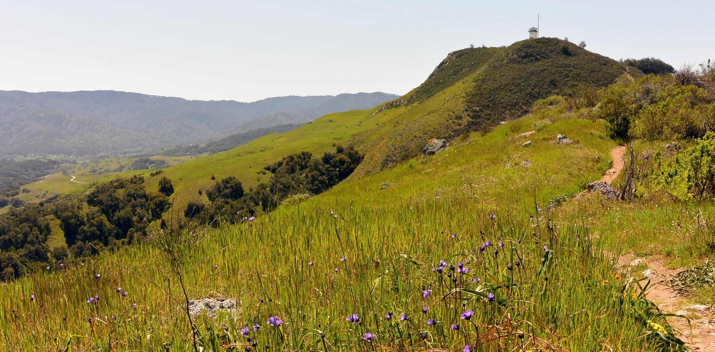
About this Location
Park in the limited parking spaces at the end of Holt Road, then walk into the Carmel Valley Ranch private development. The first mile or so is on a dirt road traveled by jeeps and trucks taking people to the horse corral. Once past the corral, the trail becomes a fire road and winds up the Ridgeline. The views of Carmel Valley, Robinson Canyon, and the Monterey Bay make the hike worthwhile.
An alternate and more scenic entry is through the main Garland Ranch trail system. For example, walk the Maple, Sage, and Sky Trails which culminate on Snivelys Ridge. Walk Snivelys Ridge Trail for its views. Please note that this park has many hotspots, so use the appropriate hotspot when you bird.
About Garland Ranch Regional Park
See all hotspots at Garland Ranch Regional Park
Garland Ranch Regional Park contains over 3400 acres that were formerly a ranch. The park is now owned and administered by the Monterey Peninsula Regional Park District. The main entrance at 700 West Carmel Valley Road has a very large parking lot with a walk to a Visitor Center and restroom facilities. A vehicle bridge (for official vehicles only) crosses the Carmel River and is available to pedestrians and cyclists year-round. A small footbridge crosses the river during the summer and fall when the water level is low. The park has a variety of habitats including riparian, meadow, mixed oak woodland, and redwood canyon. The park is multi-use: birders will share the trails with hikers, equestrians, and is dog-friendly (defined as "on leash or within direct voice control;" some park users will stretch this definition). Bicycling is only allowed in a small portion of the park.
The main units of Garland Ranch Regional Park are open dawn to dusk. There are a variety of entrances and various eBird Hotspots, including a "general" Hotspot and a variety of sub-locations that generally feature specific trails. [The is also a stand-alone Hotspot for the newly-acquired, permit-only Kahn Ranch unit.] Elevations with the primary Garland Ranch Regional Park vary from 200 to 2000 feet [60--600m] elevation. The park stretches from the banks of the Carmel River southwards into the Santa Lucia Mountains foothills. Garzas Creek bisects the Park, often flowing through densely wooded habitats.
Notable Trails
Snivelys Ridge is one of 60 miles of trails in Garland Ranch Regional Park, which spans nearly 3,500 acres.
Features
Restrooms on site
Wheelchair accessible trail
Entrance fee
Roadside viewing
Content from Carol Greenstreet
Last updated June 13, 2023