Edge of Appalachia Preserve--Buzzardroost Rock
Edge of Appalachia Preserve--Buzzardroost Rock
The Nature Conservancy OH-125 West Union, Ohio 45693
Official WebsiteBuzzardroost Rock brochure and map
Hike to Buzzardroost Rock from Jim McCormac’s Blog
Edge of Appalachia Preserve Official Website
Edge of Appalachia Preserve (Cincinnati Museum Center) website
Edge of Appalachia video
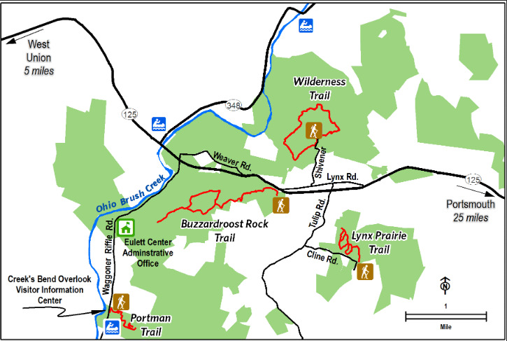
Edge of Appalachia Preserve Trail Locations map
Also, see all the hotspots at:
Edge of Appalachia Important Bird Area
About this Location
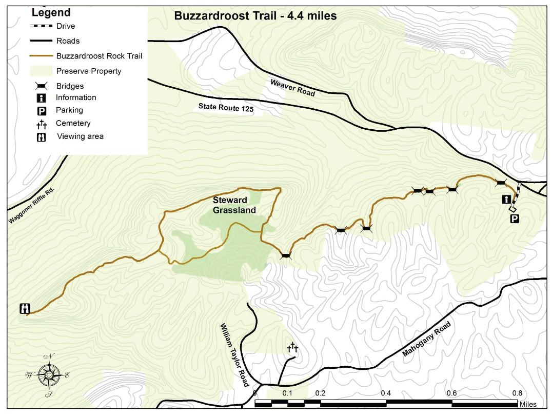
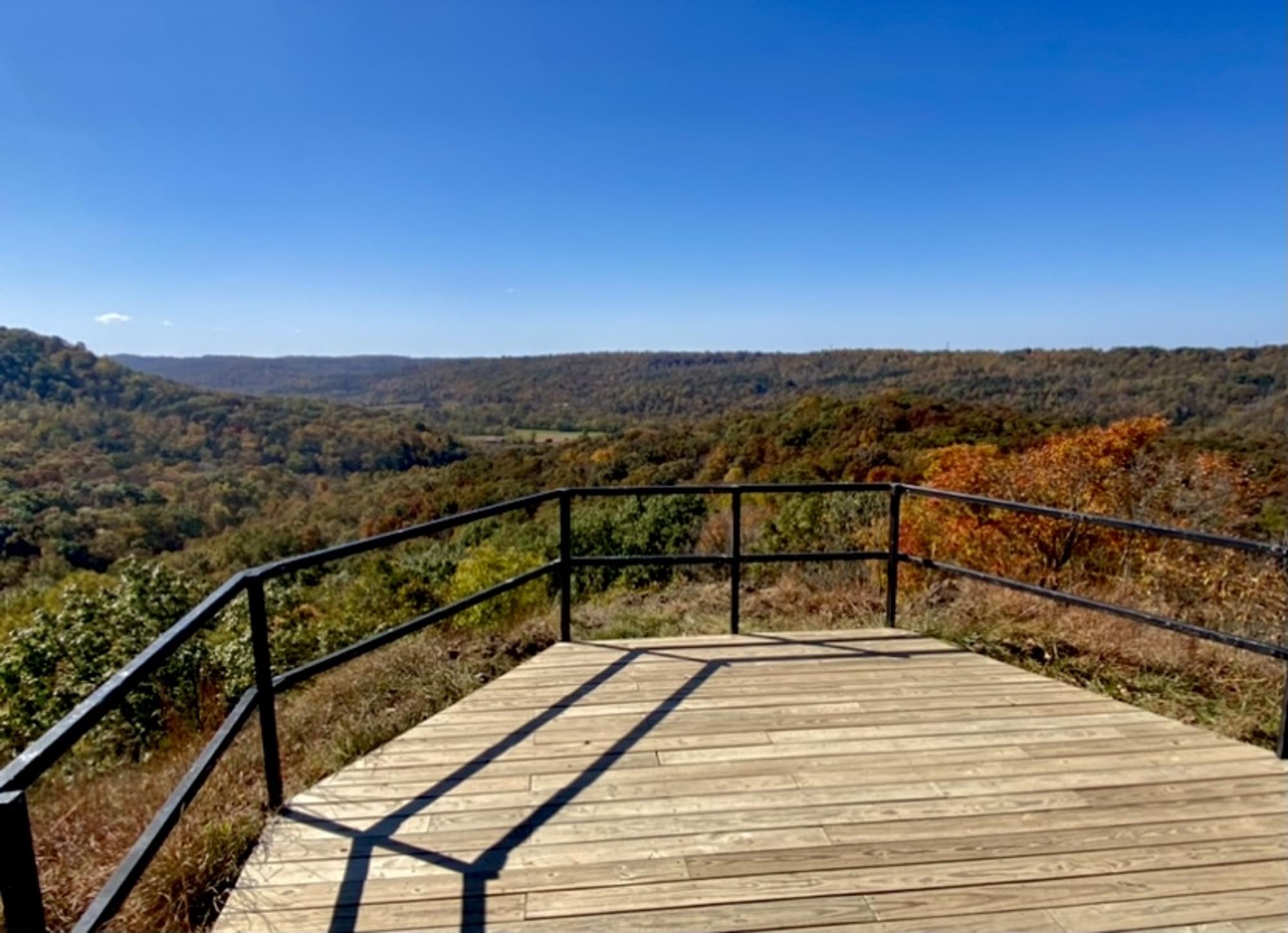
The most popular of all trails in the Edge of Appalachia Preserve system is the one that leads to Buzzardroost Rock, which stands like a giant limestone monument far above the waters of Ohio Brush Creek. The panoramic scene from this hilltop has been called Ohio’s most spectacular view. The 465-acre protected area is named for the turkey and black vultures (buzzards) frequently seen soaring above or roosting on the rock. This dolomitic outcrop towers 300 feet above the valley and provides habitat for a number of rare prairie plant species, including the plains muhlenbergia grass, which is classified as an endangered species in Ohio.
The trail at Buzzardroost Rock passes through a number of plant communities and provides the opportunity to witness the area’s diverse geologic history. The trail crosses four separate rock strata, including Estill Shale (gentle slopes with moist forests) and Lily, Bisher, and Peebles dolomites (cliff and steep sides with oak-maple forests and primary cedar barrens), and Ohio Shale (Appalachian oak forest dominated by chestnut oak).
Buzzardroost Rock trail is not a loop, and the round trip hike of 4.4 miles is considered moderately difficult, with steep grades and steps. Preserve naturalists suggest that hikers plan to spend a minimum of two to three hours for the round trip, allowing time to observe the natural features along the way and enjoy the scenic view from the top of the rock.
From Buzzardroost Rock webpage
About Edge of Appalachia Preserve
See all hotspots at Edge of Appalachia Preserve
This 20,000-acre preserve system is referred to as “The Edge.” Each separate preserve and trail offers unique qualities. Visitors will enjoy gorgeous views, distinctive geology, and peaceful trails. It is also a great place for birding, especially in spring and fall. Activities include hiking, birding, fishing, kayaking/canoeing, wildlife-watching, nature photography, and observing native plants.
Ancient forests of massive oaks and American chestnut once blanketed nearly all of what would become southern and eastern Ohio. When the first white settlers arrived in the Ohio Valley, wolves and elk wandered this rustic landscape of pristine rivers and fertile forests.
Yet by the early 1900s, about 90 percent of the original forest cover had been cleared to make room for farmland and to feed the iron furnaces of southern Ohio – severely degrading part of North America’s oldest and most biologically diverse forest systems.
Today, Ohio’s Appalachian forests are returning, with nearly 40 percent of the region cloaked in mixed hardwood forest. The Nature Conservancy’s 20,000-acre Edge of Appalachia Preserve is a key component of this recovery process, mending habitats on a large scale and preserving the landscape’s unique natural legacy.
Notable Trails
The AllTrails website has a description and map of a hike at Buzzardroost Rock.
There are descriptions of a hike on this trail in Jim McCormac’s blog.
Buzzardroost Rock Trail
This extraordinary geologic formation is one of the most popular sites to visit at the Edge of Appalachia Preserve System and is accessible via a 4.4-mile round-trip hiking trail considered moderately difficult. Buzzardroost Rock is one of four designated National Natural Landmarks located at “the Edge” and is considered one of the most scenic hiking destinations in Ohio. The trailhead is located on a small gravel lane just west of the village of Lynx off OH-125. Follow the trail across OH-125 up to the top of the ridge (500′ elevation) for breathtaking views and good birding.
From Buzzardroost Rock brochure and map
Content from Edge of Appalachia Preserve Official Website and Ohio Ornithological Society