Norwood Farm
About this Location
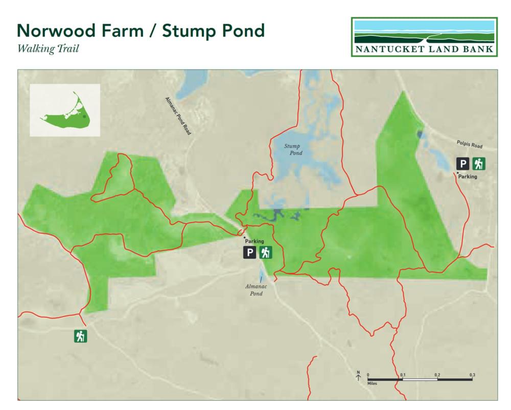
Norwood Farm is a sprawling and iconic property located in the Middle Moors, just north of Altar Rock, and borders over 3,200 acres of extensive conservation holdings to the west, south, and east. A total of 220 acres have been protected in a joint partnership between the Foundation and the Nantucket Islands Land Bank Commission. Before conservation ownership, this property represented the largest unprotected, privately owned parcel remaining on Nantucket and was widely acknowledged as a top-priority open space objective. For many generations of islanders and visitors, the vast open space in the Middle Moors area epitomizes what is so special about Nantucket. As a result of this acquisition, the expansive views of undeveloped conservation land observed in every direction from the top of Altar Rock have now been preserved in perpetuity.
One of the unique aspects of the Norwood Farm is the varied habitat types that can be found on the property, including forested uplands and wetlands, dense shrublands, freshwater bogs, kettle hole ponds, grasslands, and heathlands. Wetlands in the northern portion of the property once supported some of the island’s earliest cultivated cranberry bogs, and the remains of the water management system in use during this period are still evident, including several channelized streams, bridges, and culverts. Upland areas in the southern portion of the property were likely tilled for crop cultivation and grazed by livestock during the 1800s and 1900s. These areas now support open grasslands and shrublands that are interspersed with several small kettlehole wetlands. The diverse types of habitats present on the property support at least 18 rare species that are currently protected under the Massachusetts Endangered Species Act, including 5 plants, 13 moths, and 1 bird of prey. A series of walking trails traverse the property, and plans are underway for the development of a parking area and trail map to encourage pedestrian access.
From the Milestone rotary, follow Milestone Road to the second left, onto Polpis Road. Follow Polpis Road for 3.5 miles to 237 Polpis Road (Old Polpis Road is cut off by a pond). Take a right at the NCF logo post to enter the parking area
Features
Restrooms on site
Wheelchair accessible trail
Entrance fee
Content from Official Website
Last updated March 25, 2024