Eddy Bay Trail (BCT)
Eddy Bay Trail (BCT)
Brewster Conservation Trust Brewster, Massachusetts 02631
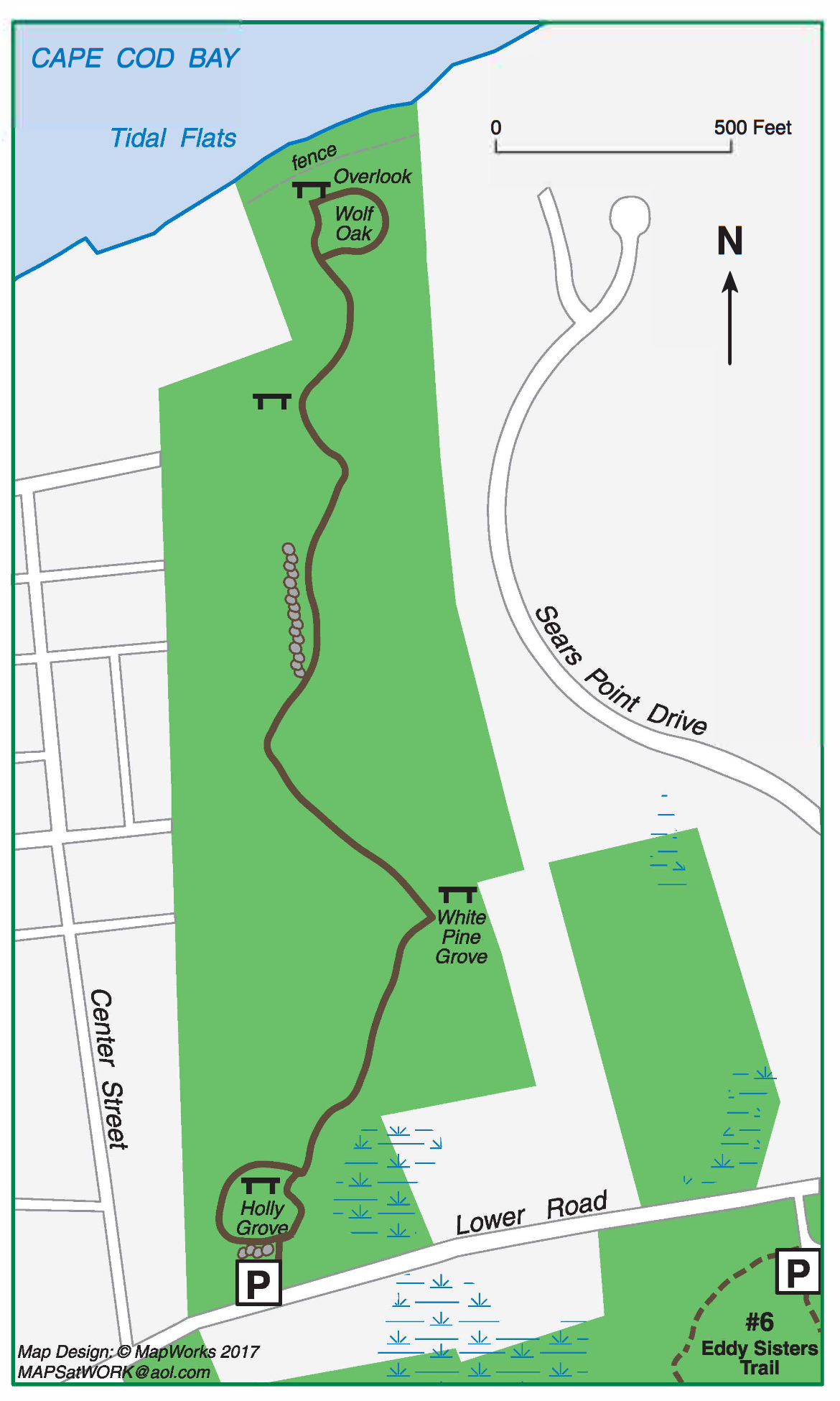
Eddy Bay Trail trail guide and mapAbout this Location
The Eddy Bay Trail is located on the site of the “planting fields” of the Saquatucket Sachemship and later divisions of farms for the colonists in the 1600s. The area later served as pasture and tillage for some of Brewster’s leading farming families through the 1800s. From Lower Road, the path leads past 1870s barn and house foundations, through a grove of large holly trees, and then pine and oak woodland. The path ends at the highest bluff in Brewster overlooking Cape Cod Bay. There is no beach access.
Round trip trail length: 1.0 miles.
From MA-6A near the Brewster Store, take Lower Road west for 0.5 miles. The trailhead is located on the northern (right) side of the road approximately 150 yards past the Community Garden and Eddy Sisters Trail entrance. There is limited parking at the trailhead and additional space at the Eddy Sisters Trail.
Notable Trails
The AllTrails website has a description and map of a hike on the Eddy Bay Trail.
Features
Restrooms on site
Wheelchair accessible trail
Entrance fee
Content from Eddy Bay Trail trail guide and map
Last updated March 6, 2024