Missouri River Access--Eagle Bluffs CA
Missouri River Access--Eagle Bluffs CA
Lupus, Missouri 65046
Eagle Bluffs Conservation Area Official WebsiteAbout this location
About Eagle Bluffs Conservation Area
See all hotspots at Eagle Bluffs Conservation Area
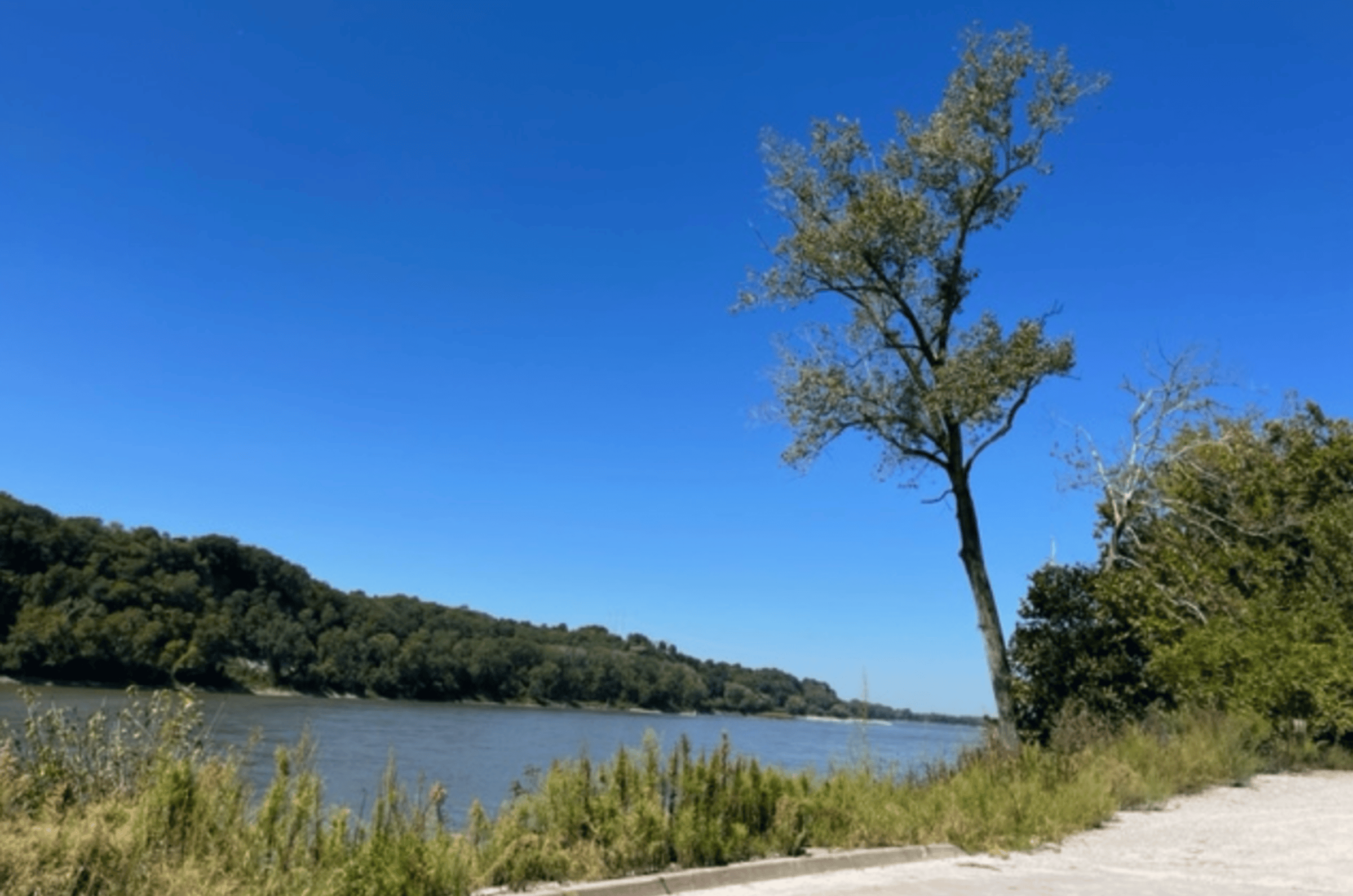
Eagle Bluffs Conservation Area is in Boone County at the southwest edge of Columbia, near McBaine. The Missouri River and Perche Creek provide over 10 miles of stream frontage on Eagle Bluffs. Through the years, the Missouri River has changed its course many times. The town of Providence, across Perche Creek from Eagle Bluffs, was once on the bank of the Missouri, before the river changed its course in the late 1800's. Providence is now almost a mile north of the river. The Missouri once flowed through what is now Eagle Bluffs and sunk the steamship Plowboy, which is now believed to be buried under sand and silt on the area. The Conservation Department purchased and developed this 4,431-acre area to help offset the loss of nearly 90 percent of Missouri's historical wetlands. The area's wetlands have been restored by creating 17 shallow pools. The wetland management infrastructure includes 30 miles of levees, 61 water control structures, river water supply pumps, a water supply junction box, pump-out facilities, and a pipeline linking the area to the City of Columbia's wastewater treatment wetlands. The City of Columbia and the Department of Conservation entered into a cooperative agreement that allows the Department to use treated wastewater from the city as a primary water source for the wetlands. The city's recycled wastewater provides a near constant source of water, but river pumps can supplement the water supply when the area's needs exceed the flow from the city. The area's 17 wetland pools allow the flooding of 1,100 acres of moist soil marshes, emergent marshes, and crop fields. These marshes provide year-round habitat for migrating and wintering birds and permanent wildlife and excellent wildlife viewing and hunting opportunities. In the fall, the area's beauty is enhanced by colorful foliage along the bordering limestone bluffs. The KATY Trail State Park passes through a portion of the area and adds to the public's use and enjoyment of Eagle Bluffs Conservation Area. The parking lot located on Warren School Road provides walking access to the area's scenic overlook.
Features
Roadside viewing
Restrooms on site
Wheelchair accessible trail
Entrance fee
Content from Eagle Bluffs Conservation Area Official Website
Last updated December 12, 2023
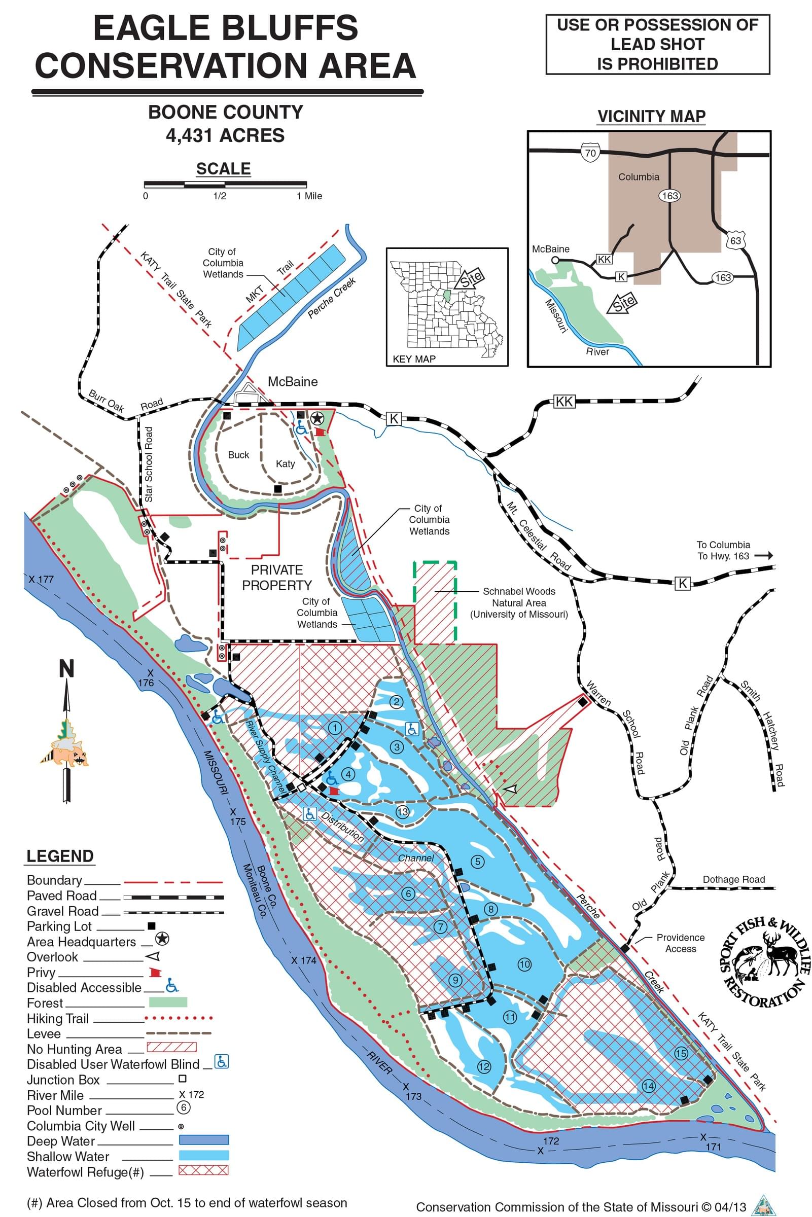 Eagle Bluffs Conservation Area Map
Missouri Dept. of Conservation