Douglas S. Westgate Conservation Area
Douglas S. Westgate Conservation Area
Wareham, Massachusetts 02576
Official WebsiteDouglas S. Westgate Conservation Area map
About this Location
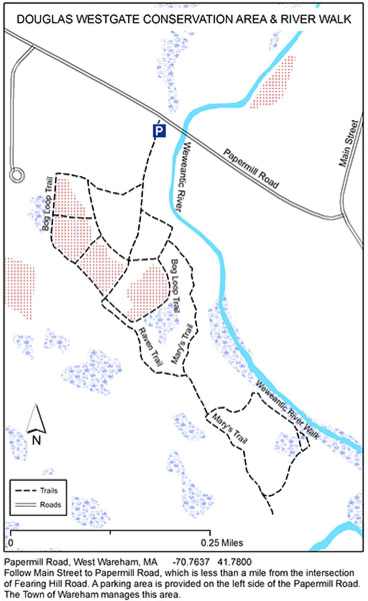
Douglas S. Westgate and Fearing Hill are town-owned adjacent conservation areas that protect 114 acres of uplands, bogs, and wetlands bordering the Weweantic River. The trail system wanders along the river, through the woods, and around several abandoned cranberry bogs.
Directions: Follow Main Street to Papermill Road, which is less than a mile from the three-way stop at the corner of Main Street and Tobey Road. A parking area is provided on the left side of Papermill Road.
Notable Trails
The AllTrails website has a description and map of a hike at Douglas S. Westgate Conservation Area.
Features
Restrooms on site
Wheelchair accessible trail
Entrance fee
Content from Official Website
Last updated February 22, 2024