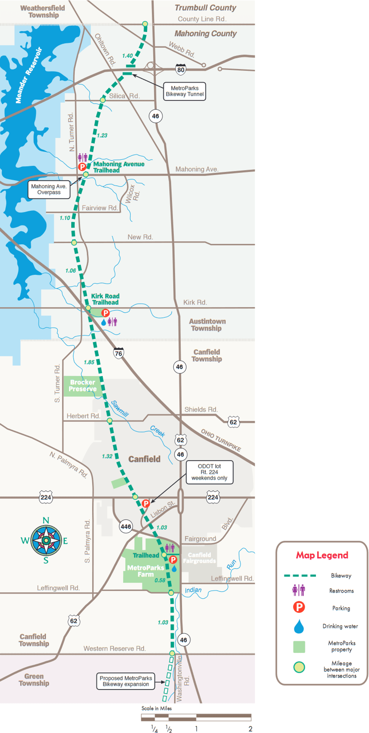
Mill Creek MetroParks Bikeway
About this Location
Leave your car behind and experience a wide variety of scenery as you reconnect with nature, the community’s history, and each other. This 11-mile paved trail offers a variety of scenery for hikers, skaters, and bicyclists. The MetroParks Bikeway runs from Western Reserve Road in Canfield Township to the Mahoning County-Trumbull County Line in Austintown Township. Parking is available at the MetroParks Farm in Canfield Township and at the Kirk Road Trailhead and Mahoning Avenue Trailhead in Austintown Township. The grade along the Bikeway is typically very gentle. The lowest point of the Bikeway is at County Line Road. The Bikeway’s grade increases to the highest point at Lisbon Street in Canfield for an elevation difference of 180 feet.
Content from Official Website