Debsconeag Lakes Wilderness Area
Debsconeag Lakes Wilderness Area
The Nature Conservancy Northeast Piscataquis, Maine 04462
Official WebsiteDebsconeag Lakes Wilderness Area brochure
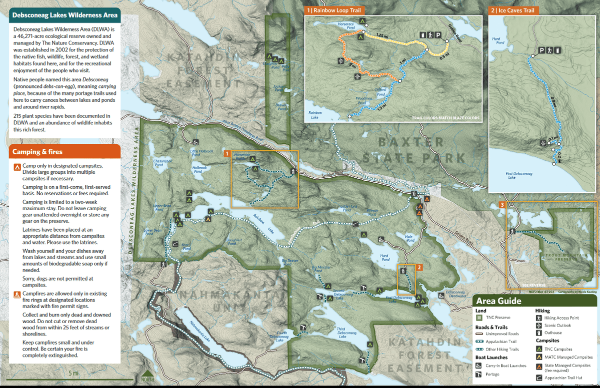
Debsconeag Lakes Wilderness Area map
Tips for Birding
When submitting eBird observations at Debsconeag Lakes Wilderness Area, it is most helpful to start a new checklist for each hotspot in the wilderness area. Use the general hotspot when you have a checklist that includes multiple locations or if no other hotspot or personal location is appropriate for your sightings.
About this Location
Nestled in the shadow of Mount Katahdin, just south of Baxter State Park, The Nature Conservancy’s Debsconeag Lakes Wilderness Area (DLWA) is a vital link in nearly 500,000 acres of contiguous conservation land.
Debsconeag means “carrying place,” named by native people for the portage sites where they carried their birch bark canoes around rapids and waterfalls. The DLWA contains the highest concentration of pristine, remote ponds in New England, as well as thousands of acres of mature forests.
Except for some areas around pre-existing camps, DLWA is managed as an ecological reserve. Ecological reserves are areas set aside for conservation and study of Maine’s ecosystems. Ideally, reserves are large enough to withstand storms, diseases and other natural disturbances and to provide secure habitat for wide-ranging species like moose, fisher, bobcat and pine marten. Ecological reserves are important to scientists studying how nature responds to challenges such as climate change, forest pests and diseases, and airborne pollution.
Last updated September 25, 2023