
Windsor Locks Canal State Park Trail

Windsor Locks Canal State Park Trail
Suffield, Connecticut 06078
Official WebsiteWindsor Locks Canal State Park Trail map
About this Location
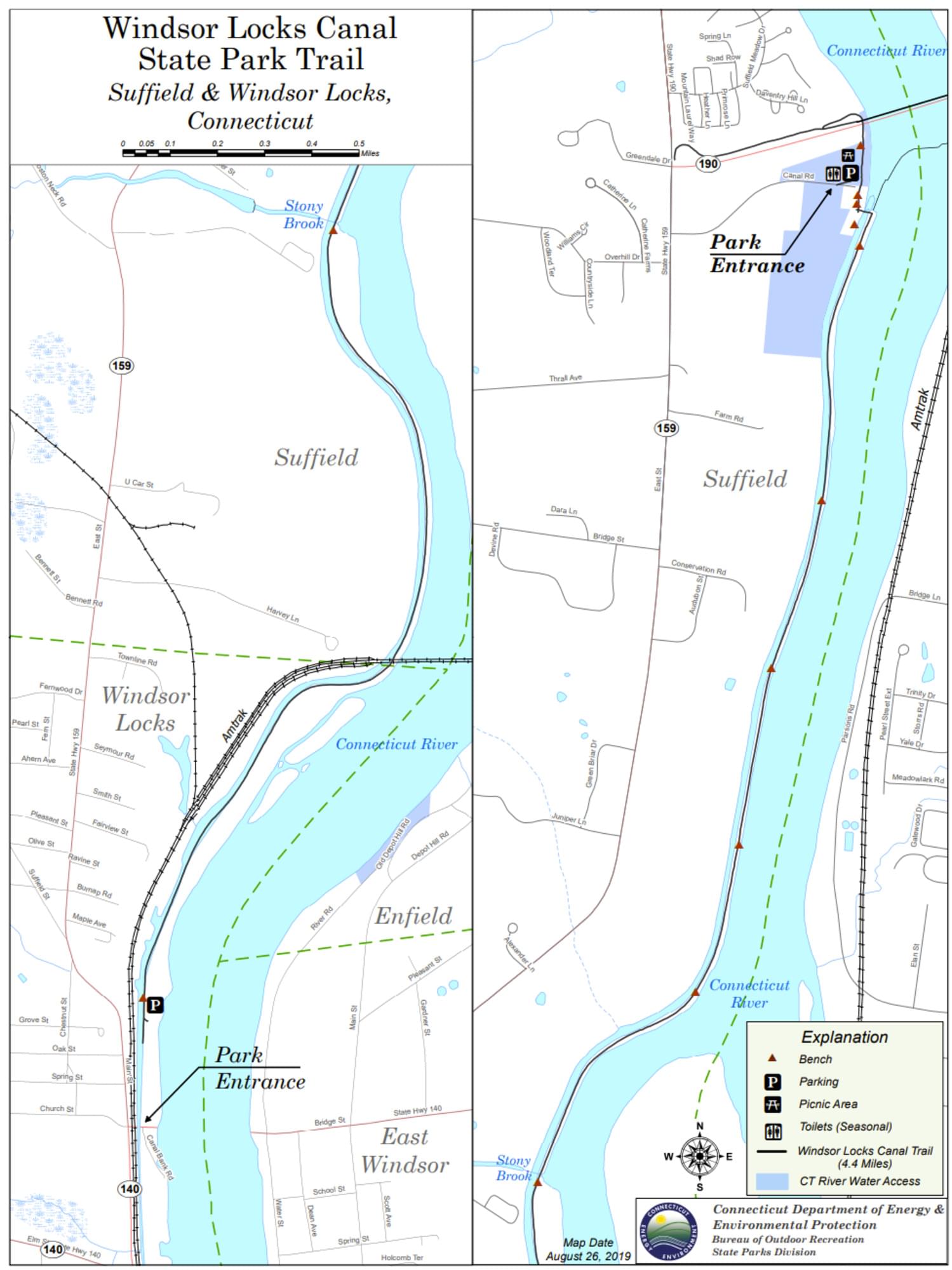
The 4.5 mile Windsor Locks State Park Canal Trail follows the historic towpath of this 170 plus year old historic waterway. The canal’s many vantage points offer the trail user scenic vistas of both the Connecticut River and the old canal.
The Windsor Locks Canal was constructed between June, 1827 and November, 1829 to skirt the Enfield rapids in the Connecticut River. The continuous water connection from the Connecticut River valley farmlands above the rapids through to Hartford and points south provided farmers with expanded markets and investors with freight fees in this business venture. Today’s paved surface lies atop the towpath, the actual walkway which animals, often mules, hauled the freight barges by rope north and south along the water way. Author Charles Dickens was a notable visitor who passed through the canal on February 7, 1842.
As with all of Connecticut’s canals, the coming of the railroads in the late 1840s spelled doom to the waterways for freighting. However, with a captive and consistent water source, the canal was well positioned to supply water for mill power, and factories sprang up along the canal banks. But as time, progress, and efficiencies of business marched on, even this use ultimately met its match. In recent decades the recreating public is the largest user of this historic remnant of Connecticut’s commercial and industrial past.
Look for a wide variety of wildlife and excellent examples of 19th century stonework in the stream crossing aqueducts and bridges.
Content from Official Website
Last updated November 16, 2023
 Connecticut Department of Energy and Environmental Protection