
West Rock Ridge State Park
About this Location
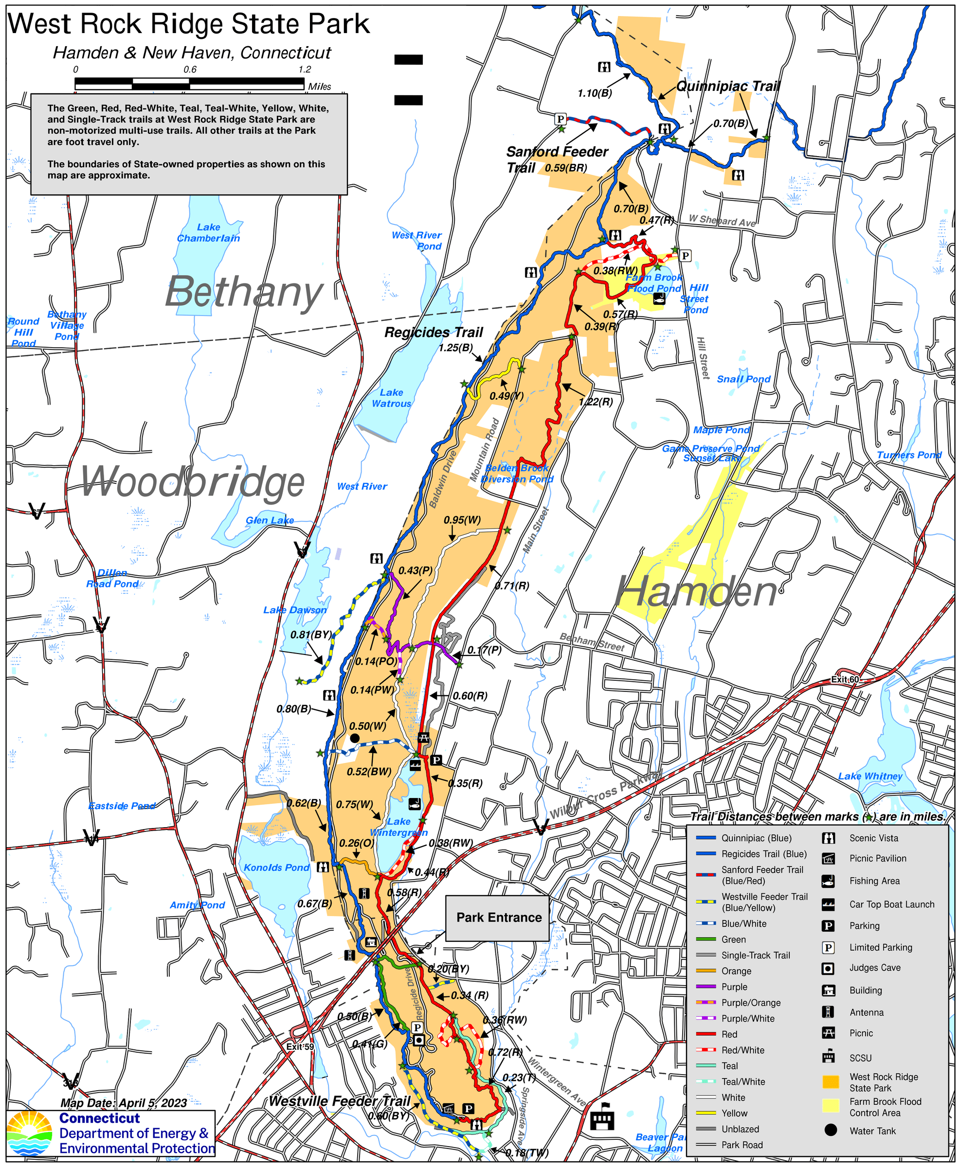
West Rock Ridge rises from 400 feet of elevation at the South Summit in New Haven to 700 feet of elevation at High Rock in Bethany on the Hamden border. The 6-mile long ridge is traversed by the 7-mile long Blue-Blazed Regicides Trail, which connects to the Quinnipiac Trail at High Rock. There are impressive vistas along the ridge, with estimates that a person can see approximately 200 square miles from various locations. There is no parking fee at West Rock Ridge State Park.
At the South Overlook, views include New Haven and the Harbor, Long Island Sound, East Rock Park, and the Sleeping Giant. Along the Regicides Trail, one can see forested water company lands to the west of the ridge, including Lake Dawson and Lake Watrous. Baldwin Drive, constructed in the 1930s as a Works Progress Administration (WPA) project, extends 5.6 miles along the ridge, and offers walkers and bicyclists a car-free experience.
Content from Official Website
Last updated July 31, 2023
 Connecticut Department of Energy & Environmental Protection