West Island
About this Location
Tucked behind quiet summer cottage neighborhoods on West Island in Fairhaven, West Island State Reservation’s forests, wetlands, and beaches feel a world away from civilization. With two miles of trails leading through 300 acres of some of Buzzards Bay’s most pristine coastal habitats, this beloved state park offers a natural retreat that outdoor enthusiasts of all ages will appreciate.
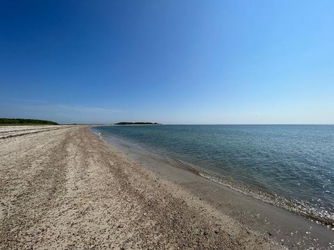
For an outdoor adventure that feels remote but is within driving distance of home, head to West Island State Reservation. West Island sits in the open waters of Buzzards Bay, about as far into the middle of the Bay as you can go without a boat. The state reservation’s rugged beaches, windswept marshes, and sheltered coves provide stunning natural views and a beautiful place to hike, ski, snowshoe, walk your dog, dig for quahogs, and enjoy the very best that the Bay has to offer.
The coastal forests and wetlands at West Island State Reservation were conserved in the late 1980s to protect these habitats and the future of Nasketucket Bay. As a result, West Island is home to some of Buzzards Bay’s cleanest, healthiest water. Eelgrass thrives in these shallow waters, providing a home for young fish, crabs, and bay scallops.
With so much protected natural land, West Island is a magnet for wildlife, from migratory birds to threatened reptiles and amphibians. Look for egrets and herons stalking fish and crabs in the salt marshes, while terns and ospreys soar over the water in search of their own prey. Among the forests, keep an eye out for turtles, deer, chipmunks, and other species hidden among the trees.
Notable Trails
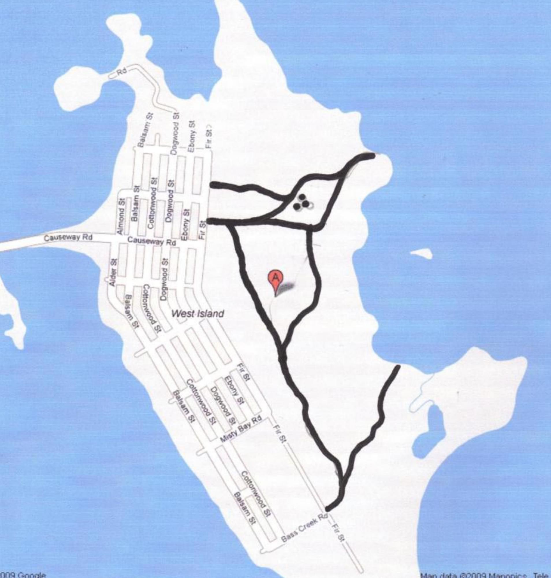
We recommend you begin your exploration of West Island State Reservation at the main trailhead on Fir Street, just north of Causeway Road. From here, you can discover a network of about two miles of trails through the woods past salt marshes to the secluded shores of Nasketucket Bay. The trails are easy but unmarked, so bring a map and a compass to guide your way. (Download trail map)
The quickest way to reach the beach is to follow the wide gravel path northeast from the main trailhead. It’s about a 15-minute walk to the water – perfect for families with small children and active older adults. Once you get to the water, turn right and venture down the shoreline to find a sandy beach where you can stop, relax, and take in the view.
In addition to this main trail, several smaller forest paths snake through the reservation, offering a longer walk for adventurous explorers. On your way back from the beach, turn left onto a trail that runs past a wide, open salt marsh – a great place for birding. This trail eventually connects with the reservation’s longest trail, which runs for about a mile south through the woods to Bass Creek Road. Turn left when you reach the end of this trail to follow a path that leads to another tranquil cove and a panoramic view of the reservation’s protected shoreline.
Content from Official Website