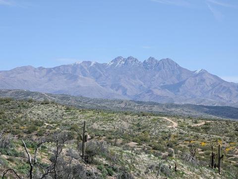
Four Peaks Wilderness Area

Tips for Birding
About this Location
This Wilderness was established in 1984 and contains approximately 60,740 acres with a major mountain rising up in its center from the desert foothills. The Four Peaks themselves are visible for many miles and are one of the most widely recognized landmarks in central Arizona. The rapid change in elevation produces interesting and unique plant and animal communities. Elevations range from 1,900 feet near Apache Lake to 7,600 feet on Brown’s Peak.
A large part of this wilderness was burned by a human-caused fire in 1996. It will take decades for the pine-covered mountains to recover.
A group size of no more than 15 people and no more than 15 head of pack or saddle animals of any type is enforced within this wilderness year-round.
Visits to some parts of this wilderness can be made throughout the year, using a rather extensive trail system. A Recreation Opportunity Guide (20 pages) is available which gives directions to trailheads and describes each trail. Copies are available from the Mesa Ranger Station.
Content from Official Website