Monterey, California, US
Monterey Bay pelagic--inshore Monterey Harbor to Pt. Pinos (MTY Co.)
160 species
Monterey, California, US
160 species
Monterey, California, US
64 species
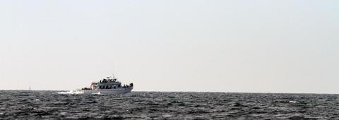
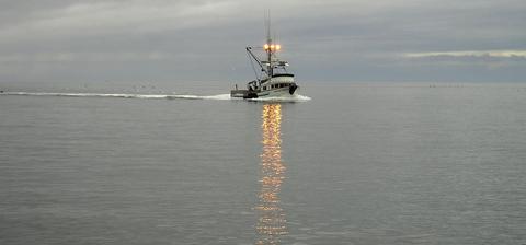
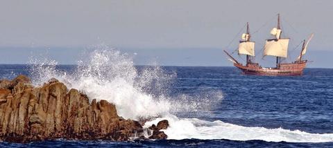
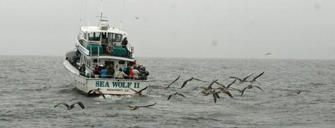
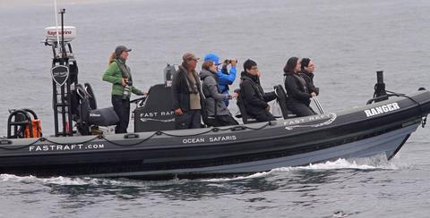
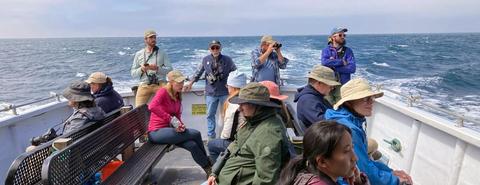
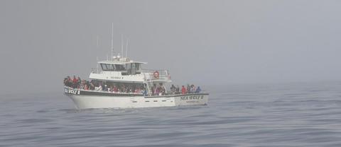
Monterey Bay has some of the finest pelagic birding in the world, with an array of regular seabirds and many extraordinary rarities. There is nothing quite like leaving Monterey, Moss Landing, or Santa Cruz harbors aboard a small fishing boat in search of the pelagic birds on Monterey Bay. Although at sea, the boat will be traversing over some of the most dramatic underwater topography on earth, as a huge submarine canyon — as big as the Grand Canyon — lies beneath the surface. Its steep walls create an upwelling of deep-sea nutrients towards the surface, encouraging a productive growth of krill, the basis of a food-web from tiny squids to huge whales. This deep-water upwelling, combined with the nutrient rich water of the California Current, combine to bring pelagic birds comparatively close to shore.
eBirding a pelagic trip: Almost every pelagic trip will have an inshore and offshore element. The border between inshore and offshore is two (2) miles offshore. In Monterey County, we have an eBird filter for pelagic trips that is intended only for trips beyond 2 miles offshore. Unfortunately, the GIS layer that eBird currently uses includes all part of the ocean, including the 2 miles from shore to offshore.This means that if enter inshore species anywhere on the ocean, they will be flagged as unusual. For example, Pelagic Cormorant generally occurs only within 2 miles of shore. It you place Pelagic Cormorant on any checklist that is mapped on the ocean, it will be caught in the filter. The same applies to Pigeon Guillemot and Marbled Murrelet, most Elegant Terns and Brown Pelicans, high numbers of Brandt's Cormorants, and all loons, grebes, scoters, rocky shorebirds, egrets on kelp, and other shoreline species. To avoid this problem for you — and a big hassle for the local editors — please enter a minimum of 2 or 3 eBird list on every pelagic trip: one for the harbor (if you wish, using the Harbor hot spot); one for the inshore portion of the trip — we recommend using the Hot Spot called "Monterey Bay pelagic--inshore Monterey Harbor to Pt. Pinos," if you trip started or ended in that direction; and another checklist for birds seen more that two miles offshore. There are many Hot Spots in and around Monterey Bay. Only a couple of them are for inshore birds (and the word "inshore" is in the title). If you are using a Hot Spot that is more than 2 miles offshore, please do not enter inshore species — unless you actually see an inshore species more than 2 miles offshore. If so, you will need to document that rare occurrence.
Using eBird's "pelagic protocol": eBird offers a specialized pelagic protocol for "checklists that are made farther than two miles offshore on oceans, seas, or large lakes. Choose the Pelagic Protocol option" ... and "count for up to 60 minutes on each checklist; stopping at the 1-hour mark. Record distance traveled ... and choose a location on the map for where you started that checklist period. Repeat this process throughout the trip until you return to within two miles of shore." Many organized pelagic trips will be using the pelagic protocol.
Please note that the "pelagic protocol" is designed only for counts made entirely more than 2 miles offshore. If you use "pelagic protocol" inshore in Monterey County, many common inshore birds will be caught in the filter, creating needless work for you and for eBird editors. [Any checklist that the computer reads as "ocean" will trigger in the "offshore filter" in Monterey County, and many personal locations trigger that filter because you created a personal location that the GIS layer reads as "ocean." To avoid this problem along the coast, always use the established Hot Spots that are sited carefully.]
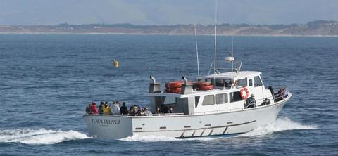
A boat trip on Monterey Bay can be a major highlight of any visit to Monterey or Santa Cruz counties, and many trips will cross official or unofficial boundaries at sea. Captains of pelagic trips on Monterey Bay often know where these borders are — see the map and the boundaries in relation to Monterey submarine canyon topography. eBird editors around Monterey Bay require that you enter lists only within one county. If you cross a county line, please start another checklist. There are no Hot Spots for a "general checklist" on Monterey Bay that includes inshore and offshore birds, or that crosses a county line. However, the Hot Spots called "Monterey Bay pelagic (MTY Co., 2+ mi offshore)" and "Monterey Bay pelagic (SCZ Co., 2+ mi offshore)" are the "general Hot Spots" for a typical 8-hour pelagic trip within Monterey County and Santa Cruz County waters, respectively. If you cross the border on a typical 8-hour Monterey Bay pelagic trip, you will need separate checklist for each county, and then additional checklists for inshore or harbor birds.
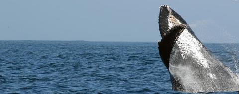
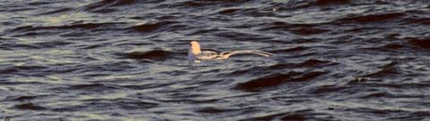
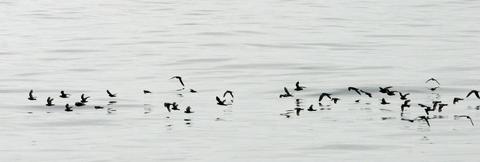
Birders on pelagic trips seek seabirds that are primarily seasonal visitors and undertake long, annual migrations to reach Monterey Bay's rich feeding grounds, arriving here from Chile, New Zealand, Mexico, Hawaii or Alaska. What is seen on any particular day, though, depends on the season, that day's weather, sea-surface temperature and salinity, winds, currents, and the patchiness of food. A condition of larger scale is whether it is a, El Niño or a La Niña year (El Niño years often bring warm water with tropical seabirds while a La Niña years many produce colder-water species). Some pelagic trips are spectacular; others can be cold, foggy, and slow-going, but there are always birds, and each trip is different. Not only do birders come from around the world to search for seabirds, even more tourists board pelagic trips in hopes of seeing a variety of whales and other cetaceans, along with resident sea-lions, seals, and Sea Otter, not to mention seasonal jellyfish, tuna, sharks, or sea turtles.
Most of Monterey Bay and much of the offshore oceanic waters are protected within the Monterey Bay National Marine Sanctuary; see a map of its boundaries, including the isolated section far offshore over the Davidson Seamount (in Monterey County).
Restrooms on site
Content from Don Roberson' s Birding on Monterey Bay, Don Roberson's Monterey Bay boundaries for birders, and Monterey Bay National Marine Sanctuary--seabird page
 Official and birder borders in Montelrey Bay. Monterey Bay is divided between Monterey County (southern part) and Santa Cruz County (northern part). The red lines are the official borders of Monterey and Santa Cruz counties at sea. These official borders include Monterey Bay proper and 3 miles seaward beyond that. Once an observer is west of those formal boundaries, the "nearest point of land" determines the birders' county line (yellow line on map)
 Map of Monterey Bay National Marine Sanctuary, including the Davidson Seamount far offshore and southwest from Pt. Sur