State Game Lands 37
State Game Lands 37
Tioga County, PA Contact the Pennsylvania Game Commission North Central Region Office. 1566 South Route 44 Highway Post Office Box 5038 Jersey Shore, PA 17740-5038
Official WebsiteUS Army Corps of Engineers Ives Run Recreation Area Trail Map
Mid State Trail
Tips for Birding
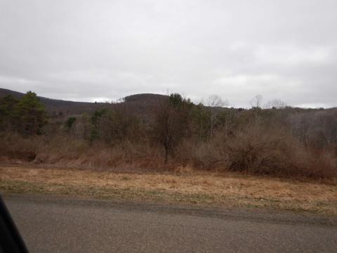
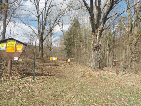
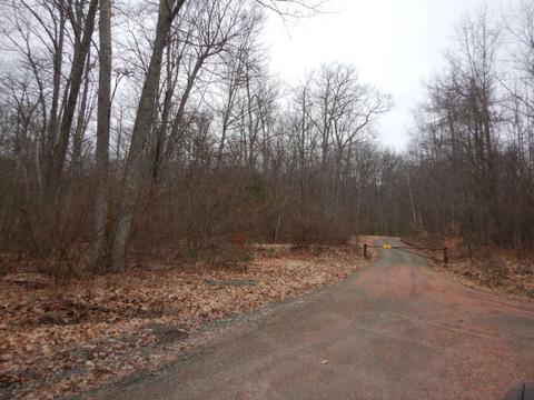
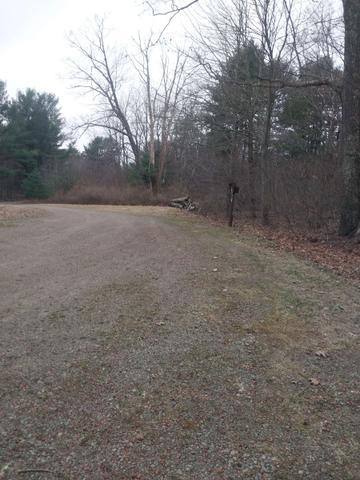
Pennsylvania State Game Lands 37 is a large game lands. There is limited access by road. Birding is best done by walking. Binoculars are sufficient. Firetower road is open to the top of the hill seasonally. There is limited traffic on the road and roadside birding is possible. The road is a steep uphill drive and passes through deciduous forest. Some maintenance roads are open to bicycle or horse traffic, and seasonal access for handicapped hunters. These roadways are also used by trail runners, hikers, and dog walkers. Be alert for other there users.
Some of the best birding is found in the food plots that are manages as fields and hedgerows to provide habitat for wildlife.
There are a few beaver dams on streams in this Game Lands. One is found at the head of Stephenhouse Run. It is a two mile walk from the parking lot on Stephenhouse Road to the beaver dam and the fields that surround it. There are several small fields along this road that may harbor sparrows. Most of the the area is deciduous forest.
There are a number of deer exclosures on this Game Lands. A deer exclosure is surrounded by a high fence to keep deer out of the area. Unless there is a marked trail through these areas, it is best to stay outside of the fence. Exit gates are few. The area inside the fence is usually a mess of briars and dead tree tops. It is not a fun or easy place to walk. One of the most easily accessed is near the parking lot at the top of the hill on Firetower Road. A walk along the maintenance roadway on the outside of the fence may yield some interesting birding.
Ticks and other biting insects are prevalent. Wear long pants, and use insect repellent. Rattle Snakes may be present in some areas. Watch what is underfoot. Give any snakes that you do see plenty of room. Also be alert for any other snakes that may be in the area. You do not want to stumble into one you did not see while avoiding the snake you do see or hear.
Birds of Interest
Probably any common and even some rare bird species can be found somewhere on this Game Lands. Raptors are present. Eagles and Osprey may frequent the beaver dams and the Tioga Lake. It is, however, a long walk/hike from the nearest parking lot to the shore of the lake. Wood ducks, mergansers, geese and herons may frequent the beaver dams and some portions of the lake. Warblers pass through in season. Sparrows, Robins, Blue Jays, Chickadees, and cardinals may be found in the food plots and fields. Wood and Hermit thrushes frequent the woods. Some vireos are summer breeders. Woodpeckers, crows and Ravens can also be found.
About this Location
State Game Lands 37 is a large Game Lands (8858.32 acres) spanning the ridge between the Tioga and Hammond Lakes. It also extends nearly to the Hills Creek and Lambs Creek Areas. Part of this Game Lands extends east from the Tioga Lake in the Mill Creek Area. Much of the property is forested. There are vernal pools, beaver dams, small fields and brush areas. Same areas are select or clear cut and in various states of maturity as the vegetation recovers. A number of deer exclosures have recently been built on this Game Lands. One of the most easily accessed is near the parking lot at the top of the hill on Firetower road.
The primary purpose of any Game Lands is to set aside land for hunting. Be aware of hunting and trapping seasons. If you are not comfortable being near these activities, do not bird watch or otherwise recreate on Game Lands during hunting season. Wear and orange hat during hunting season. It is best to avoid the area during rifle bear and deer season. If you do go, wear an orange hat and vest and stay on the roadways or trails so you are as visible as possible. The land and maintenance roadways are also open to the public for bicycling, trail running, hiking, and bird watching. Some activities are only permitted in designated areas. Check the Game Commission Website link above for more details. Treat any hunters or trappers that you meet with respect.
If you plan to explore areas off the maintenance roads and trails bring a compass or use a cell phone app that works when there is no service. Unless you are comfortable, with wilderness navigation it is much safer to stay on the trails, maintenance roads, and logging roads. The lay of the land can be confusing. Cell service is limited to non-existent. Bring along, water, snacks, and any other items that you may need. It is possible to unintentionally cross a ridge and find oneself in the wrong valley, or hollow and facing a very long walk back. If fortunate, you will be in an area where you have cell service or can request a ride from a local back to where you started. In some areas, the only option will be to figure out how to walk back to where you started. Be smart, be cautious and stay on the trails and avoid becoming lost. Spare your friends and family the stress of worrying about what has happened to you.
Ticks and other biting insects are prevalent. Wear long pants, and use insect repellent. Rattle Snakes may be present in some areas. Watch what is underfoot. Give any snakes that you do see plenty of room. Also be alert for any other snakes that may be in the area. You do not want to stumble into one you did not see while avoiding the snake you do see or hear.
Notable Trails
Mid State Trail passes through the park on it the way from the border with Maryland to the border with New York State
C. Lynn Keller Trail is seven to nine mile loop trail with a vista from the top of the ridge. The trail is steep in places. Part of the trail is a narrow path on a steep sidehill as it climbs the ridge. It can become muddy and slippery near where the trail joins Stephenhouse Road. The trail then follows the road back to the trailhead. There are two trail heads in the park. One is near the campground area. The other is at the parking lot on the end of Stephenhouse Road where it joins the entrance road to the park. There is a connecting trail between the two trailheads. There is also an inner route that is about four miles. Biking is prohibited...and also very unsafe. An orange hat should be worn during hunting season. Current regulations require even non-hunters to wear an orange vest or jacket during deer season.
Features
Restrooms on site
Content from Official Website, US Army Corps of Engineers Ives Run Recreation Area Trail Map, and Mid State Trail
Last updated March 13, 2024