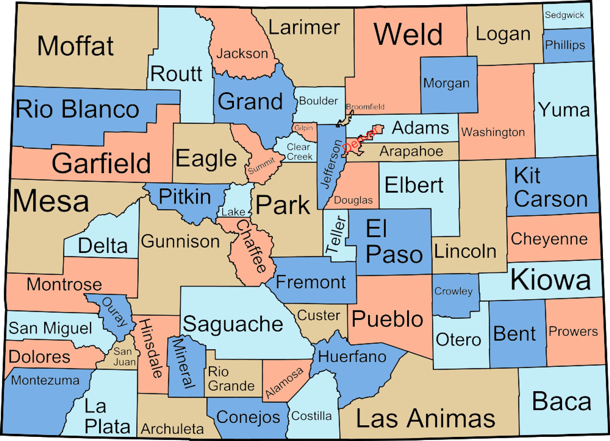
Colorado Counties - From the Plains to the Peaks
|
Originally published on Birding Colorado
Adams CountyCounty Seat: BrightonSize: 1,182 square miles Low Elevation: 4,497 ft. - Badger Creek on the Morgan border High Elevation: 5,665 ft. - DIA Ridge Best Birds: Ivory Gull (1926), Anhinga (1927) Adams is an Eastern Plains county at heart. Except for a few tiny settlements along I-70 on its southern border, the eastern three-quarters of the county is virtually uninhabited, containing not a single town. By stark contrast, the western quarter is nearly smothered by the sprawling northeast suburbs of Denver. Right in between is Barr Lake State Park, the undisputed gem of the county as far as birding is concerned, where the Rocky Mountain Bird Observatory is headquartered. |
Alamosa CountyCounty Seat: AlamosaSize: 719 square miles Low Elevation: 7,499 ft. - Rio Grande River on the Conejos border High Elevation: 14,345 ft. - Blanca Peak Best Birds: White Ibis (1998), Magnificent Hummingbird (1992) At the heart of the San Luis Valley, Alamosa County has a little bit of everything, but not all of it is easy to access. The jewels of the county are several excellent state parks and wildlife refuges, including a Nature Conservancy preserve, that provide access to fantastic wetland habitats in addition to extensive semidesert flats. The city of Alamosa, meanwhile, offers some very decent birding. Nice PJ can be found on public land in the northeast, as can higher montane habitats all the way to tundra, but to reach most of them you'll have to do some very strenuous hiking. The Nature Conservancy attaches a very high value to the county and the region for its natural wonders--and rightly so. |
Arapahoe CountyCounty Seat: LittletonSize: 800 square miles Low Elevation: 4,743 ft. - Beaver Creek on the Washington border High Elevation: 6,210 ft. - Smoky Hill Ridge Best Birds: Arctic Loon (2002), Wood Stork (1902), Black-headed Gull (1988) Like Adams County, its neighbor to the north, Arapahoe is a long, long rectangle whose western quarter is urban and whose eastern three quarters are nearly empty. Like in Adams, the undisputed crown jewel of birding sites in Arapahoe is one state park built around a large reservoir--in this case, Cherry Creek Reservoir. |
Archuleta CountyCounty Seat: Pagosa SpringsSize: 1,353 square miles Low Elevation: 6,085 ft. - Navajo Reservoir High Elevation: 13,300 ft. - Summit Peak Best Birds: Whip-poor-will (1999), Least Bittern (1915) Archuleta is a southwestern county, which borders New Mexico, is sparsely populated and not traversed by very many major highways. It is not heavily birded and the eastern portions are not easily accessible unless you are camping. The Continental Divide crosses the southeast corner and mountain peaks exceed 12,000 feet in the southeastern part of the county. Habitats range from sub-alpine to dry sagebrush with considerable pinyon-juniper regions in the south and southwestern regions. Navajo Reservoir is the only large body of water and there are several lakes just west of Pagosa Springs, the only town of any size in the county. Most of the central parts are ponderosa with spruce/fir at higher elevations. |
Baca CountyCounty Seat: SpringfieldSize: 2,554 square miles Low Elevation: 3,470 ft. - Cimarron River on the KS border High Elevation: 5,280 ft. - Carrizo Mountain Best Birds: Barred Owl (2000), Cerulean Warbler (1989), Louisiana Waterthrush (1989), Common Black-Hawk (1991) Despite the distance from Denver, many Colorado birders make the pilgrimage to Baca County regularly, often several times a year. Among Baca's many charms, the foremost have to be the tremendous potential of the county's many migrant traps, the state's only publicly accessible Lesser Prairie-Chicken lek, and the unique biogeography of the area around Cottonwood Canyon, where many birds typical of the southwest deserts meet eastern breeders. |
Bent CountyCounty Seat: Las AnimasSize: 1,517 square miles Low Elevation: 3,665 ft. - Arkansas River on the Prowers border High Elevation: 4,855 ft. - San Jose Ranch Mesa Best Birds: Dusky-capped Flycatcher (1883), Sulphur-bellied Flycatcher (2002), Sharp-tailed Sandpiper (2000) This is not just another square shaped eastern plains county. Bent County is arguably the best of the counties east of the mountains in both variety and quality of species that breed, migrate through, or winter here. For example, over 20 and sometimes over 30 species of warblers occur in the county every year, Greater Roadrunners and Black Rails breed within a couple of miles of each other, and just about every species of shorebird, wader, and waterbird that has been seen in the state has been seen somewhere in the county. |
Boulder CountyCounty Seat: BoulderSize: 741 square miles Low Elevation: 4,893 ft. - St. Vrain Creek on the Weld border High Elevation: 14,255 ft. - Longs Peak Best Birds: Sharp-tailed Sandpiper (1975), Garganey (1992), Brambling (1983) Though it is usually included in discussions of the "Metro Area," the city of Boulder considers itself distinct and has bought enough open space along its south and east borders to ensure that the suburbs of Denver never envelop it. With its numerous plains reservoirs, migrant traps, and mountain parks (including the highest part of Rocky Mountain National Park), Boulder County has something to offer the birder on every day of the year. Many thanks to Bill Schmoker for his comments and revisions on the text of this page, and to Bill Kaempfer and Randy Seibert for their contributions. |
Broomfield CountyCounty Seat: BroomfieldSize: 33.6 square miles Low Elevation: 5,008 ft. - Across from LUNA reservoir High Elevation: 5,840 ft. - Hwy 128 at Indiana Best Birds: Brant, McCown's Longspur Broomfield is the newest of Colorado's sixty-four counties and is situated just north of Denver. It is bordered by Jefferson, Adams, Weld and Boulder counties. Birding areas are few and consist of small reservoirs, residential feeders, and some farmland that is rapidly disappearing. |
Chaffee CountyCounty Seat: SalidaSize: 1,008 square miles Low Elevation: 6,880 ft. - Arkansas River on the Fremont border High Elevation: 14,420 ft. - Mount Harvard Best Birds: Yellow-crowned Night-Heron (1908), Golden-crowned Sparrow (1908) Chaffee County. Fourteeners and the Banana Belt in the same day! From Salida at 7,000' elevation to the summits of the Collegiate Peaks, the Upper Arkansas Valley offers good access to a wide variety of habitats: alpine tundra, ponderosa forest, pinyon-juniper woodland, high meadows, big aspen groves, and over 100 miles of river riparian. Over 70% of the county is public land, with plenty of trails and access along both the Continental Divide and the Arkansas River Valley floor. If you like to mix your birding with other forms of recreation, be sure to bring your kayak, your skis, your mountain bike, and your fishing pole and don't forget your swim suit (or in some places your birthday suit) for a dip in the area's hot springs when you've got a bad case of binocular neck. The public river accesses through Chaffee County are managed by the Arkansas Headwaters Recreation District, a joint Colorado State Parks/BLM arrangement. Most require a State Parks Pass or a day use fee. While there are many points marked "DOW Fishing Access," please keep in mind that usually these are state leases on private land for fishing access only. Technically that means that unless you're carrying a fishing pole and a license, you're not supposed to be there and the property owner can make a complaint. Information and maps can be found at the AHRA office in Salida, on G Street between Sackett and First (Hwy 291). There is a Forest Service office on Highway 50 in Salida, as well and in the summer the "Crossroads" Visitor Center is open at the junction of Highway 50 and Highway 285 in Poncha Springs. |
Cheyenne CountyCounty Seat: Cheyenne WellsSize: 1,783 square miles Low Elevation: 3,798 ft. - Smoky Hill River on the KS border High Elevation: 5,290 ft. - Ranch Road Best Birds: Mourning Warbler (1990), Red Phalarope (1992) It can probably be fairly said that Cheyenne County is the least birded county in the state. After San Juan, it is the hardest county in which to see 100 species. It probably has less surface water than any other county, including Clear Creek and San Juan! That said, there are a few hidden gems in Cheyenne County, such as a small and very hard to find Lesser Prairie-Chicken population and a few breeding pairs of Mountain Plovers. If you want a challenging county to bird, one that has not been thoroughly covered by other county listers, then this is your county. |
Clear Creek CountyCounty Seat: GeorgetownSize: 396 square miles Low Elevation: 6,900 ft. - Clear Creek on the Jefferson border High Elevation: 14,270 ft. - Grays Peak Best Birds: White-throated Sparrow (2002-2003) Sadly, Clear Creek County ain't what it used to be. This small mountain county just west of the Denver Metro area contains what used to be the best-known and most often visited spots in Colorado for ptarmigan and rosy-finches, not to mention the highest paved road in North America--but the Loveland Basin Ski Area has taken down the feeders that used to attract rosy-finces like supermagnets, and the county decided it could no longer afford the expense of paving the Guanella Pass road in winter, making the white winter ptarmigan a much harder bird to see. Despite these new difficulties, the mountain specialties can still be found in the county, although not as easily as before; and summer remains a great time to play and bird here in the high elevations...so take heart, and see what you might be able to find! |
Conejos CountyCounty Seat: ConejosSize: 1,290 square miles Low Elevation: 7,295 ft. - Rio Grande River on the NM border High Elevation: 13,172 ft. - Conejos Peak Best Birds: Golden-winged Warbler (1998), Black Phoebe (1996) Conejos County. This southern San Luis Valley county is little-birded, but has big potential. It is a county of high mountains, large reservoirs, extensive sagebrush plains and bad bridges. In short, this is one of those magical counties that has a little bit of everything! |
Costilla CountyCounty Seat: San LuisSize: 1,227 square miles Low Elevation: 7,295 ft. - Rio Grande River on the NM border High Elevation: 14,345 ft. - Blanca Peak Best Birds: Bendire's Thrasher (1993), Black Phoebe (1996) Costilla County is home to the oldest continually inhabited town in Colorado, the southernmost fourteen-thousand-foot peak in the US, and one seriously messed up road-numbering system. What it is not home to is public property. Because the entire county was created out of the Sangre de Cristo Land Grant, public property is limited to three SWAs (all reservoirs) and a tiny piece of land on the Huerfano/Las Animas lines. An entire mountain range almost completely limited to the county (the Culebra Range of the Sangres) is privately owned! Despite this great shortcoming, Costilla can be a productive county to bird. The SWAs are often birdy, and many privately owned areas can be birded from the road. Habitat in the county varies from agricultural lands to sagebrush flats, PJ woodland, high mountain habitats of all descriptions (though mostly hard to access), and the aforementioned decent lakes and reservoirs. |
Crowley CountyCounty Seat: OrdwaySize: 790 square miles Low Elevation: 4,157 ft. - Horse Creek on the Otero border High Elevation: 5,220 ft. - Schubert Hill Best Birds: Whip-poor-will (1989), Hermit Warbler (1999) Small but satisfying, Crowley serves up good birds, especially in migration. Most of the county is shortgrass prairie or cholla flats, but the southeastern part of the county has some amazing lakes. A stop here on the way between Denver and Lamar is absolutely de rigueur. |
Custer CountyCounty Seat: WestcliffeSize: 740 square miles Low Elevation: 5,720 ft. - East slope of Jackson Hill High Elevation: 14,260 ft. - East Crestone Peak Best Birds: Snowy Owl (1971), Pomarine Jaeger (1973), Reddish Egret (2009) Like many of Colorado's small mountain counties, Custer County is rarely birded except by a few locals. Unlike many of Colorado's small mountain counties, Custer County includes a surprising large range of habitats, and the potential to rack up a list of 100 or more on a good day during migration. Possibilities range from lowland species such as Lewis' Woodpecker and Juniper Titmouse in the NE corner to shorebirds and waterbirds near Westcliffe to ptarmigan and rosy-finches above treeline. Not many Front Range counties can offer such a choice! |
Delta CountyCounty Seat: DeltaSize: 1,141 square miles Low Elevation: 4,725 ft. - Gunnison River on the Mesa border High Elevation: 11,396 ft. - Mount Lamborn Best Birds: Painted Redstart (1967), Anna's Hummingbird (1996) Delta County hosts many habitat types from desert to high-elevation Spruce-Fir. Extensive Riparian habitat with public access also exist in the county, primarily at the Gunnison and Uncompahgre River confluence. Public lands in the form of national forests and BLM lands are easy to access throughout the county. |
Denver CountyCounty Seat: DenverSize: 154.63 square miles Low Elevation: 5,132 ft. - South Platte River on the Adams border High Elevation: 5,680 ft. - Kipling near Belleview Best Birds: Eskimo Curlew (1882), Wood Stork (1934) Synonymous with the city of Denver, the mile-high city, this tiny county is not one that will easily yield a mile-high list. For the most part, Denver County is a concrete jungle, birded more for the proximity of its hotspots than their quality. Nonetheless, there are many pockets habitat if you know where to look. The county boasts one of the great metro area reservoirs, thickly vegetated greenbelts, a few natural areas and even some undeveloped land on the plains. Given a concentrated effort, Denver County's position between the front range and the plains will actually result in quite a selection of species. Strict county listers should pay close attention to the county's boundaries, as they can be quite convoluted. |
Dolores CountyCounty Seat: Dove CreekSize: 1,077 square miles Low Elevation: 5,150 ft. - Cross Canyon in the SW spike High Elevation: 14,246 ft. - Mount Wilson Best Birds: Hooded Warbler (2001) Dolores County. This remote western county is the farthest from Denver by car. It has every kind of scenery possible in SW Colorado, but it is probably one of the least explored counties in the state, and its bird potential remains largely untapped. The county has three distinct geographical areas, with the PJ canyons, sagebrush and agricultural fields in the west; the mid-elevation Ponderosa Pine and oak woodland in the central part of the county; and the high-country spruce-fir area in the east. |
Douglas CountyCounty Seat: Castle RockSize: 841 square miles Low Elevation: 5,370 ft. - South Platte River below Chatfield High Elevation: 9,836 ft. - Thunder Butte Best Birds: Arctic Loon (2002), Long-billed Thrasher (1993) Despite its fast-growing people population Douglas County offers a diversity of habitats and hence of birds. Spread from 5,370 feet below Chatfield Dam to 9,836 feet at the top of Thunder Butte, habitats include high-elevation prairie in its southeast, riparian stream bottoms, scrub oak and other shrubby thickets, ponderosa pine woodlands, and mixed conifers. The county embraces three state parks (each an Important Bird Area), numerous county open space parcels, and the Pike National Forest, which covers a third of its territory. The South Platte River serves as the northwest-side county line, and Douglas shares with Jefferson several top-notch bird sites. The most important of these are Waterton Canyon and Chatfield State Park (one of the IBAs), both of which are covered under Jefferson County. |
Eagle CountyCounty Seat: EagleSize: 1,690 square miles Low Elevation: 6,125 ft. - Colorado River on the Mesa border High Elevation: 14,005 ft. - Mount of the Holy Cross Best Birds: Brown Pelican (1908), White-eyed Vireo (1992) Most famous as the home of resort town Vail, Eagle County is also home to every West Slope habitat from redrock cliffs to sagebrush flats to spruce-fir, krummholz and tundra. Most birders drive through it on their way east or west, but Eagle County is good evidence that the middle's a great destination in itself. This page is dedicated to the memory of Jack Merchant. |
El Paso CountyCounty Seat: Colorado SpringsSize: 2,129 square miles Low Elevation: 5,052 ft. - North of Smith Reservoir High Elevation: 14,110 ft. - Pikes Peak Best Birds: Buff-breasted Flycatcher (1991), Brambling (1983) El Paso County is located very near the center of the state and is host to many different habitats. From alpine tundra to the grasslands of the High Plains you can spend a whole day just exploring the different habitats. The one thing the county seems to be short on is good "birdable" large bodies of water. Note: Fort Carson Army Base is not covered because access is very limited, so even though some species may be more reliably found on the Base we will not refer to them here. |
Elbert CountyCounty Seat: KiowaSize: 1,851 square miles Low Elevation: 4,960 ft. - Beaver Creek on the Arapahoe border High Elevation: 7,360 ft. - Elbert Rock Best Birds: Thick-billed Kingbird (2004) For being as close to Denver as it is, Elbert County gets very little birding traffic. Most of the county is high prairie rangeland, but there is quite a bit of ponderosa, especially in the southwest. Unfortunately, with the exception of one large intermittent reservoir, water is hard to come by, and bird diversity suffers accordingly. Nonetheless some good rarities have been reported from Elbert County, and such local specialties as Dickcissel and Cassin's Kingbird can also make it a worthwhile destination. |
Fremont CountyCounty Seat: Canon CitySize: 1,538 square miles Low Elevation: 4,944 ft. - Arkansas River on the Pueblo border High Elevation: 13,105 ft. - Bushnell Peak Best Birds: Phainopepla (1989 & 1998), Painted Redstart (2007) Often sadly neglected in favor of its large neighbor Pueblo, Fremont County contains all of the habitats present in that awesome birding county, minus perhaps high-quality prairie. But Fremont has certain habitats in large abundance that Pueblo lacks, especially higher-elevation habitats such as spruce-fir woodland and alpine tundra (though the latter is hard to access). Fremont County is also one of those special counties where many species reach the limit of their range, including Greater Roadrunner, Ladder-backed Woodpecker and Rufous-crowned Sparrow at the NW edge of their range in the state and Gray Flycatcher at the NE edge of its range. |
Garfield CountyCounty Seat: Glenwood SpringsSize: 2,952 square miles Low Elevation: 4,918 ft. - East Salt Creek on the Mesa border High Elevation: 12,354 ft. - Flat Top Mountain Best Birds: Hepatic Tanager (1973), Black Phoebe (1994) Garfield County. This long thin West Slope county contains vast diversity. In the west are sagebrush and scrub deserts; in the middle, the eroded canyons of the Roan Plateau; and in the north and east, the high montane forests of the Flat Tops. The Colorado River slices through the county lengthwise, dragging Interstate 70 along with it through Glenwood Canyon. Although this corridor seems to be filling up rapidly with people, most of the rest of the county is pleasantly far from the beaten path. |
Gilpin CountyCounty Seat: Central CitySize: 149 square miles Low Elevation: 6,905 ft. - North Clear Creek on the Jefferson border High Elevation: 13,294 ft. - James Peak Best Birds: Vermilion Flycatcher (1987) Gilpin County. This tiny county--smaller even than Denver in area and larger only than Broomfield--is often overlooked despite its proximity to Denver. Like many other mountain counties, it lacks a wide diversity of habitat, but it also contains some wonderful birding spots. And butterfly enthusiasts may rejoice: this county's Fourth of July Butterfly Count routinely leads the nation in species diversity, beating out even the counts in the Rio Grande Valley of Texas! |
Grand CountyCounty Seat: Hot Sulphur SpringsSize: 1,854 square miles Low Elevation: 6,840 ft. - Colorado River on the Eagle border High Elevation: 13,553 ft. - Pettingell Peak Best Birds: Blue-throated Hummingbird (1973), Black-billed Cuckoo (1973 & 2000) This county lives up to its name. It contains the headwaters of the Colorado River, the entire west slope of Rocky Mountain National Park, several large reservoirs, the largest natural lake in the state, a superb patch of road-accessible tundra, some beautiful and easily birded PJ habitats, and everything that one could reasonably expect to come in between. A large part of Grand County is comprised of the intermountain valley known as Middle Park (because of its strategic location between North Park and South Park), much of which sports high sage desert complete with Greater Sage-Grouse. |
Gunnison CountyCounty Seat: GunnisonSize: 3,238 square miles Low Elevation: 5,930 ft. - North Fork Gunnison River on the Delta border High Elevation: 14,265 ft. - Castle Peak Best Birds: Nelson's Sharp-tailed Sparrow (1952), Ruby-throated Hummingbird (1998) Gunnison County. This is one of the largest counties in the state of Colorado. It is very mountainous and contains two large reservoirs (Blue Mesa and Taylor), three major rivers (Gunnison, East and Taylor), and a number of various sized streams (Tomichi Creek, Lake Fork of the Gunnison, etc.). Birding is affected by the distinct seasons (winter is about 5 months of the year) and access, which is limited by roads, trails, and private property. For instance, Blue Mesa Reservoir is generally accessible, but is totally frozen about 4 months of the year; many of the mountain roads and trails are not passable until after June 15, the high peaks not until July; and there is virtually no access to Tomichi Creek. The sites listed below are a small fraction of the county's birding sites, but they are the best representatives and are accessible as described. Around 280 species have been seen in Gunnison County. Of these, about 250 are seen with some regularity over the course of a year. A few birds (Grace's Warbler, for instance) have been sighted about two hundred feet outside the county boundary. But for the past 10 years, new birds have been found. Good luck in birding the Gunnison area. Note: all mileages are from the intersection of Highways 50 & 135 (Main & Tomichi) in Gunnison. |
Hinsdale CountyCounty Seat: Lake CitySize: 1,115 square miles Low Elevation: 7,592 ft. - Piedra River on the Archuleta border High Elevation: 14,309 ft. - Uncompahgre Peak Best Birds: Rose-breasted Grosbeak This is the least populated county in the state and one of the least visited by birders. During the tourist season there are more Texans here than Coloradans. Hinsdale County is dominated by the high San Juan Mountains, and only in the southern end of the county are there extensive stands of ponderosa pines. The best birding spots are several good lakes in the southeast portion of the county. Unfortunately, the county ends in the north before it reaches extensive sagebrush habitat. |
Huerfano CountyCounty Seat: WalsenburgSize: 1,584 square miles Low Elevation: 4,225 ft. - Cucharas River on the Pueblo border High Elevation: 14,320 ft. - NE Ridge of Blanca Peak Best Birds: Brown Pelican (2002), Painted Bunting (2002) The name of this county, pronounced "WAR-fa-no", comes from the Spanish word for "orphan", which was used to describe the lonely butte standing beside I-25 north of Walsenburg. Huerfano County contains nearly every Colorado habitat from the low dry grasslands in the east up to the tundra along its southwest boundary, but much of the county is private land, especially at the lower elevations. |
Jackson CountyCounty Seat: WaldenSize: 1,614 square miles Low Elevation: 7,735 ft. - North Platte River on the WY border High Elevation: 12,951 ft. - Clark Peak Best Birds: Harlequin Duck (1976), Magnificent Hummigbird (1980) Jackson County is essentially synonymous with North Park. The floor of this mountain park is predominantly sagebrush with extensive hay meadows. It contains numerous lakes and ponds, which can make for excellent water-birding. The park is also probably the easiest place in the state to see Greater Sage-Grouse. The mountains that ring the valley on three sides provide the county with tremendous habitat diversity. No question about it: this county does not get as much birding traffic as it deserves! |
Jefferson CountyCounty Seat: GoldenSize: 768 square miles Low Elevation: 5,243 ft. - Clear Creek on the Adams border High Elevation: 11,589 ft. - Buffalo Peak Best Birds: Thick-billed Kingbird (1992), Red-faced Warbler (1993), Bronzed Cowbird (1990) This westernmost urban metro county, affectionately known by locals as "Jeffco", contains lots of people, but luckily also lots of National Forest and Open Space. It does not extend far enough west to get into the very high country, but it does boast many fine foothill and low montane birding spots, some tightly packed urban and semi-urban migrant traps, and many excellent bodies of water ranging from the small to the very large. |
Kiowa CountyCounty Seat: EadsSize: 1,758 square miles Low Elevation: 3,690 ft. - Big Sandy Creek on the Prowers border High Elevation: 4,690 ft. - Selenite Bluff Best Birds: Curlew Sandpiper (1998), Royal Tern (1997), Black Skimmer (2001) Kiowa County. Long, thin, flat and sparsely populated, this eastern plains county is not on any major river corridor, but its big lakes and small woodlots are a regular stop for all Colorado birders on their spring trips to the southeast, and summer and fall have brought outstanding rarities to the county. It is well worth a stop at any season. |
Kit Carson CountyCounty Seat: BurlingtonSize: 2,160 square miles Low Elevation: 3,657 ft. - Beaver Creek on the Yuma border High Elevation: 5,290 ft. - Ranch Road Best Birds: Hermit Warbler (1991), Kentucky Warbler (1996) Like most of Colorado's central plains counties, Kit Carson is large, rectangular, and woefully underbirded. But in recent years birders have discovered the potential of the migrant traps at Flagler and Burlington, which make for a great spring or fall birding loop from Denver when included with Bonny Reservoir and Last Chance. Kit Carson has many other things to offer, from sought-after prairie species to seasonal pools with migrating shorebirds and waterbirds. This is a county sorely in need of increased birding coverage. |
La Plata CountyCounty Seat: DurangoSize: 1,692 square miles Low Elevation: 5,924 ft. - Animas River on the NM border High Elevation: 14,083 ft. - Mount Eolus Best Birds: White-eared Hummingbird (2005), Green Violet-ear (1998), Purple Gallinule (1978) Home to Durango, the largest town in southwest Colorado, La Plata County is arguably the best-birded county in this part of the state. Its diversity of habitats, ranging from lowland desert up to 14,000 feet, make it a great ecotourism destination. The bodies of water are not large, but some, especially Pastorius Reservoir, can be surprisingly productive. La Plata County is home to the only publicly accessible colony of Acorn Woodpeckers in the state, and has attracted more than one Mexican stray. With coverage, it's certain to produce many more! |
Lake CountyCounty Seat: LeadvilleSize: 379 square miles Low Elevation: 9,160 ft. - Arkansas River on the Chaffee border High Elevation: 14,433 ft. - Mount Elbert Best Birds: Alder Flycatcher (2003), Red-headed Woodpecker (2004) This high mountain county is one of the least birded in the state, and at first glance would not seem to be especially good for birds�it has the highest lowpoint of any Colorado county. However, Lake County has some fairly good lakes, and several different kinds of montane habitat. Even a few really good rarities have shown up here. |
Larimer CountyCounty Seat: Fort CollinsSize: 2,604 square miles Low Elevation: 4,779 ft. - Cache la Poudre River on the Weld border High Elevation: 13,560 ft. - Hagues Peak Best Birds: Kelp Gull (2003), Tropical Parula (2005), Streak-backed Oriole (2007-2008) Larimer County is one of the largest counties of Colorado, and extremely varied in ecosystems, with high Rocky Mountain peaks, rivers, foothills, prairie grasslands and rich agricultural areas. The southeastern corner is populated by the growing cities of Fort Collins and Loveland, and this large human development provides an unnatural but attractive ecosystem to many species of birds. The reservoirs created to provide drinking and irrigation water also attract a great variety of birds, including many rarities. Most visiting birders will associate Larimer County with Rocky Mountain National Park. Bibliography: |
Las Animas CountyCounty Seat: TrinidadSize: 4,771 square miles Low Elevation: 4,318 ft. - Purgatoire River on the Otero border High Elevation: 13,626 ft. - West Spanish Peak Best Birds: Crested Caracara (1997), Louisiana Waterthrush (1975) Nearly the size of Connecticut, Las Animas County is not only the largest county in Colorado, but also one of the most varied and underestimated. The vast majority of the county is privately owned, but luckily many of the landowners allow access to birders for a fee. Thoroughly exploring this huge county can take a long time--although practically every habitat in Colorado is present somewhere in Las Animas, they are often quite far from one another. |
Lincoln CountyCounty Seat: HugoSize: 2,586 square miles Low Elevation: 4,412 ft. - East Fork Adobe Cr. on the Kiowa border High Elevation: 5,960 ft. - County Line Rise Best Birds: Connecticut Warbler (1899), Brown Pelican (1991) Lincoln County is not a prime destination for most birders. It does, however, provide some great Eastern Plains birding. It consists mostly of grassland, semi-desert and agricultural fields. There are a few nice migrant traps and a number of small ponds that can be found with a little driving around. You can find parks in Limon, Hugo and Karval and you can usually find feeders around town that might host something worthwhile. Also, just driving around the county you can find many Prairie-Dog towns that usually host Mountain Plovers and Burrowing Owls. |
Logan CountyCounty Seat: SterlingSize: 1,818 square miles Low Elevation: 3,367 ft. - South Platte River on the Sedgwick border High Elevation: 4,940 ft. - State Line Bluffs Best Birds: Ross's Gull (1983), Henslow's Sparrow (1988) Only two hours from Denver, Logan County gets less attention than many of its neighbors but has far more high-quality birding spots than most of them. So why not go the distance? Next time you're birding Prewitt or Crow Valley or Jackson, take the extra step and bird Tamarack Ranch, or Sterling Reservoir, or Duck Creek and Jumbo! It won't hurt you, and you'll probably find something good. |
Mesa CountyCounty Seat: Grand JunctionSize: 3,309 square miles Low Elevation: 4,320 ft. - Colorado River on the UT border High Elevation: 11,236 ft. - Leon Peak Best Birds: Lawrence's Goldfinch (2007), Broad-billed Hummingbird (2002) Home to Grand Junction, the largest city on the West Slope, and Colorado National Monument, one of its most famous birding spots, Mesa County is a major destination for birders. It contains the best-known and most accessible locations for specialty species including Chukar, Gray Vireo, Black-throated Sparrow and Scott's Oriole. In addition it has a few decent-sized lakes and montane habitats ranging all the way up to spruce-fir. This is an area no visitor should pass up! |
Mineral CountyCounty Seat: CreedeSize: 877 square miles Low Elevation: 7,644 ft. - West Fork San Juan River on the Archuleta border High Elevation: 13,895 ft. - Gwynedd Mountain Best Birds: Brown Pelican (2002; pending acceptance) Mineral County. This small southwestern mountain county is among the least explored, if not THE least explored county in Colorado. Not only is it small and out-of-the-way, but it has few lakes, the average elevation is high, and there is little in the way of riparian areas. A positive aspect of this county is that most of the land is owned by the Forest Service (probably a higher percentage than any other county in Colorado), though much of the land is not readily accessible. The record state snowfall for the winter is routinely recorded at Wolf Creek Pass, in the southern part of the county. |
Moffat CountyCounty Seat: CraigSize: 4,732 square miles Low Elevation: 5,024 ft. - Green River on the UT border High Elevation: 10,840 ft. - Black Mountain Best Birds: Common Moorhen (1987), Whip-poor-will (1992) The second largest county in the state is also one of the least birded. This is truly unfortunate, as Moffat County has something to offer just about every birder, from grouse leks to great water and marsh birding, excellent mountains, great hikes, and even some decent migrant traps. Moffat County is also the only place in the state to find Ruffed Grouse, probably the most geographically limited and rarest breeding species in the state. |
Montezuma CountyCounty Seat: CortezSize: 2,038 square miles Low Elevation: 4,598 ft. - San Juan River on the UT border High Elevation: 13,232 ft. - Hesperus Mountain Best Birds: Hooded Oriole (2006), Common Moorhen (1992) The southwestern cornerstone of Colorado, Montezuma County is a land of contrasts. It contains such well-known landmarks as Mesa Verde National Park and the Four Corners, lesser-known National Monuments like Hovenweep and Canyons of the Ancients, reservoirs large and small, parched desert canyons, and lush coniferous mountain forests. It is also a land of bitter ironies, as evidenced by its namesake and that of its county seat. The southern half of the county is part of the Ute Mountain Indian Reservation, which is essentially off-limits to birders. This underbirded county would be a great place to find Colorado's next first state record...Rufous-backed Robin, anyone? |
Montrose CountyCounty Seat: MontroseSize: 2,240 square miles Low Elevation: 4,695 ft. - Dolores River on the Mesa border High Elevation: 11,453 ft. - Castle Rock Best Birds: Common Black-Hawk (2001), Lesser Nighthawk (1987) Montrose County lies in west-central Colorado on the Utah border. An average-sized country, it represents a little over 2% of Colorado. Only 31% of the county is in private ownership. BLM is 42%, USFS is 23 % and other public entities comprise 4%. Most of the county's population is found in the southeastern corner of the county in the greater Montrose area. Montrose County has nearly all the habitats expected in western Colorado. However, only two square miles of water surface exists. The county makes up for lack of surface water by the miles and miles of riparian habitat along rivers and streams. When driving through the county, check all small ponds and reservoirs next to the road. A good bird could be lurking just about anywhere. |
Morgan CountyCounty Seat: Fort MorganSize: 1,278 square miles Low Elevation: 4,081 ft. - South Platte River on the Washington border High Elevation: 4,935 ft. - Judson Hills Best Birds: Mottled Duck (2013), Yellow-bellied Flycatcher (2013), Curlew Sandpiper (2012. 2013), American Black Duck (2012), Kelp Gull (2003), Garganey (1990), Henslow's Sparrow (1985) Morgan County is one of the most frequently birded counties of Colorado's Eastern Plains. The habitats are typical of the High Plains ecosystem, with short-grass prairie, riparian habitat along the South Platte River and associated irrigation reservoirs, irrigated agriculture (mostly hay fields), sandhills scrub, and managed landscapes of homesteads and several small towns and cities. Most visiting birders will associate Morgan County with Jackson Lake State Park. The Colorado Division of Wildlife operates numerous State Wildlife Areas (SWA), primarily for hunting. Access to these may be limited at various times of the year. Most of these SWA are within or close to the South Platte River riparian corridor, which is characterized by a wide swath of large cottonwood trees and small willow shrubs. Just about any wooded area along the river might harbor rare Eastern migrants. The riparian corridor provides a western extension of breeding habitat for several eastern species such as Great Crested Flycatcher. |
Otero CountyCounty Seat: La JuntaSize: 1,247 square miles Low Elevation: 3,966 ft. - Arkansas River on the Bent border High Elevation: 5,260 ft. - Dry Bluff Best Birds: Harris's Hawk (1995), American Woodcock (2000) Right in the heart of the Arkansas River Valley, wonderful Otero County may have more birding spots per square mile than any other in the southeastern part of the state. In addition to its terrific lakes, sewage ponds and migrant traps, it may have better access to pinyon-juniper canyon country than any other southeastern county. |
Ouray CountyCounty Seat: OuraySize: 542 square miles Low Elevation: 6,318 ft. - Uncompahgre River on the Montrose border High Elevation: 14,150 ft. - Mount Sneffels Best Birds: Red Fox Sparrow (2001) Ouray County. This western county is about halfway between Grand Junction and Durango and has been little birded until recently. In the past, Box Canyon, in the town of Ouray, was about the only stop that visiting birders made in the county (that, to see the nesting Black Swifts, in season) on their way north or south. Recent efforts, mostly in autumn, have shown that the county is a potential gold mine of interesting migrants, particularly of typically eastern species. The relatively recent construction of Ridgway Reservoir provided a large body of water that has produced a few locally rare species and will probably continue to surprise. The steep topography of the San Juan mountains in the southern third of the county, of which the town of Ouray is the gateway, prevent all but the most mountain goat of us from visiting large areas of the county. However for those interested in hiking, US 550 provides access to some incredible scenery of Spruce-Fir and Alpine Tundra. The northern two thirds of the county is of relatively low elevation covered in Pinyon-Juniper woodland, interspersed with pastures, homesteads, and riparian stringers. Areas in the Uncompahgre River valley are incredibly rich in fruiting shrubs and trees (native and exotic), thus support large numbers of frugivorous birds in the fall. Though it has not yet been found in the county, these areas would be an excellent place to search for Varied Thrush in late fall. |
Park CountyCounty Seat: FairplaySize: 2,192 square miles Low Elevation: 7,118 ft. - South Platte River on the Teller border High Elevation: 14,286 ft. - Mount Lincoln Best Birds: Pyrrhuloxia (1996), Glaucous-winged Gull (1981) Park County is essentially synonymous with South Park. This vastly under-birded county has started to receive more birding attention due to the discovery of the potential of its three big reservoirs during migration. Habitat in the county varies widely, including Ponderosa forest in the east and south, grassland on the valley floor, all sorts of high-mountain forests, alpine tundra, bogs, and large reservoirs. Hopefully the increased birding attention will not only result in an increase the coverage of the reservoirs, but all the other varied habitats in the county. |
Phillips CountyCounty Seat: HolyokeSize: 688 square miles Low Elevation: 3,523 ft. - Frenchman Creek on the NE border High Elevation: 4,120 ft. - County Line Rise Best Birds: Barred Owl (1897) Phillips County has the dubious distinction of having the least native vegetation of any county in Colorado--only three percent. Nonetheless, it can be a rewarding county to bird. Migrants and Mississippi Kites can be found in the towns, and there is some good habitat for grassland birds. If you like a county-listing challenge, this county's for you! |
Pitkin CountyCounty Seat: AspenSize: 968 square miles Low Elevation: 6,230 ft. - Crystal River on the Garfield border High Elevation: 14,265 ft. - Castle Peak Best Birds: Long-billed Murrelet (1982), Golden-crowned Sparrow (1996) Some people say that Pitkin County and the Roaring Fork Valley have up to eleven life zones. From high tundra above timberline to the confluence of the Roaring Fork and Colorado Rivers, and along the many creeks flowing into the Roaring Fork, you have an opportunity to see a rich variety of bird life in all the life zones. The Roaring Fork, in the 60 miles before its confluence with the Colorado River, has a greater elevation drop than the entire Mississippi River Basin. There are a number of 14,000 foot peaks in Pitkin County and over 70% of the county is managed by either the Forest Service or the Bureau of Land Management. |
Prowers CountyCounty Seat: LamarSize: 1,629 square miles Low Elevation: 3,348 ft. - Arkansas River on the KS border High Elevation: 4,711 ft. - Two Buttes Best Birds: Black-chinned Sparrow (2006), Pyrrhuloxia (1989), Broad-billed Hummingbird (2005) Spring is not spring, for many Colorado birders, without a trip to Prowers County. There are enough migrant traps in and around Lamar to keep you busy for half a day, and when you consider that within forty miles of town are spectacular hotspots like Two Buttes, John Martin and the Indian Reservoirs, plus tragically underbirded spots like Holly, it's hard not to consider this place the epicenter of southeastern birding. Although waterbirds can be a challenge, the county does host an annual Snow Goose festival each February, and Sandhill Crane flocks in migration can be mind-boggling. This is not flyover country, folks--for the birders or for the birds! |
Pueblo CountyCounty Seat: PuebloSize: 2,377 square miles Low Elevation: 4,319 ft. - Arkansas River on the Otero border High Elevation: 12,347 ft. - Greenhorn Mountain Best Birds: Iceland Gull (1999), King Rail (1976), Nelson's Sharp-tailed Sparrow (1973) Pueblo County. This might be considered the king of Colorado birding counties. At the very least, it has the largest bird list. This is one of the easiest areas in which to see most of the southeast canyon specialties, and Pueblo Reservoir, one of the largest bodies of water in the state, has attracted just about every rare waterbird you can think of. Much of Pueblo County is private land and the only way to bird is on the road by car. Many of these are gravel roads with a clay base. Clay roads get slick when wet so it is not a good idea to travel on them when rain is threatening (about twice a year in Pueblo). |
Rio Blanco CountyCounty Seat: MeekerSize: 3,228 square miles Low Elevation: 5,053 ft. - White River on the UT border High Elevation: 12,027 ft. - NW Ridge of Orno Peak Best Birds: Canada Warbler (1999), Red Phalarope (1979) Rio Blanco County is 3,228 square miles, of which approximately 75% are federally owned, with habitats ranging from desert shrubland in the west to alpine tundra on the Flattops in the east. Meeker and Rangely are the only towns and both are quite small, the population of the entire county being around 6000 people. |
Rio Grande CountyCounty Seat: Del NorteSize: 913 square miles Low Elevation: 7,591 ft. - SE border of the Monte Vista NWR at Alamosa High Elevation: 13,203 ft. - Bennett Peak Best Birds: Cerulean Warbler (1997), Vermilion Flycatcher (1950) Located in the San Luis Valley in south-central Colorado, Rio Grande County includes part of the flat basin, adjacent foothills, and mountains. Elevations range from about 7,600 feet to 13,200 feet and annual precipitation includes, on average, 6-8 inches to about 100 inches depending on the elevation. Habitat types vary from grassland and irrigated agricultural land in the Valley floor up dry foothills through montane and subalpine zones in the mountains. The Rio Grande and several of its tributaries offer riparian habitats, as well as road access to the higher country. Native vegetation types, from lowest to highest elevations, are grasses and greasewood, pinyon/juniper/shrubs in foothills, brush/willow/cottonwood in riparian areas, shrubs/aspen/ponderosa/fir on moist mountain slopes, and scattered scrub/aspen/spruce/bristlecone and meadows at the higher locations. Irrigation ditches, impoundments, small brooks and lakes, and rock outcrops add to the variety. Among human activities that have altered natural habitats are irrigation, extensive farming and grazing, mining, timber-cutting, towns and rural home development, while a National Wildlife Refuge has increased several species. Because political boundaries of Rio Grande County are irregular except on the east side, access to some areas requires routes through other counties. Several Forest Service roads and trails enter the San Juan Mountains from the east and north in Rio Grande County, and others reach the La Garita Mountains from the south, but Forest Service roads are not maintained in winter, and mud or high water may limit access in any season. Lakes, even on the Valley floor, are usually frozen over from December into March or May, depending on elevation. Many 4x4 roads exist, but most of the birding locations listed here can be reached in passenger cars. |
Routt CountyCounty Seat: Steamboat SpringsSize: 2,367 square miles Low Elevation: 6,237 ft. - Yampa River on the Moffat border High Elevation: 12,180 ft. - Mount Zirkel Best Birds: Pomarine Jaeger (1999), Scissor-tailed Flycatcher (2000) The eastern border of Routt County lies along the Continental Divide. The Zirkel Wilderness in the northeast, the Flattops Wilderness to the southwest and the Sarvis Creek Wilderness in between supply meltwater for the Yampa River Valley. This river valley and its tributary valleys dominate both the economic pulse and wildlife abundance of Routt County. The eastern half of the county is considered "high country," reaching 11,000 feet but staying heavily forested. The land drains to the west, slowly dropping in elevation to 6,000 feet. In the western portion of Routt County the cottonwood floodplain habitat is very important to birdlife. Small open areas between mountain ranges called "parks" are high sagebrush-dominated areas scattered throughout the county. Four open water areas (Steamboat Lake, Pearl Lake, Stagecoach Reservoir, and Lake Catamount) are important waterfowl migratory stopover locations. |
Saguache CountyCounty Seat: SaguacheSize: 3,167 square miles Low Elevation: 7,528 ft. - San Luis Creek on the Alamosa border High Elevation: 14,294 ft. - Crestone Peak Best Birds: Bendire's Thrasher (1984, 1986 & 1990), Anna's Hummingbird (1984) Enormous, varied, and not even that remote, Saguache County ("sa-watch") has been almost criminally neglected by birders. The Continental Divide slices through it, separating the wonderful wetlands of the San Luis Valley from the sage and sage-grouse of the Gunnison Basin, and making this one of the few counties in Colorado to cover both slopes. Above the two valleys rise montane habitats from pinyon-juniper all the way up to the tundra of the Sangre de Cristos and the La Garitas. With the exception of large reservoirs and true shortgrass prairie, Saguache County has it all! It even contains the majority of the Great Sand Dunes National Park and Preserve--but since the easily visited parts of it are all in Alamosa County, you'll find it described on that page. |
San Juan CountyCounty Seat: SilvertonSize: 388 square miles Low Elevation: 8,251 ft. - Animas River on the La Plata border High Elevation: 13,894 ft. - Vermillion Peak Best Birds: What can you find? San Juan County has many unique features, but bird variety is not one of them. This county is located high in the San Juan Mountains of western Colorado. It is very sparsely populated, only has one major road, one town, one river, and many high elevation mountains and abandoned mines. The low point of the county is about 8,400 feet above sea level and the county has many 13,000-foot peaks. Most of the drainage is to the Animas River, which flows south. Silverton at 9,200 feet and with about 500 people is the only town. It is surrounded by high peaks. The only highway is US 550, which bisects the county from north to south and winds through three passes above 10,000 feet. The Continental Divide snakes through the eastern part of the county. One recent Silverton Christmas Bird Count amazingly recorded Sandhill Cranes flying south over 12,000 foot mountains in January. |
San Miguel CountyCounty Seat: TellurideSize: 1,287 square miles Low Elevation: 5,305 ft. - Dolores River on the Montrose border High Elevation: 14,017 ft. - Wilson Peak Best Birds: Painted Bunting (2000) San Miguel. This remote county is little-birded but rewarding. From the low desert sage and redrock canyons in the west to the high mountains that cradle Telluride in the east, with a good-sized reservoir in the middle, San Miguel has a little bit of everything. |
Sedgwick CountyCounty Seat: JulesburgSize: 540 square miles Low Elevation: 3,355 ft. - South Platte River on the NE border High Elevation: 4,120 ft. - Sand Hill Best Birds: Whip-poor-will (1987), Baird's Sparrow (1989) Sedgwick County is in the extreme northeast corner of Colorado. It has the lowest average elevation of any county in Colorado. It is sparsely populated and arid. The main geographic feature of Sedgwick County is the South Platte River, which enters from Logan County to the west and exits north into Nebraska just east of Julesburg. The river bottom hosts a strip of riparian timber, primarily cottonwoods. I-76 runs on the south side of the river and State Highway 138 parallels the river on the north. The towns of Sedgwick, Ovid, and Julesburg are all on Highway 138, north of the river. River crossings connect these three towns to Interstate exchanges. Much of the land north of the river is hills and prairies. South of the Interstate is a narrow band of hills, and south of that is mostly flat cropland. Much of the river valley is irrigated cropland. |
Summit CountyCounty Seat: BreckenridgeSize: 607 square miles Low Elevation: 7,530 ft. - Blue River on the Grand border High Elevation: 14,270 ft. - Grays Peak Best Birds: Magnificent Frigatebird (1985), LeConte's Sparrow (1886) Famous as a ski destination, Summit is the closest West Slope county to Denver. Like other small mountain counties, it can be hard to amass a long list here, but quality is often high. Summit's two large reservoirs are usually pretty dull, but once in a while they can come through with good waterbirds. In the winter Barrow's Goldeneye is reliable, and Rosy-Finches can sometimes be found at feeders in the ski towns, but otherwise this county is best as a warm-weather birding destination. |
Teller CountyCounty Seat: Cripple CreekSize: 559 square miles Low Elevation: 6,704 ft. - Fourmile Creek on the Fremont border High Elevation: 13,060 ft. - Devils Playground Best Birds: Sandwich Tern (2013) For a small mountain county, Teller does not get very high--it barely clears 13,000 feet. Its bodies of water are not that large, and its area is not that big. In spite of all this, however, the birding here can be excellent. The county's checklist is surprisingly large, as is its diversity of montane habitats. It is a great destination for birders visiting the Colorado Springs area. |
Washington CountyCounty Seat: AkronSize: 2,520 square miles Low Elevation: 4,061 ft. - South Platte River on the Logan border High Elevation: 5,420 ft. - Presidents Hill Best Birds: Reddish Egret (2002), Connecticut Warbler (2001) Washington County. This county is famous for including most of Prewitt Reservoir, one of the state's premier sites for shorebirds and migrant passerines. Other than that, it is generally reputed to be one gigantic backwards-L-shaped piece of empty. But, as we hope to show, this reputation is only mostly deserved! |
Weld CountyCounty Seat: GreeleySize: 3,990 square miles Low Elevation: 4,296 ft. - Pawnee Creek on the Logan border High Elevation: 6,380 ft. - Bison Butte Best Birds: Brant (1993), American Black Duck (2002, 2015), Yellow-billed Loon (2006), Brown Pelican (1991), Fulvous Whistling-Duck (1990), Roseate Spoonbill (1913), Ancient Murrelet (1965), Gyrfalcon (1994) If Colorado's third-largest county were to secede, it would become the third-smallest state. As if this were not distinction enough, Weld County is home to the Pawnee National Grasslands--a highlight destination of any birding trip to Colorado--and Crow Valley Campground, one of the state's best-known migrant traps. Its waterbird habitats run the gamut from tiny ponds to huge reservoirs and vast cattail marshes. Its checklist is long and distinguished. The only thing Weld County doesn't have, in fact, is mountains. But it commands fantastic views of them, and this is one of the factors accounting for its burgeoning human population. |
Yuma CountyCounty Seat: WraySize: 2,365 square miles Low Elevation: 3,320 ft. - Arikaree River on the KS border High Elevation: 4,440 ft. - Yuma Corner Best Birds: Groove-billed Ani (1976 & 1982), Louisiana Waterthrush (1977), Swallow-tailed Kite (1984) This giant plains county offers birders a great opportunity in all seasons with a choice selection of savory locations that are largely underbirded. Yuma County provides a long list of bird specialties that appear more at home in the eastern U.S. as it shares its border with Kansas and Nebraska. Such gems as Red-bellied Woodpecker, Yellow-billed Cuckoo, Greater Prairie Chicken, Northern Cardinal, Baltimore Oriole, and a whole host of rare warblers have been seen annually. The prime location that shouldn't be missed in the county is South Republican SWA (formerly Bonny Lake State Park) with a birding list that rivals the best of locations in Colorado. So whether you spend a few hours or several days in Yuma County - you'll be delighted with the feathered friends that make their appearance. |