Bosque del Apache NWR--South Loop (formerly Marsh Loop)
Bosque del Apache NWR--South Loop (formerly Marsh Loop)
San Antonio, New Mexico 87832
Bosque del Apache National Wildlife Refuge websiteFriends of Bosque del Apache NWR website
Bosque del Apache NWR Important Bird Area (Audubon) website
Habitat! Guide to Bosque del Apache NWR booklet
Bosque del Apache National Wildlife Refuge map
Tips for Birding
This hotspot is the south portion of the refuge Auto Tour Loop; despite its name, it is not itself a loop, but rather just half a loop. The Main 2-Way (East-West) Road allows the birder to make a loop without venturing on the north portion of the Auto Tour Loop, but the East-West Road is a separate hotspot, and sightings along it should not be included in lists for the South Loop. A gravel road suitable for driving, you may encounter bikers and hikers along the route; drive no more than the speed limit, not only for safety but also to reduce the dust otherwise suffered by those you pass or those following.
The road, which initially heads south from the Tour Loop entrance, then curves east and back north, takes you through seasonal wetland, semi-permanent marsh, meadow/savannah, and cropland habitats, skirting some of the riparian forest habitats. Given the active management of much of this area, views from the road may be very different from one year to the next. Overall, the South Loop is about 5.25 miles long, or only a bit over 5 miles if you take the South Seasonal Shortcut instead of passing by the Taylor Trail.
Along its route, the South Loop provides views of or access to 4 specific hotspots:
Dabbler Deck;
Boardwalk Lagoon;
Taylor Trail; and
Old Rookery.
There are separate parking areas to get out and explore the first 3 of these hotspots; there is no parking area for the Rookery. At the northeast end of the Rookery, the South Loop merges into the East-West Road: turning west puts you on that road; continuing straight ahead sets you on the North Tour Loop; and a right turn will bring you to the parking area for the Bike Trail and Rio Viejo Trail. It is just a short walk back to the Rookery from this parking area.
The value of eBird data to both birders and researchers is enhanced by an accurate and precise recording of where you saw the birds. So, if you explore any of the four specific hotspots along the Loop, it is appreciated that you record your sightings for the appropriate location. However, if you are going to record your South Loop sightings in a single list, do not dump them all into one of the more specific hotspots.
After leaving the Auto Tour Loop fee station and passing over the bridge across the Elmendorf Ditch, turn right at the crossroads stop sign to begin the South Tour Loop. Many visitors make this right turn because the numbered road markers (shown on the map) coinciding with audio sections of the compact discs describing views from the Auto Tour Loop (sold by the Friends of Bosque del Apache at their Nature Store) are arranged for a counter-clockwise Auto Tour Loop drive.
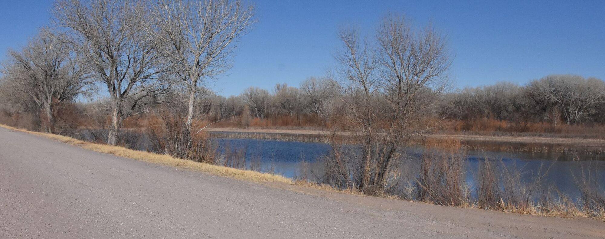
The road, which for this stretch accommodates two-way traffic, heads south between the Elmendorf Ditch on the west and a large field on the east. This field (the first of seven on the east side of the western portion of the South Loop), extending approximately two-thirds of a mile to the Dabbler and Diver Deck, is managed as a seasonal wetland and in winter has the appearance of a narrow lake. “Narrow” is relative, and even with a good pair of binoculars, birds on the east “shore” can prove challenging to identify from the Tour Loop. When flooded, the water is deepest at the Dabbler Deck, which provides a nice platform to set up your spotting scope.
West of the Elmendorf Ditch and the eponymous trail on its west side, the landscape to NM-1 is covered in Chihuahuan desert scrub which really can’t be seen from the Loop due to cottonwoods lining the west side of the trail. This type of vegetation continues on the west side of the road south of the Dabbler Deck, whereas on the east side of the road immediately south of the deck is a small open field, generally not fully flooded in winter, populated by cattail, common cane, sunflower, grasses, and kochia.
Continuing south, the next field on the road’s east side is the second largest on the western portion of the South Loop. The field was burned in late winter 2021 to remove invasive tamarisk; charred trunks remain standing in what, as of 2022, is otherwise a relatively open field. The field is generally not flooded nor maintained as a wetland.
However, directly south on the east side of the road are three small fields (each a few tenths of a mile in length along their western side) which are annually flooded, appearing to be ponds in the winter. The northernmost of these has its northern boundary across from the Audio 2 sign on the Tour Loop, and the southernmost is bounded on the south by an east-west ditch a few feet from the south end of the Boardwalk parking area. Dense vegetation obscures viewing of these fields from the Tour Loop; the South Seasonal Shortcut (when open) offers much better viewing from their east side, particularly in the morning.
Also at about Audio 2 begins (for southward travelers) east of the Elmendorf Ditch a large cattail marsh. Whereas a few birds may be observed in this marsh from the Elmendorf Trail, the likelihood of seeing any birds there from the South Loop is extremely low. An east-west berm (incorrectly showing in Google Maps as of February 2022 as a trail) separates this marsh from the cattails at the north end of the Boardwalk Lagoon. Depending on the height of willow and cane on the east side of the Elmendorf Ditch, the west side of the Ditch, and the east side of the Lagoon itself, birds on the Lagoon might be observed from the South Loop, but hiking the Boardwalk or the Elmendorf Trail offers much better viewing of the Lagoon.
Note that south of the Boardwalk parking area, the road is one-way only. The Elmendorf Ditch continues west of the South Loop, while the field on the east appears forested from the road, which after about a third of a mile makes a sharp turn to the east. Less than 50 yards beyond this turn, visitors may have the option of turning north onto a stretch of dirt road which tends to be open only in spring and summer, but if open in the fall and winter provides views of waterfowl in flooded fields hidden by willows from the more westerly portion of the South Loop. There are two large fields to the east of this road, rather open near the road but backed by cottonwood. Unlike the seasonal wetlands fields to the west, these fields are not usually maintained as wetlands; Wild Turkey (Rio Grande subspecies) may be seen here. Observations along this road are appropriately recorded with those of the South Loop hotspot. This road is sometimes called the South Seasonal Shortcut, as it rejoins the main portion of the South Loop after the latter has passed by the John P. Taylor Trail trailhead.
If you continue east on the main portion of the South Loop, instead of entering the Shortcut, an agricultural field will be on your right (south); recently, this field has been planted with triticale. The lucky birder may pass by when the field is being flood-irrigated, which attracts numerous birds (particularly waders in the spring). As you approach the Taylor Trail, the area to the north is cottonwood bosque. This bosque continues on your west as the road turns north after the trailhead, whereas savannah-like grassland lies to the east. The bosque closes in on both sides of the road before the main South Loop is joined by the Shortcut.
The South Loop then continues north for over a mile. Along most of that length, looking west, there is a ditch, a restricted maintenance road, a swath of cottonwoods, and then either managed wetlands or less-moist fields, some with dense cottonwood bosque. One of the wetlands, opposite the Audio 9 marker, is the east side of the Dabbler Deck field. Though there are a few small seasonal wetlands along the east side of the road, the vegetation on this side tends to be a dense bosque of broom, willow, mesquite, and cottonwood. The large grassy area to the east of the Audio 9 marker, frequented by elk and mule deer, is an exception.
About a quarter-mile from its end, the South Loop turns northeast, defining the east boundary of the Old Rookery, with the Rio Viejo bosque on the road’s east side, before terminating at the Main East-West Road.
A few final points to remember…
- Easterly views from the western portion of the South Loop are severely backlit in the early morning, providing at times only bird silhouettes, with a similar situation looking west from the eastern portion of the Loop in the evening. Given that only the western portion of the South Loop allows two-way traffic, exploration of all areas along the Loop may require multiple trips along the same road segment, but at different times of the day.
- For safety, as well as courtesy, pull well off to the side of the road should you stop, being sure not to leave your door open on the traffic side of the road. During peak visitation times, traffic can be surprisingly heavy on both the Loop proper and the Shortcut.
- Other than the Seasonal Shortcut, dirt roads off the gravel South Loop are maintenance roads used by Fish and Wildlife Service staff; public access is prohibited. Regardless of how tempting it is to advance beyond the “Area Closed” signs, remember that the primary purpose of Bosque del Apache is to provide refuge for wildlife.
Birds of Interest
Willow Flycatcher is frequently observed May-September. Yellow-billed Cuckoo is occasional, June-August . The hotspot is reliable for Bell’s Vireo mid-April through August.
About Bosque del Apache National Wildlife Refuge
See all hotspots at Bosque del Apache National Wildlife Refuge
Established in 1939 to provide a critical stopover for migrating waterfowl, the refuge is well known for the thousands of sandhill cranes, geese, and other waterfowl that winter here each year.
Situated between the Chupadera Mountains to the west and the San Pascual Mountains to the east, the 57,331-acre refuge harbors a wild stretch of the Rio Grande, a ribbon of cottonwood and willow trees visible on the landscape from distant mesas.
Petroglyphs tell the story of ancient people who lived and hunted here. The river and its diversity of wildlife have drawn humans to this area for at least 11,000 years when humans migrated along this corridor, sometimes settling to hunt, fish, and farm. Artifacts and stone tools found nearby tell us that nomadic Paleo-Indian hunters pursued herds of mammoth and bison in the valley.
Today, Bosque del Apache is part of the National Wildlife Refuge System, a national network of lands and waters set aside and managed for the benefit of wildlife, habitat, and you.
Features
Entrance fee
Roadside viewing
Restrooms on site
Content from Bosque del Apache National Wildlife Refuge website, John Montgomery, Birding in New Mexico (National Audubon Society), and John Montgomery
Last updated March 10, 2024
