Whipple Hill Conservation Area, Lexington
Whipple Hill Conservation Area, Lexington
Lexington, Massachusetts 02420
Lexington Trail Guide bookletWhipple Hill Conservation Area information and map
About this Location
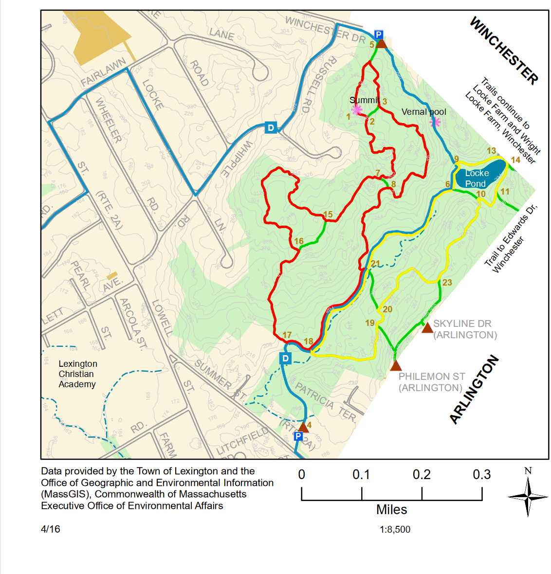
Whipple Hill Conservation Area, 120 acres and 3.9 miles of trails, is Lexington’s second largest conservation area and includes the highest point in town, the summit of Whipple Hill (375 feet). Trails wind across ledge outcrops, through mature stands of northern hardwoods and white pines, and along Whipple Brook and Locke Pond. Many species of birds visit Whipple Hill, particularly during migration, and the vegetation is richly varied, including a few species that are considered to be uncommon to rare in the area.
Access is from Winchester Drive (with a small parking lot) and Summer Street in Lexington, and Philemon Street and Skyline Drive in Arlington.
Notable Trails
The AllTrails website has descriptions and maps of hikes at Whipple Hill Conservation Area.
Features
Restrooms on site
Wheelchair accessible trail
Entrance fee
Content from Whipple Hill Conservation Area information and map
Last updated January 9, 2024