Wayne National Forest--Wildcat Hollow Trail, TR-300 to Town Hwy. 455
Wayne National Forest--Wildcat Hollow Trail, TR-300 to Town Hwy. 455
Glouster, Ohio 45732
Official WebsiteWildcat Hollow Trail map
Wayne National Forest website
Wayne National Forest printable maps
Also, see all the hotspots at:
Wayne National Forest-Athens Important Bird Area
About this Location
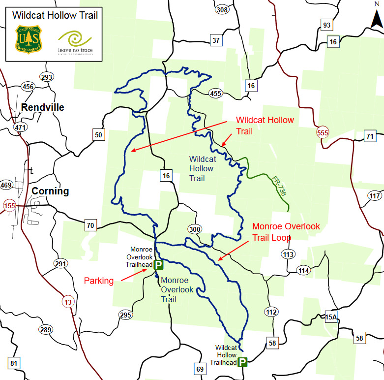
The Wildcat Hollow Hiking Trail offers two options; a 15-mile loop of scenic trails along ridge-tops and stream bottoms, and a short five-mile loop for day hikes. Both trails will lead through tall pine forests, open meadows, quiet streams, rock outcroppings, and down old roads overlooking miles of beautiful landscape. You will also pass by some land management activities. Wildflowers are at their peak in the spring, but we ask that you not pick them so that others may also enjoy them. The hiker who treads softly can often catch glimpses of the wildlife who call the forest home. Bring your binoculars and enjoy your visit. This area is one of the recommended wildflower viewing areas in the Forest.
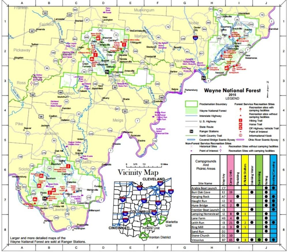
About Wayne National Forest
See all hotspots at Wayne National Forest
The Wayne National Forest is located in the hills of southeastern Ohio. This small national forest, in the heart of the heavily populated Midwest, covers almost a quarter million acres of Appalachian foothills. The Wayne is divided into three blocks administered by two Ranger Districts at Athens and Ironton. A field office is also located east of Marietta.
Visitors to national forest lands are welcome to camp, hike, hunt, and fish. The Forest boundaries surround a checkerboard pattern of ownership, with public and private ownership interspersed. There are over 300 miles of trails in the Forest for hiking, all-terrain vehicle (ATV) riding, mountain biking, or horseback riding.
Features
Restrooms on site
Content from Official Website and Wayne National Forest website