Berlin Lake--Price St. Bridge
Berlin Lake--Price St. Bridge
Deerfield, Ohio 44411
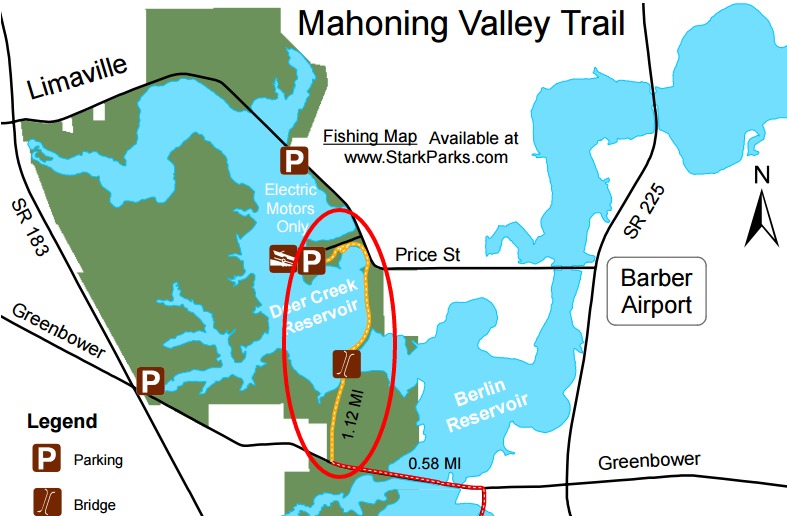
Official WebsiteMahoning Valley Trail map
Berlin Lake Official Website
US Army Corps of Engineers Water Management website
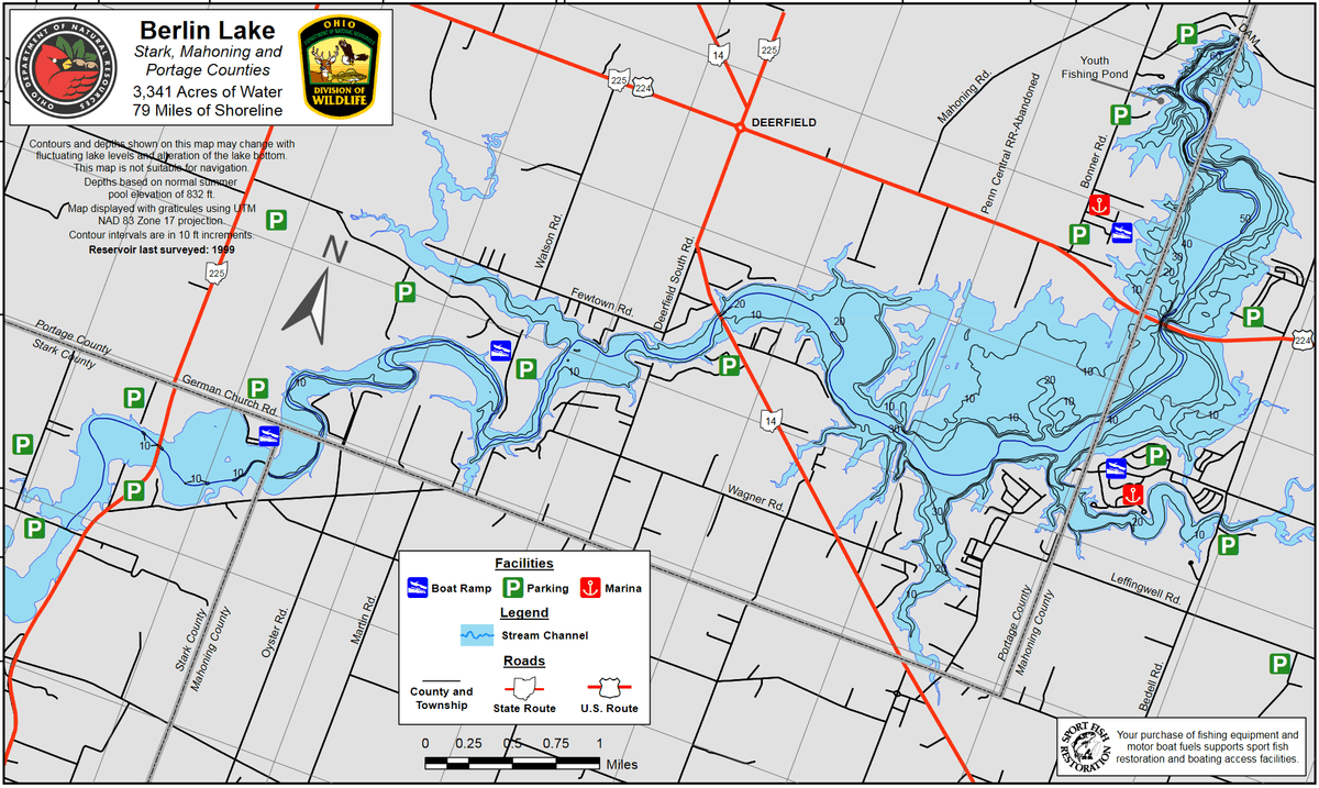
Berlin Lake map
Also, see all the hotspots at:
Berlin Lakes System Important Bird Area
Berlin Lake Birding Drive
About this Location
For those interested in shorebirds, the best areas to find them are the mudflats north and south of the Price Street Bridge. To get to this area, go south about 1 mile from the OH-225 bridge and turn west on Price Street. Cross the bridge and enter the large parking area on your right. From this point, one can see several acres of mudflats when conditions are right. By crossing the roadway and hiking the west shoreline, south of the bridge, you can explore over a hundred acres of mudflats. Further southwest, this area opens up to reveal mudflats that cannot be seen from any road. The mudflat areas, both east and west of the OH-225 bridge, are also choice locations for shore birding. This area has also been a very productive region in recent years. Parking here, though, can be difficult as there is no parking available in the immediate vicinity of the bridge. Parking is permitted, however, if you go beyond the “No Parking” signs and walk back to the bridge area. The US-224 bridge area, later in the season, from late August through November, can also be very rewarding. The best strategy here is to park at the west end of the bridge and walk south along the west shoreline. Here you can walk miles of shoreline and mudflats encountering cove after cove of choice habitat. This area has also been a good area for migrating waterfowl, raptors, and gulls.
About Berlin Lake
See all hotspots at Berlin Lake
Berlin Lake spans three counties. The eastern portion is in Stark County, the middle portion is in Portage County, and the western portion is in Mahoning County. See the map for the county line boundaries.
Berlin Lake lies in the northeastern part of Ohio at the junction of Stark, Portage, and Mahoning counties. The lake is located on and is accessible from US-224 and OH-14 and OH-225. The U.S. Army Corps of Engineers constructed Berlin Lake in 1942 on the Mahoning River. The Congressionally authorized purposes were flood control, low flow augmentation, water quality control, and water supply. Berlin Lake has a mean depth of 23 feet with a maximum depth of 55 feet. Annual water level fluctuations can be as much as 20 feet. Mud, sand, and gravel make up most of the bottom composition. Rock ledges can be seen along the original river channel at low pool level.
Restroom facilities can be found at the headquarters building, the picnic area by the dam, and the Circle Restaurant in Deerfield.
Content from Ohio Ornithological Society and Susan Carpenter