Trimble Township Community Forest
Trimble Township Community Forest
Glouster, Ohio 45732
Official WebsiteTrimble Township Community Forest map
Also, see all the hotspots at:
Wayne National Forest-Athens Important Bird Area
About this Location
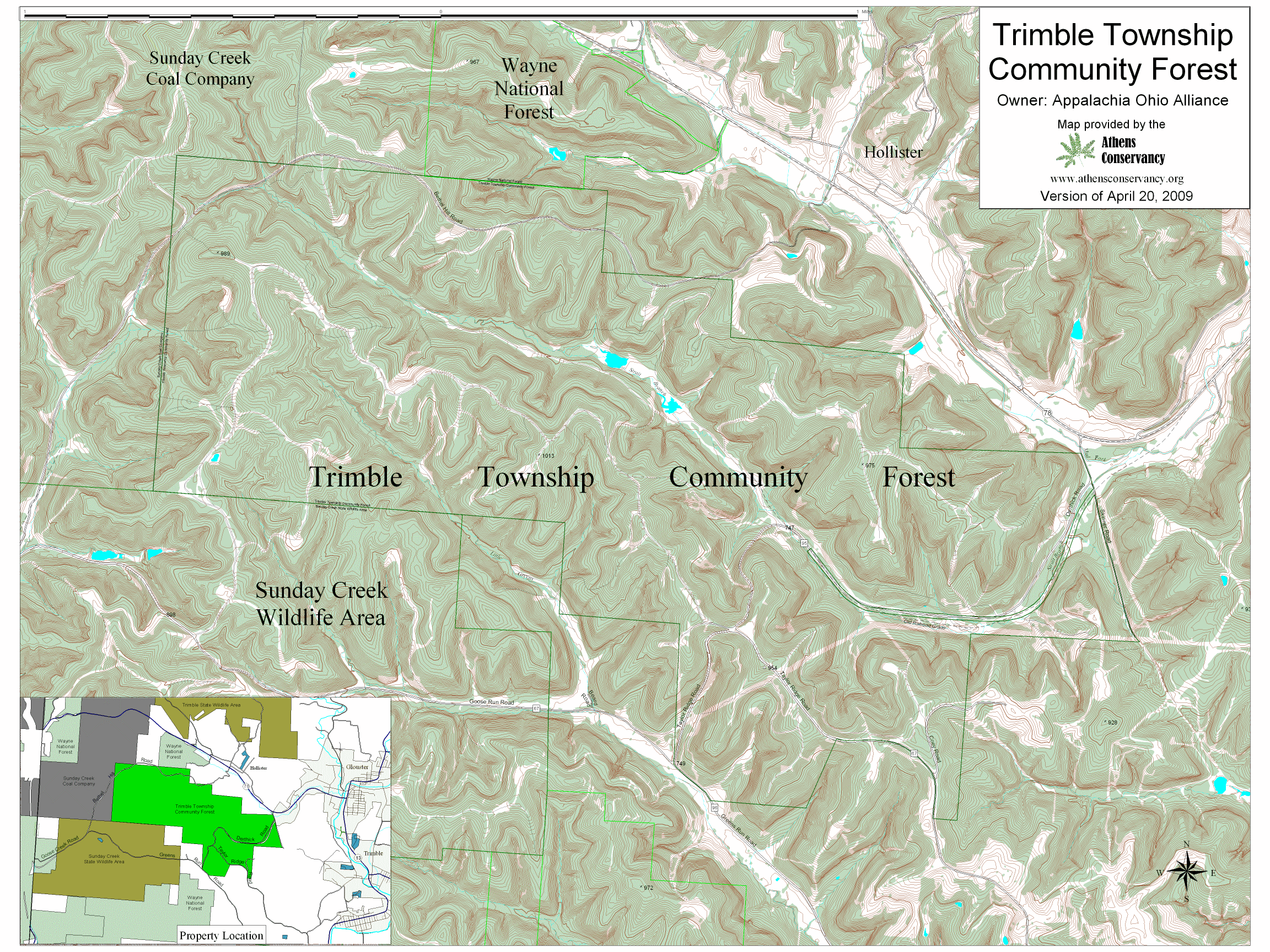
The Trimble Township Community Forest comprises some 1200 acres of former Sunday Creek Coal Company lands, purchased by the Appalachia Ohio Alliance with Clean Ohio Conservation Fund funds. It is administered, in part, as a land lab for Trimble High School. It is centered around Derthick Road, Taylor Ridge Road, and Bethany Hill Road. This land has had a long history of resource extraction: coal, timber, oil, natural gas, and so it is in recovery mode.
To reach this area from Athens, go out Columbus Road to OH-13. Turn left on OH-13, then turn right in Chauncey to stay on 13. Go 8.8 miles to Glouster from the turn in Chauncey. At the stoplight in Glouster, turn left on OH-78. Go 1.2 miles to Derthick Road, on the left, and turn left. The Forest is from to 0.1 to 1.9 miles on this road (1.9 is when the road tees into Goose Run Road after it becomes Taylor Ridge Road).
Content from Official Website